A December to
Remember
Southeast Asia: From
Vietnam to Laos via Angkor
By Mary Goldsmith
Edited by Angelica
Syseskey & Steven Goldsmith
In
December 2008, we traveled to Vietnam, the Angkor area of Cambodia, and Laos. We’ve
always wanted to see Vietnam especially since we grew up hearing about it most
days on the nightly news. If you’ve read about our past travels, you know we
like to go to countries which have recently become open to Americans for travel
and are making the transition from communism to democracy. We also rarely go to
only one country, so we agreed that adding Cambodia and Laos to our vacation
would make for an interesting trip especially because of their shared history.
I found it easy to find small group tours that went to two of the three
destinations. However no company would accept us on their tour that did all
three. Believe it or not, there are still a few companies that flatly refuse a
person who uses a wheelchair when it makes sense for her to do so. Before I
contact a company, I review their itinerary to screen out trips which would be
too difficult. I only contact companies to ask for details when I think it
might be possible to join their tour. One company wouldn’t even listen to my
traveling history of over 50 countries. The representative just said that I
would inconvenience other tour members too much.
After
hitting too many dead ends, I decided to look for a Travel Agent. I called
Virtuoso and they had an agent from Connecticut call me. I explained what we
were looking for, my limitations and the research I’d done so far. She found a
company which had a tour to Vietnam and Angkor. We asked to add on Phenom Penh
and Laos. She said that she had just done a Laos tour for someone and felt
sure she could add that, but given the time we had it would be impossible to do
both. Steve definitely preferred Laos over Phenom Penh because he had done a
report on Laos in junior high school. His assignment had been to do a report
on a Southeast Asian country. Most students chose Vietnam, but Steve chose
Laos. At that time there was little information on the country but he did not
give up. Now he wanted to see this nation. We booked with Vido Tour:
Indochina Travel on their Mystic Marvels of Indochina tour and added three Laos
destinations. We were told that at least one other couple had booked the tour
and we’d have a Tour Manager and local guides.
As
I mentioned earlier, we are not typical travelers. I have juvenile rheumatoid
arthritis and insulin-dependent diabetes. I use a wheelchair, which Steve has
good heartedly pushed on terrain that is  definitely
not accessible. We generally get along just fine. However, it does require a
little more forethought and planning. I mention this because I will include
accessibility information in this travel log. The start of access information
will be marked with the international access symbol. Here it appears to the
left.
definitely
not accessible. We generally get along just fine. However, it does require a
little more forethought and planning. I mention this because I will include
accessibility information in this travel log. The start of access information
will be marked with the international access symbol. Here it appears to the
left.
Day
1: Wednesday, Dec. 10
Our
car comes early and we’re not quite ready. We finish preparations quickly and leave
about a half an hour earlier than we planned, after saying goodbye to our cats.
Our driver asks us if we’re going to France. We reply no, we’re going to Hanoi,
Vietnam by way of Singapore. He has our correct information, but the destination
is listed as FRAN. We think that perhaps this is the designation for our
stopover since our flight information states there's one stop for re-fueling.
The drive to JFK airport goes quickly. During the ride my blood glucose drops
lower than I want it to be. Our driver offers me food, of which he has a
variety. I choose a peanut butter granola bar.
When
we arrive at the airport, Singapore Airlines is not yet set up for check-in, so
we don’t find any signs for our flight. We’re not the first one at the
Singapore Airlines counter, but once they set up check-in, it moves quickly. As
we go through security, I am thoroughly checked over. They even require me to open
my money belt. Security is not crowded so we don’t have to rush. We find our
gate and then go to eat. We only find one restaurant open, but luckily it has a
good number of available tables.
We
return to the gate where they are setting up the boarding area. The staff is
almost obsessive about placing the line barriers. They reposition them about ten
times. Boarding goes easily. We sit next to a nice woman, Veronica, who is a Merchant
Marine going to Singapore on her next assignment. We learn that our layover is
in Frankfurt, Germany. We’re a bit dismayed because we assumed that we were
flying west to Singapore. It takes six hours to reach Frankfurt. Our layover
goes quickly. As we wait to board our next flight, I find people rude. It’s a
bit of a challenge to board early because many people try to cut us off. Once
on board, we have 14 hours to Singapore.
Day
2: Thursday, December 11
We
spend the day in flight. We find Singapore Airlines very nice. The seats are as
comfortable as possible. The stewardesses are very courteous and caring. We receive
much to eat and drink. For airline food it's quite good and they have
interesting choices of Oriental or continental cuisine. Steve watches movies.
My
sugar spikes high so I sleep a good amount during the flight to Singapore.
Day
3: Friday, December 12
When
we arrive in Singapore, a transporter meets us with an aisle chair. Then we get
my wheelchair and the transporter takes us on a tram to a lounge nearby our
next terminal. The Airbus is very nice and barrier free. At the lounge, a staff
member takes my boarding pass and gives me a sticker which indicates my boarding
pass has been processed. At least, that’s what we think the sticker indicates.
We find the lounge comfortable at first. People come and go. Most are seniors, children
or have mobility problems. After a while we feel confined. Steve leaves the
lounge to look around. When he returns, I ask him if he found a rest room. He
gives me directions and I tell the staff member monitoring the entrance where
I’m going.
Our
next flight goes quickly. Thirty-six hours and too much aggravation later, we
reach our final destination of Hanoi, Vietnam. We meet our guide, Le Thanh Long
and our driver Mr. Tang. We ask him if the two other people who are supposed
to be on our tour have arrived yet. He’s surprised to hear about them and
states that most of the tours his company does are private tours, with only
people who know each other. Perhaps the other two people canceled. We’re
disappointed to learn that we’re the only two people on our tour. Long reviews
our itinerary and suggests a revision which switches the first and third day
activities. He states that what we’re scheduled to do on our third day in Hanoi
is not a good idea because most of the sites are closed. He suggests that we do
these sites tomorrow and the third day we’ll have to ourselves. We agree to
this and wonder why, since this is the private tour, this change was not
previously made. He also asks for a copy of our entire itinerary, since he’s
only been given that of Hanoi. We question why he only has information on Hanoi
and he states that this is the only part of our trip to which he’s assigned. He
explains that each time we fly we will get a new local guide when we arrive at
our destination. This is also a surprise to us, but he states that this is the
only way to keep the price reasonable. It’s especially disappointing to me
because I asked about having one tour manager for the entire trip. I confirmed
with our travel agent that the only place we get a different tour manager was
in Laos.
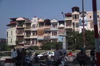 City Homes
|
Our
drive to the hotel is quite interesting. We both take many pictures as Long
explains what we’re seeing. We reach the outskirts of the city. Long tells us
that rich people from the city purchase vacation homes to get away from the
city noise and their business. I find these homes quite nice. We see many
motorbikes, many of which are used to transport merchandise. Once in the city,
we are amazed at the houses. Long explains that taxes are based on house
frontage. Therefore the houses are narrow, tall and deep. Unless one lives in a
corner house, there are windows only in the front and back walls. In the city,
it costs $2000 per square meter to buy real estate. Our hotel, the French
colonial Sofitel Metropole Hanoi, is located in the city center and it’s very
nice. We find the location convenient to some of the city sites. We're in an
old section of the city where historical emphasis has been on the arts and
learning. The buildings have remained relatively small, simple and in harmony
with nature.
I
believe that in order to enjoy a visit to any place it's useful to know the
history. So before I tell you about our experiences, I will give you a brief
overview of the history.
History of Vietnam
It appears that
Vietnam had inhabitants as far back as the Stone Age. Civilization probably
began in the Early Bronze Age, from when archeologists have found artifacts in
the Vĩnh Phúc Province,
close to Hanoi. These reveal evidence of early Vietnamese culture from
approximately 2000 to 1400 BC. In approximately 1200 BC, wet-rice and bronze production began in the Ma River and Red
River plains. These led to the development of the Dong Son culture, known
for creating elaborate bronze
drums.
Before 257 BC, the Hồng
Bàng Dynasty ruled Vietnam. Before becoming a
dynasty, in the north most people lived around the Hồng River and the Ma
River. As time went on, population spread to the rest of Vietnam forming 15
tribes. One leader,
Hùng Vương, pulled the tribes
together and declared himself Emperor, creating the Hồng Bàng Dynasty.
Credited with teaching his subjects how to grow rice, he named this country
Văn Lang which translates to Vietnam. In successive generations, the
throne passed from father to son through 18 lines of descent.
In the third century
BC, Thục Phán overthrew the Hồng
Bàng Dynasty. The Thục Dynasty
only ruled 50 years. There's debate as to whether Thục Phán was a
prince from a Chinese state or an indigenous Vietnamese. He renamed Văn Lang to Âu Lac.
For 1045 years, Chinese
dynasties ruled the area. During this time the Vietnamese people continually
fought against Chinese expansion which came from the north. The first Chinese
Dynasty to rule Vietnam divided Vietnam into two parts but kept it separate
from China. The Dynasty lasted until 111 BC.
After
approximately 100 years, the next dynasty of the Hán, took over and made Vietnam
part of China. It divided Vietnam into nine districts. During the first century
of rule, China governed Vietnam leniently. In the first century A.D., the Hán raised
taxes and instituted marriage reforms with the purpose of making Vietnam a
patriarchal society which would accept political authority. In 39 A.D., a
revolt broke out led by two sisters, one of whom was the wife of a Vietnamese
lord who had been put to death. The Trưng Sisters captured
more than 65 cities and were crowned the queens of Vietnam in 40 A.D. This ended the first Chinese
domination of Vietnam. Although the queens’ reign only lasted for three years
they are highly regarded as heroines and celebrated with an annual holiday.
The second Chinese
domination of Vietnam occurred from 43 through 544 A.D. the area was ruled by
Chinese governors. During this time local rebellions continued to occur. In 248
another Vietnamese woman led a rebellion. She was able to hold onto her
victory for six months.
In the 530s, Lý Bí , a military
overseer of the Duc province, wanted to free his area from rule
by the Chinese. In 544, he announced secession from the Liang Empire and
declared himself Emperor of the region of Vạn Xuân. He established his capital in
today's Hanoi and appointed effective military and administrative scholars to
leadership positions. He promoted literacy and established a foundation for
many reforms which were modeled after Chinese social structure. However in
October, the Chinese attacked and war ensued. Triệu Việt
Vương became Emperor of Vietnam. He used guerrilla warfare to hold
the Chinese. In 550, he defeated the Chinese. He remained as Emperor until 571
when Lý Nam Đế overran his territory. Lý
Nam Đế remained in power until 602.
In the Mekong Delta from
the first through the sixth century, the kingdom of Funan flourished. It had
contact with China, India, Persia and the Mediterranean. During the late second
century, the Hindu kingdom of Champa established itself in the Danang area.
From 602 to 906, the
third Chinese domination of North Vietnam occurred. After 618 the Chinese
Dynasty established 12 provinces. Islam arrived in Vietnam during the middle of
the seventh century.
During the 10th
century, Vietnam declared independence from China and began almost 1000 years
of their own Dynastic tradition. In 905, Khúc Thừa Dụ instigated a
rebellion against the Chinese. By 906 the rebels established independence. A
series of Khúc governors ruled during the next 24
years.
From 931 to
937, Dương Đình Nghệ was an administrator. He showed skill,
talent while serving under Khúc Hạo. In 937, General Kiều Công Tiễn
moved up when he defeated Dương Đình Nghệ. In 939, Kiều
fled and Dương's son-in-law Ngô Quyền
established the Ngô
Dynasty. Between 939 and 968, five Ngô ruled. From 966 to
968, The 12 Lords Rebellion occurred when local lords seized power from their
governments and created court conflicts. The country divided into 12 regions,
each administered by a different lord and fighting to expand its rule to the
entire country.
In 968, Lord
Đinh Bộ Lĩnh became victorious over the other 11 lords and took
control over the country. He declared himself Emperor under the title Đinh Tiên Hòang
Đế. He established the Đinh Dynasty
renaming the country Đại Cồ Việt. The
Đinh Dynasty
lasted until 980. He strengthened his government by appointing military
personnel to important positions. One of his top generals was Nguyễn
Bạc., Nguyễn Bạc’s oldest son Đinh Liễn became a
major figure for the Đinh Dynasty succession and the rise of the Lê
Dynasty.
The Lê
Dynasty ruled for three generations and is best known for holding
off the Chinese. In 990, southward expeditions to Champa began and occurred again in 994. Che Dong and Che Cai, two successive Cham
kings, negotiated with Lê Đại Hành for peace and agreed to be a
Vietnamese vassal state. The last
Lê
Emperor became greatly hated when the people and peasants grew
disgusted with his cruelty. Upon his death the court under the influence of
Buddhist Monk's enthroned Lý Công Uẩn as the new emperor. Lý Công
Uẩn established the Lý
Dynasty in 1009.
The Lý Dynasty
became the first Vietnamese dynasty able to hold onto power for more than
several decades. They expanded Vietnam. While the Lý Emperors were devout Buddhists, the
influence of Confucianism
from China increased. The first
University in Vietnam opened in 1070 (Temple of Literature)
for the selection of civil servants not from noble families. The Lý created an
administrative system based on rule of law rather than on dictatorial principles.
They chose the Đại La Citadel as the capital (today’s Hanoi) showing
that they believed in power due to economic strength. The population liked the Lý.
In 1054, the name of the country was changed to Đại Việt by
Emperor Lý Thánh Tông.
The first
century of Lý rule was dominated by warfare with China to the North and Chenla
and Champa to the South. After successfully overcoming these threats, the
second century of Lý rule was relatively peaceful enabling the Lý Emperors to
establish a Buddhist ruling tradition. Buddhism became a state religion. Royal
family members and the nobility made pilgrimages and supported pagoda building.
Some entered monastic life. Monks became a privileged class, exempt from taxes
and military duty. At the same time, Vietnamese Buddhism associated with magic,
spirits, and medicine grew in popularity with the people.
The
Vietnamese began their long march to the south (Nam Tiến), defeating the
Cham and the Khmer. In 982, Vietnamese forces overran the Cham capital of Indrapura,
so the Cham established a new capital at Vijaya. Captured twice by the
Vietnamese, in 1079 the Cham were forced to hand over their three northern
provinces to the Lý rulers. Soon afterwards, Vietnamese peasants began moving
into the untilled lands, turning the land into rice fields. The Vietnamese
continued moving south. The Lý Emperors supported the improvement of Vietnam's
agricultural system. They constructed and repaired dikes and canals and allowed
soldiers to return to their villages to work for six months of each year.
With
expanding territory and population, Lý Emperors looked to China as a model for organizing
a strong, centrally administered state. In 1075, minor officials became chosen
by examination for the first time. A civil service training institute and an
imperial academy were established in 1076. In 1089, a fixed hierarchy of state
officials was set up. Examinations for public office became required, and
literary competitions determined the grades of officials. In 1075, a 40 day
battle occurred with the Chinese. Vietnam became victorious.
From 1225
to 1400, the Trần Dynasty ruled Vietnam. Trần Kinh, founder of the Trần
dynasty, had become rich and powerful under the Lý Dynasty. The final Lý Empress
having ascended the throne at six years of age ruled under the influence of the
commander of the royal guard, head of the Trần family. The leader of the
Trần clan decided to overthrow the Lý Dynasty and establish a new dynasty
ruled by his own clan. First he moved his clan to the royal palace and arranged
a secret marriage between the Lý Empress and a member of his family. He did not
inform the mandarins or members of the Lý royal family. Afterwards, he
announced the fait accompli to the royal court and forced the Empress to turn
over the throne to her new husband on the grounds that she was incapable of
holding office. In 1225, the 216-year reign of the Lý Dynasty ended and the new
Trần Dynasty began.
The emperor
massacred members of the Lý royal family to avoid retribution. Still several
rebellions occurred but the Trần remained in power. In 1257, the first of
several Mongol invasions took place. By December of that year, the Trần Dynasty
became victorious and reestablished peace. In December 1284, a second invasion
ensued from both the north and south borders. In May 1285, after much fighting, Trần
Quang Khải fought the deciding battle and almost destroyed the Yuan navy.
In March 1287, the Mongols launched their third invasion. This one ended one
year later when the commanding Vietnamese Prince broke the enemy campaign.
After the
invasions, during the reigns of the next three Emperors, Vietnam experienced a
period of prosperity and peace. Many good mandarins served these Emperors. In
1306, the Champa king proposed two prefectures for marriage with the Vietnamese
princess. After one year of marriage, the Champa spouse died and by custom the
Vietnamese woman was to be cremated with her husband. Anh Tông, the Vietnamese
Emperor sent his mandarin to Champa to save her. Finally she returned to Vietnam.
The successor of the Champa king, no longer wished to abide by the peace treaty.
After that event, Anh Tông with two generals commanding three groups of
military units attacked the Champa in 1312. The Champa leader was defeated and
captured in this invasion. Anh Tông installed a hand-picked successor, but the
relations between Vietnamese and Champa remained strained for a long time
afterwards.
In 1357,
the Trần Dynasty began to collapse during a period of chaos caused by excessive
spending. The Emperor appointed his brother's son to secede even though this
appointee was not from the Trần clan. The new Emperor continued
the wastefulness. Upon the advice of several mandarins and members of the royal
family, the emperor’s father-in-law overthrew and killed the Emperor. The former
Emperor's mother fled to Champa and convinced the king to attack Vietnam. The
Champa army chased the Trần Royal Court from its capital and looted the
city. It took until January 1390 for the Trần to stop the Champa. Another
period of struggle for the Trần began, ending in 1400 when the Hồ
Dynasty began.
The Hồ
Dynasty lasted seven years and had only two emperors. In 1407, the Chinese
Dynasty took control of Vietnam. Although the Chinese considered Vietnam to be
a separate country, they suppressed all Vietnamese literature replacing it with
theirs. As the Chinese dynasty grew weak, the Vietnamese rebelled against it. Rebellion
leaders included several Trần. However these revolts were
short-lived and poorly planned but they helped put in place the groundwork for Lê Lợi's war for
independence which led to the Later Lê Dynasty.
This
dynasty began in 1428 when Lê Lợi drove the
Chinese army from Vietnam. During the Lê Dynasty, Vietnam's territories grew from
a small northern state to almost its current size. In addition, large changes
to Vietnamese society occurred. The Buddhist state became Confucian after 20
years of Chinese rule. The Lê emperors instituted many changes modeled after
the Chinese system, including civil service and laws. The popularity of the early emperors
facilitated their long period of rule. Besides Lê Lợi's liberation of the
country from Chinese rule, Lê's
reign brought Vietnam into a golden age.
In 1527,
the Mạc
Dynasty overtook the throne. In 1533, the Lê Dynasty was restored.
However, they still had to compete for power with the Mạc Dynasty.
This period became known as the Southern and Northern Dynasties. The restored
Lê emperor held no real power. Civil strife and constant peasant uprisings
occurred. In 1592, the Mạc Dynasty became confined to only a small area. The
Nguyễn controlled the south and made its capital Hue. The Trinh held the
power in the north.
War between
the Trịnh and the Nguyễn ended in 1673. Life for the northern
peasants under the Trịnh Lords was relatively peaceful. However, the
Nguyễn Lords engaged in almost constant wars with the weak Khmer Empire and,
later, the stronger state of Siam.
The Nguyễn often won their wars. The new conquered lands offered
opportunities for the landless poor, but the frequent wars took their toll on
the popularity of the Nguyễn rulers.
In 1769,
the new king of Siam, Phraya Taksin, began a war to try to regain control over Cambodia. They fought
against the Nguyễn army and forced the army to retreat from some of the
newly conquered lands. This example of governmental failure coupled with heavy
taxes and corruption at the local level caused three brothers from Tây Sơn
to revolt against the Nguyễn Lord.
In 1778, the
Tây Sơn wanted to restore power to legitimate authorities. One of the
brothers, Nguyễn Nhạc proclaimed himself Emperor. In 1786, he led
an attack against the Trịnh and defeated them. The Trịnh fled to
China. Nguyễn Huệ married the daughter of the nominal Lê Emperor,
Lê Hiển Tông. Lê soon fled to China and requested aid from the Chinese
Emperor. In 1788, an attack against the capital of Hanoi occurred with victory
going to the Chinese. Nguyễn Huệ assembled an army and attacked the
Chinese. He became victorious and forced the Chinese and Lê, back to China.
Nguyễn Huệ controlled Vietnam which was larger than ever before.
He assumed the title of Emperor and renamed himself Quang Trung. He distributed
land to the poor, encouraged suppressed artisans, allowed religious freedom,
opened Vietnam to international trade and eliminated Chinese as the official
language.
In 1788,
the peasant uprising of the Tây Sơn brothers
defeated both the Trịnh and the Nguyễn, restoring power to the Lê
Dynasty. Three Tây Sơn brothers became the leaders of the common southern
Vietnamese people. Their revolt won battles against the Nguyễn army. The
Tây Sơn had popular support from the poor farmers and some of the minority
tribes. One the brothers was a skilled military leader. He set a goal to end
the people's oppression, reunite the country and restore power to the Lê
Dynasty emperor in Hanoi. The three brothers also promised to eliminate corrupt
officials and redistribute land. In 1773 the Tây Sơn army captured the
city of Qui Nhơn. Merchants
who had suffered under restrictive Nguyễn laws gave the Tây Sơn army
financial support. The Nguyễn made peace with Siam, giving up some land
they conquered. However the Trịnh Lord, Trịnh Sam, decided to end
the 100 year peace by dispatching his army south to attack Hue, the Nguyễn
capital. Victory went to the Trịnh. The Nguyễn fled to Saigon. The Trịnh army
continued south while the Tây Sơn army also continued its fighting of
other southern cities. In 1776, the Tây Sơn army seized the final
Nguyễn stronghold of Saigon. The entire Nguyễn family was killed,
except for a nephew, Nguyễn
Ánh, who escaped to Siam.
The Tây Sơn spent much of the following 10 years building up their control
of Nguyễn territory. However Nguyễn Ánh
convinced Siam to invade Vietnam. In 1782, the Siamese king was killed and the
Nguyễn Ánh
forces fled Vietnam.
In 1792, Quang
Trung planned to attack the remaining Nguyễn Ánh's land in the
Saigon area. However he died suddenly while waiting for optimal conditions. His
son at age 10 succeeded him but his uncle Bui Dac Tuyen held the power. Bui Dac
Tuyen executed many who served under Quang Trung. Within 10 years, Nguyễn
Ánh with help from French and European mercenaries captured the entire country.
In 1802, Nguyễn Ánh ended the Tây Sơn dynasty and the final imperial
dynasty of the Nguyễn began when Emperor Gia Long ascended the
throne.
The Nguyễn
Dynasty lasted 143 years. During the reign of Emperor Gia Long, the nation
officially became known as Việt Nam (越南). He moved Vietnam’s capital to Hue. From
1820 to 1841, Minh Mang served as Emperor. He invaded the remaining Champa
Kingdom, renamed the
country Đại Nam, and suppressed religion.
This
Dynasty became marked by the increasing influence of French
colonialism which began in 1858 when Napoleon III launched a naval
expedition to retaliate against the Vietnamese for their treatment of Catholic
missionaries and forced the government to accept French presence in Vietnam. In
1861, a full invasion occurred and by 1862, Vietnam handed over three southern
provinces which the French named Cochinchina. In 1887,
France totally conquered Vietnam. Although the Nguyễn Dynasty retained
nominal rule over the French protectorate of Annam, France brought in Catholicism and writing with the
Latin alphabet. In addition, Tonkin
became a protectorate, independent in name only.
During
World War I, France maximized use of Indochina’s natural resources and man power
in its war effort by increasing its diligence against Vietnamese patriotic mass
movements. From 1914 to 1917, Vietnam was hit with natural disasters which
caused great stress on the agricultural section. In May 1916, 16 year old Emperor
Duy Tân left his
palace to take part in an uprising of Vietnamese troops. An informant notified
the French resulting in the leaders being arrested and executed. Duy Tân was exiled to
an island in the Indian Ocean. In 1925, Ho Chi Minh founded the first Marxist
group in Indochina, the Vietnam Revolutionary Youth League.
During
World War II, on September 22, 1940, the Japanese invaded Vietnam to construct
military bases. A large Vietnamese resistance developed, tying down a
significant number of Axis divisions. With Allied assistance, the Việt Minh continued
to fight the Japanese. In March 1945, the Axis attacked French authorities,
imprisoned their civil servants and declared Vietnam "independent"
under Japanese "protection", with Bảo Đại
as Chief of State. After
the end of World War II, the French were allowed to reoccupy Vietnam. From
1947, the Việt Minh fought a guerilla war against the French in the First
Indochina War. It ended in 1954 when the Việt Minh defeated the French.
After
Japanese surrender, Ho Chi Minh led a revolt and requested the last Emperor, Bảo Đại,
to resign. In return, Bảo Đại
was named Supreme Counselor to the new government but he soon went into exile
in Hong Kong because he did not agree with Ho Chi Minh's policies. In 1948, the
French convinced Bảo Đại
to return as chief of state to Vietnamese areas in which France had control.
While Bảo Đại enjoyed the good life at his luxurious
homes in Vietnamese highlands and Paris, a bloody war with the Viet Minh
occurred. In 1954, the Geneva Accords divided Vietnam at the Ben Hai River. The
division was supposed to be temporary but in 1956, when Ngô Đình Diệm refused to hold elections, it became
permanent. After Vietnam divided into the North and South, the South Vietnamese
prime minister Ngô Đình Diệm, in a referendum overthrew Bảo Đại
and assumed the position of President
of the Republic
of Vietnam. This permanently ended Bảo Đại's
involvement in Vietnamese affairs.
The Second
Indochina War known as the Vietnam War began in the late 1950s when the United
States backed the South Vietnamese against the communist North. Communism had
prevailed in the North because China, the Soviet Union and other communist bloc
members provided military and financial backing. In the beginning, communists
convinced Vietnamese that their way of life would provide for the needs of the
common family. In 1955, the United States sent advisors to South Vietnam. Around
1960, North Vietnam changed its policy of opposition from ‘political’ to
‘armed’ struggle. The Viet Cong formed, providing North Vietnam with manpower
to transport supplies on the Ho Chi Minh Trail. This trail ran through
Cambodia and Laos, bringing these countries into the war.
In 1964 US
involvement increased. In 1965, the US sent its first combat troops. South
Korea, Thailand, Australia and New Zealand followed. In 1968, the Tet Offensive
occurred resulting in military victory for South Vietnam and the United States.
However it coincided with American voter opposition to US support of South
Vietnam. In 1970, United States began withdrawing its troops. The Paris Peace Accords
set up a cease-fire, prohibiting North Vietnam from sending more troops into
South Vietnam. The North Vietnamese were permitted to continue occupation of
South Vietnamese regions it had already conquered. Fighting continued through
1973 and 1974, while the North Vietnamese planned a major offensive. Soon after
the Paris Peace Accords, the United States increased budget cuts in military
aid to South Vietnam. The Vietnamese American trained troops fell into
disarray, finally disintegrating by January 1975. The North Vietnamese
attacked, meeting little resistance. On April 30, 1975, Saigon surrendered to
North Vietnam, ending the war.
The Third
Indochina War a.k.a. Sino-Vietnamese War occurred between February and March
1979 between the People's Republic of China and the Socialist Republic of
Vietnam. In 1978, Vietnam invaded Cambodia and overthrew the ruling Khmer
Rouge. As a political ally of China, the Khmer Rouge attack led to retaliation
from China in 1979. However they abruptly withdrew. Vietnam became more
dependent on USSR economic and military aid. As a result, Vietnam continued to maintain
a large army.
In the post
war period, the communist party outlawed all other political parties. They sent
Republic Of Vietnam public employees and military personnel to re-education
camps and started collectivization of farms and factories. Millions left the
country in poorly built boats while reconstruction efforts proceeded slowly and
serious humanitarian and economic problems occurred.
In 1986,
during the Sixth Congress of the Communist Party, new leadership replaced old.
Led by Nguyễn Văn Linh, the reformers made him the Communist Party’s
General Secretary. The party implemented free market changes known as Đổi Mới or renovation. These managed reforms
from a communist state economy to today’s market socialist economy. The new
leadership encouraged private ownership of companies and farms as well as
foreign investment while maintaining strategic control over industry. This
facilitated rapid economic growth in agriculture, industry, construction and
foreign investment.
In 1992, a
new state constitution was approved. It mandated that political organizations
be affiliated with or approved by the Communist party. In 1995, the US
established diplomatic relations with Vietnam. When American-Vietnamese
relations normalized in 1994, tourism and trade restarted. Today American
tourists rank third in visiting Vietnam, behind Chinese and South Koreans.
Day
4: Saturday, December 13
Today
we have a full day of Hanoi sightseeing. As we head out, it’s a hazy day. We
ride through the French quarter. First we see Ho Chi Minh’s mausoleum. Ho Chi
Minh actually did not want this traditional Communist mausoleum. He had
requested to be cremated. Built from 1973 to 1975, it consists of natural
materials brought from all over Vietnam.
History of Hanoi
Much of Hanoi’s history follows that of Vietnam’s, since from 1010 to 1802, it was the primary political center. The city has been inhabited since at least 3000 BC. In approximately 200 BC, Co Lao became one of the first known citadels. Throughout history it's had many names including Tống Bình during Chinese domination, Long Đỗ which means dragon's belly in English and Đại La when made into a citadel. In 1010, Emperor Ly Thai Tố built his walled citadel and named it Thăng Long which means ascending Dragon. Remember that in the Orient dragons represent good. The city remained the capital until 1397 when it became the Eastern capital. Today's name of Hanoi, bestowed in 1831, means the city in a bend of a river.
The French occupied Hanoi in 1873. In 1887, the city became the capital of French Indochina. In 1940, the Japanese invaded and occupied Hanoi. It was liberated in 1945 when it became the seat of the Vietnam government after Ho Chi Minh declared Vietnam's independence. In 1946, the French occupied the city. Fighting ensued between the French and the Vietnamese for nine years. In 1954, the French occupation ended. Hanoi became the capital of the Socialist Republic of Vietnam. During the 1960s, the Hanoi government altered its policy of opposing the Diem regime by politics to arms. The Viet Cong were founded to fight against Diem. Ho Chi Minh lived in Hanoi from December 1954 to September 1969.
The transportation systems became disrupted during the bombing of bridges and railways in the Vietnam War. Their repair was given prompt attention. In 1975, Hanoi became the capital of reunified Vietnam. However, during the 1980s Hanoi dragged behind Saigon as the latter drew greater attention as Saigon became the financial center.
In May 2008, the government decided to merge Ha Tay province, Vĩnh Phúc's Mê Linh district, four communes of the Lương Sơn district and Hoa Binh in to Hanoi. This occurred on August 1, 2008 increasing the city to 334,470 hectares divided into 29 subdivisions. This tripled the city's size. The population became 6,232,940.
Currently Hanoi has become a charming historic city with old buildings gracefully mixed in with modern structures. Where we stayed in the Old Quarter, approximately 1000 buildings were constructed over 100 years ago. The streets still carry the names of the trades of the stores that they contain. The summer of 2010 marks the city's millennium anniversary. A large mural of Hanoi’s history will wrap around the Temple of Literature. The climax will include concerts, history exhibits and art shows during 10 days ending on October 10.
While the government understands the importance of retaining the feel of the historic city, it's planning modernization to improve traffic and deal with overpopulation. Archaeologists have found over one million artifacts from the original citadel. The city hopes to become a UNESCO world heritage site.
 Ho Chi Minh Mausoleum
|
When
we arrive in the square, Long informs us that my wheelchair is not allowed into
the mausoleum. Four soldiers come with another wheelchair into which I transfer.
They do not let Steve push me. As we approach the inside, everyone becomes
silent. When we get to the stairs, the four guards carry me up and down two
flights each way. We silently walk past the corpse which is lit up in a glass
sarcophagus. Later Steve tells me and everyone else we happen to meet, that I looked
like real royalty. We’ve seen other mausoleums of Communist leaders, but never
had a chance to go inside any because the lines were too long. We find this mausoleum
quite impressive. We’re actually lucky that Ho Chi Minh is in his mausoleum
because often at this time of year his body is taken to Moscow for
maintenance. No cameras are allowed inside the mausoleum, but when we come out
we take our share of pictures of the square. Long tells us that approximately 7,000
people visit the mausoleum each day.
Next
we go to the Presidential Palace but don’t go in because Long advises us there
are many more interesting things to see and we’ll need the time to do so. The Palace
is a European-style large yellow building, quite impressive to look at. Constructed
in 1906, the building was previously Indochina's General Governor Palace.
From
May 1958 to August 1969, Ho Chi Minh lived in a small house nearby, since no
good Communists would live in a Palace. He believed that this house on stilts
symbolized his way of living in simplicity, modesty, gentleness and dedication
to the nation and its people. Steve goes into the house. When he returns he
says that this house is decorated in the Oriental custom of much dark wood and,
according to Western standards, fairly stark inside. We see a nice lake in
front of the house.
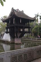 One Pillar Pagoda
|
The One
Pillar pagoda stands on another nearby lake. Built by Emperor Ly Thai Tong
during the 11th century, the pagoda’s shape represents a lotus blossom, the
symbol of purity, which rises out of a sea of sorrow. Since there’s a steep
staircase to get to it, Steve goes in and takes some pictures while I take
pictures from the outside. Long is very helpful and pushes me whenever Steve
wants to take pictures.
Next
we ride through the streets of Hanoi. I find them quite interesting. Telephone
and electric wires hang down from polls in a real mess. Long tells us that it’s
easier to hang new ones than to figure out which ones no longer work and remove
them. Most of the wires don’t even work. We see banners with communist sayings,
written in Vietnamese. Long says that the Ministry of the Interior hangs these
banners which contain communism slogans such as “young workers unite” and
“government protects human rights". We see a sign with a picture of a
horn. It instructs drivers to honk their horn, to warn vehicles in front that
they’re approaching them. Since there are so many different types of vehicles,
especially the slower ones need to know when someone is approaching. This
makes the city very noisy. The quantity and the variety of goods that motorbike
drivers pile onto their bikes amazes me. Just when I think that I’ve seen the
most astounding combination, another load surprises me.
 Bahnar Community House
|
Next we visit the wonderful
Ethnology Museum. It displays exhibits of the diverse ethnic groups which have
been constructed by artisans from villages which they represent. Unfortunately
we don't have time to see the entire museum, but we see a good amount. First we
tour the outside portion. We see a Vietnamese boat, which looks like a very
ornate canoe with oars protruding from its sides. It took several months to
build due to its design. It holds 50 people.
We
proceed to the area where homes from mountain tribes have been brought from
their indigenous area. The first house comes from the Bahnar tribe of the Central
Highlands. It is a 19 meter high community house with a very high roof shaped
like an ax. The roof is about two thirds of the entire structure and the shape
symbolizes skill and strength, especially of the tribe’s men. Although we can’t
see them, later I read that along the top, there are arrows. The house was
built in 2003 by 42 villagers from the Kon Rbang village in Kontum town. This
and the next tribe are matriarchal societies.
 Ky Long House
|
The
next house comes from the Ky village, Buôn Ma Thuôt City in Dak Lak province.
It’s approximately 750 feet in length and
called a longhouse. It belongs to one extended family, often housing three or
four generations of daughters and granddaughters. Each new couple adds a
section. The entrances to both this house and the preceding one are similar. Each
has several steep
ladders which lead up to the platforms on which the houses sit. The ladders
into the Bahnar house are fairly narrow. For both communities, the ladders are
of different widths. Females use the wider ladder while males use the narrow
ladders. The ladders used by females also have wooden breasts on the top.
Steve climbs the male ladder and goes into the house. As we’ve seen in other
Oriental cultures, there is very little furniture inside. The floor is bamboo
and he says it’s not easy to walk on. According to the museum brochure, during
the 1980s, both longhouses and the Ky communal living organization vanished
from the Central Highlands.
 Ancestor Altar in Vietnamese House
|
We go to the area of
the Thanh Hoa province inhabited by people of Vietnamese ethnicity. Long tells
us that Vietnamese make up 85% of the country’s population making it the
largest of 54 ethnic groups. This group practices ancestor worship. The home is
one storey, and very wide. U-shaped, it surrounds the front yard and is typical
of the traditional living style of the Vietnamese rural area. It has many
rooms, each of which has its own purpose. The most important room is set up for
ancestor worship. The carved wooden beams are almost 100 years old. Quite
ornate, it has an altar with religious objects and items of value on top of it.
Several banners hang from the ceiling. The adjacent room serves as an area
used for teaching and learning. The family also gathers in this area to discuss
matters of importance. Long tells us that this is located next to the ancestor
worship room so that ancestors can hear important matters being discussed. We
see a kitchen and another family room. There’s a room dedicated to sewing and
another room for other crafts including painting and printing. We also see a
carpentry room in which they make water puppets and several bedrooms.
Next
we see a building of the Tay from the Dinh Hoa district in Thia Nguyen
province. It is a simple square building with a roof that looks like thatched
palm leaves. The final outside building is a Giarai tomb, Arap subgroup, Gia
Lai province. It has many figures outside including a pregnant woman and
sexually explicit male and female figures facing each other. The figures
symbolize fertility and are intended to accompany the dead into the afterlife.
On
our way to the building which houses the inside portion of the museum, we pass
a wedding party preparing for pictures. We’ve found this to be a very common
site in the Orient. Brides and grooms like to have their pictures taken at
nationally famous sites.
 Fish Traps on Bicycle
Used to Deliver Them
|
The first item we see
inside the museum is the tree of life. It’s a tall, thin statue of a palm tree with
platforms and ornamentation every few feet. Opposite that we see an old
bicycle, covered with fish traps. The man to whom this belonged spent his days
delivering the traps. We wonder how he could see over them since they are
piled so high. We see an exhibit of a Muong funeral with the figures dressed
in traditional costumes. The Muong primarily live in the valley areas in Hoa
Binh and Thanh Hoa provinces. Renowned for the richness of their folk
literature and repertoire of ritual songs, their language shares many elements with
Vietnamese and provides evidence of a common origin. However they developed a
way of life and material culture which is similar to their Thai neighbors.
 Madonna
|
Next we go to the
Christianity exhibit. In comparison to other interior exhibits, it’s large. Ten
percent of Vietnamese are Catholic. There is a replica of the painting the Last
Supper. We see a statue of the Madonna. Her face is very oriental. I comment
that it’s probably closer to what she really looked like than our white
Caucasian images. The final item in this exhibit is Santa Claus. There is one
large figure with a lot of little figures attached. The whole Santa Claus display
is shaped like a Christmas tree.
Outside
of the museum building, there’s a class of girls dressed in Vietnamese
traditional outfits of bright pastel colors. They’re posing for their class
picture. It makes for quite a picture especially because a good number of the
girls are drama queens.
I
really enjoyed the Ethnology Museum. I think it gave us a good insight into
many of the cultures of Vietnam. We had a good amount of time to view the
outside exhibits. However it would have been nice to have seen more of the
inside.
Back
in our minivan, Steve comments that the streets are wet. Long says they spray
the streets in the hope that they will be cleaner. We ask him about his family.
He says that his father was in the military during the Vietnam War. He
contracted malaria and became disabled from it. He spends most of his time
inside his home caring for his bonsai plants. His mother worked for the
government in office supply. Long and his wife live with his parents and will
take care of them when they can no longer care for themselves. Long chose the
type of work he does. He enjoys it.
We
go to lunch in a small out-of-the-way restaurant, a culinary institute named
Hoa Sua Training Restaurant, which trains disadvantaged youth. We have a set
menu and for our starter course we have chicken and mushroom soup, excellent fried
crab, meat spring rolls with nuoc mam sauce and fried shrimp with coconut. We
find the shrimp is okay but not as good as we had hoped. The main course
consists of grilled chicken with lemon leaves, roasted pork with caramel sauce,
steamed vegetables, and rice. We especially enjoy the chicken. For dessert we
have caramel crème. We sit on the outside patio which is decorated for
Christmas. Afterwards we have our picture taken in front of the Christmas tree.
Next
we go to the Hoa Lo prison a.k.a. Hanoi Hilton. Steve is looking forward to
this famous prison camp, however I’m not and become quite uncomfortable early
on. According to the brochure, at the end of the 19th century, it was built to
contain the growth and development of the anti-colonial movement. The French
government increased its police force, built up the court system and
constructed an extensive network of prisons. As the largest in the north, this
prison held thousands, many in chains and leg irons. It opened in 1896. After
the French left, it became a state prison. From April 5, 1964 to March 31, 1973
it served as a POW camp for American pilots and earned the name Hanoi Hilton.
After 1993, the south east third became a museum. The other two thirds were
demolished and replaced with apartment and office buildings.
First
we visit the guillotine room. The French brought guillotines to Vietnam. The
exhibits deal with both the French occupation and the Vietnam War. We see many
rooms and Long describes most of them. One room named the Room of Enemy Crimes
contains a wall painting of the burning of a neighborhood and pictures of the
devastation. We see the small cells in the sections where each of the sexes
were imprisoned. When we enter the first room dedicated to the Vietnam War, we
read the comments about how well American prisoners were treated. There’s a
picture of prisoners eating a chicken dinner on Christmas. The description
boasts of the wonderful meal the prisoners received including half of a chicken.
Long tells us that this is utter propaganda. He says that during the war
rations were so small that each North Vietnam citizen was allowed only 250 grams
of meat per month. He says that there is no way prisoners received half a
chicken in one meal. We are amazed that he will openly admit to the propaganda
of his government.
In
the courtyard outside, which was used for exercise, there is a memorial to
“patriotic” combatants. The carvings of the figures in this memorial are of the
style we recognize as traditionally communist, extremely boxy. I am so relieved
when we leave the museum and go on to our next stop.
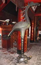 Phoenix Standing on Turtle
with Pearl in Mouth
|
We ride to Van Mieu, the
Temple of Literature, and the first university of Vietnam. Dedicated to
Confucius in 1070 by Emperor Ly Thanh Tong, it became the university for
education of mandarins, considered to be “knowers of all”. Mandarins served as
government officials. The outside gate appears large and impressive. It's inscribed
with a request to dismount from one’s horse before entering. Five courtyards
are situated inside. The first contains a beautiful reflecting pool. I find all
of the grounds beautiful. We pass through a bell tower gate which is much like
those we saw in Imperial Chinese architecture. Long explains the four major
symbols of the university, (1) the unicorn represents devotion and loyalty, (2)
the phoenix represents wisdom, (3) the turtle stands for long life and (4) the dragon
is for power.
We
see the Confucius Temple. One of the rooms contains an altar to Confucius.
Alongside the altar we observe a phoenix standing on a turtle with a pearl in
its mouth, representing a long life of intelligence and great strength. Only
the best of the best, males of course, were admitted to the university. In
1484, Emperor Le Thanh Tong mandated building a stele for each class going back
to 1442 to honor those receiving doctorates. This numbers 82 stelaes. Each
graduate has his name and record engraved on a stele. Each stelae sits on top
of a turtle for all time. I’m not so sure I would want my grades posted for
eternity but Steve thinks it’s a wonderful idea.
We
see a fish and a bottle which Long tells us is another symbol of knowledge. The
bottle holds holy water and it's believed if you touch it, it will make you
intelligent. There’s another area dedicated to Confucius, who will provide
suggestions to his visitors. The receiver uses them to help decide what will be
best for him in his life. This area has a more individualistic focus than similar
areas that we saw in China. We visit the small souvenir area. We buy a few
birthday cards, necklaces each with a different Confucius symbol for our nieces
and a few bookmarks for gifts.
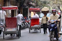 Cyclos & Varied Transportaion Modes
|
We return to our
hotel but don’t go inside. Instead we get into a cyclo, which is similar to a
rickshaw. My driver tilts the cyclo forward and Steve helps me into it. This
is much easier than I imagined it would be. Steve and I each ride in a separate
cyclo. It’s very interesting. We ride right alongside traffic through the old
quarter. We see and pass many other cyclos. Later Long tells us that cyclos are
not only for tourists. We go through the shopping district. As we ride, we see
that each street specializes in a specific type of good. We ride down the shoe
street, the metal goods street, at least one clothing street and streets which
sell many other types of goods. One of the corner stores looks as if it
contains nothing but Santa suits. Both of our drivers are very considerate and
slow down or stop, as appropriate, each time we raise our cameras to take a
picture. I am amazed at the number of people who are walking and carrying
different types of goods which they appear to be delivering. One woman even
carries a huge basket, balancing it on her head. We see an interesting electric
billboard which is topped by an Oriental type roof, fusing new technology with
traditional architecture.
We
arrive at our next destination, a water puppet show at the Thang Long Puppet
Theatre. Developed at least 1000 years ago, water puppetry started in North
Vietnam. Rice farmers manipulated wooden puppets using their rice paddies as
the stage. Traditional music plays in the background. We've been really looking
forward to this especially since several people we know recommended it. We are two
of the first people to arrive in the auditorium. I try to sit in one of the
first rows but Long urges us to climb the stairs and go up higher. Although we
take his advice, we soon learn that this is a big mistake. Very soon the rows in
front of us fill up. Once the show starts, we can barely see. People in front
of us all keep jumping up to take pictures. Even though Steve stands, he doesn't
even get one decent picture. He gets the tops of people’s heads. The show is an
utter disappointment and when we meet back with Long, I tell him so. I request
that we stay to see the next show but he says we cannot do this. The little that
we could see was impressive.
We
have dinner at a French restaurant. It’s delicious and includes soup; starters
of shrimp, pickled salad, fried squid, crab spring rolls; main course of chicken
rice, vegetable with shrimp, a curried vegetable which is not spicy; dessert of
pineapple and watermelon, and tea. We purchase wine.
After
dinner we return to our hotel. Except for the water puppet show, it’s been a
very good but quite long day.
Day
5: Sunday, December 14
We
drive to Ha Long Bay. We see people along the highway selling fruit and
wares. We pass fields of corn and bananas, and rice paddies. Long tells us
that about 60% of the population work in some stage of rice production. The
army has approximately one million soldiers. Service is compulsory for men
between the ages of 17 and 25 unless they have a job or go to school. Since
Long’s father served, his children don’t have to. Long has two degrees from
the National University in Foreign Language and Tourism. In 1997, he led a
tour of National Geographic photographers. He learned a lot and became very
interested in photography.
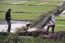 Working Rice Paddies
|
We ride through one
of the few towns on the way to Ha Long Bay. Long tells us that coal and oil
are Vietnam’s main fuels. We pass a coal power station. It doesn’t look
particularly special, just an ordinary building. We stop to take pictures of
rice paddies. The very manual irrigation process consists of two people
holding a cone on a rope. There’s a stream on one side of them and a trench
which leads to the paddies on the other. They dip the cone into the stream and
pour it into the trench. Off to the side, I see another woman working in a paddy.
I’m not sure if she’s harvesting rice or doing something else. To grow rice,
it’s first planted outside the paddy. After approximately two weeks, it
sprouts, and then it’s transplanted into a paddy. We see a man fishing with
batteries. He shocks the fish to stun them. Then he catches them. The
paddies are very green and I find this a picturesque view.
We
stop at a craft place to shop. It has a steep ramp at the entrance which Steve
helps me ascend. Hóa Đơn is a training facility for disabled teens.
They are working on the premises and we have the opportunity to watch. It’s a
vocational school where the students live on the grounds. If they want, they
go home on Wednesdays after working for six days. The crafts are very
impressive and we buy many to give as gifts. We purchase scarves for our
sisters, embroidered wall hangings for Pete and Cathy’s and for friends’ new
homes. We also purchase two compasses inlaid with hand carved wood for
nephews. I’m delighted that we have almost completed our souvenir shopping.
We
see that even in the areas where there is a lot of land, buildings are tall,
long and narrow to keep the frontage small and taxes low. Farmers’ living conditions
have been improving so they are building better homes. Coal is used for
cooking and some heating. As we get closer to the mines, the streets and
sidewalks become black from the coal dust.
We
pass the province teachers’ college. Children ages six through 17 attend
school six days a week. There’s a three month summer vacation but no winter
vacation. Elementary school is five years, followed by three years of middle
school and four years of high school.
I
find the ride to Ha Long Bay interesting. We see many examples of country
lifestyles characteristic to the northeast of Hanoi. Long does a great job of
providing the details of these lifestyles. When we arrive at the bay, Long
arranges for our boat. He selects one that is as easy to board as possible.
Both Steve and Long help me go down the rough concrete stairway.
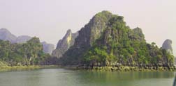
In 1994, Ha Long Bay became a
UNESCO world heritage site featuring thousands of limestone karsts and small
islands. The limestone evolved over 500 million years with the karsts forming
for 20 million years impacted by the tropical wet climate. Historical research
has shown prehistoric human beings inhabited this area tens of thousands of
years ago. Earliest cultures include the Soi Nhu from 18,000 to 7,000 BC, the Cái Bèo from 7,000 to 5,000 BC
and the Hạ Long from 5,000 to 3,500 BC. Many artifacts found in Ha Long
Bay’s largest grotto show that Ha Long Bay played an important part during the
history of Vietnam. In 2008, Ha Long Bay ranked among Vietnam's most popular
tourist destinations.
There
is a local legend about the formation of Hanoi Bay. The Vietnamese fought
Chinese invaders and their gods sent a family of dragons to help them. The
dragon spit out jewels and jade. The jewels became the bay's islands and
islets and formed a wall against the invaders. This allowed the people to keep
their lands safe and later formed the country of Vietnam.
 Lunch on Our Ha Long Bay Cruise
|
As soon as we’re
underway, the staff feeds us a delicious lunch. It’s only the three of us on
this boat which looks as if it could hold at least fifty people. We start with
prawns and crab. The seafood we eat comes from the bay. Long shows us how to
make the traditional sauce. One squeezes kumquat into fish sauce and mixes it
with salt and peas. Next we have vegetables and rice. Long eats with us and we
discuss many subjects such as the food price and quantity eaten by Vietnamese
and Americans. Three Vietnamese eat a one pound lobster which they divide into
many dishes. It would be used for soup, salad and the main course of a meal. The
same lobster probably wouldn't fill most Americans.
We
discuss medical insurance which the government no longer provides for most Vietnamese
citizens. Long gets his from his employer but he does not like the clinics his
insurance uses. Long's wife gets her insurance from her company. His
insurance cannot cover her. There’s no social security or other government
insurance unless one works for the government or military. We explain our
political party system. Long thinks the Scandinavian systems are the best but
he likes to make his own choices. We ask him about whether he likes his job to
which he replies that it depends on the tourists to which he’s assigned. He
says that the Danish seem to be the best. Steve and Long discuss cameras.
Long also uses a Canon. He tells us more about his National Geographic group
assignment in 1997, which he enjoyed very much.
The
boat is large and very comfortable. After lunch, Steve and I go up to the top
deck using the large stairs outside. Steve pulls me up while Long and a crew member
spot. It’s nice and sunny on deck but there are only wooden lounge chairs. I
find it very difficult to move to move around. I see much of this beautiful
bay, but I just can’t position myself to take good pictures. Steve makes up
for this. He snaps away and gets many nice ones.
 Fishing Village
|
Just
when I’m thinking that the crew has been so good and helpful, especially the
female member, she brings up a tray of jewelry, mostly freshwater pearls, and
makes a heavy sales pitch. I get aggravated that she won’t take no for an
answer! I show interest in a pair of pearl earrings and ask the price. She
says $30 which I think is too much. I say no and she lowers the price about
four times finally reaching $25. I accept thinking that at least she’ll leave
me alone to enjoy our ride. She only tries to get me to buy other items. I’m
just about to ask Steve to get Long to ask her to stop, when she quits. She
then returns with other items and starts pitching to Steve. After he says NO
several times, she leaves. Actually asking Long to have her stop pitching
probably would not have been fruitful. Later I tell him that the one negative
part of the day was the incessant sales. He replies that the pearls are of
excellent quality. The Japanese contracted with Ha Long Bay to seed the bay.
They take only the best and leave the rest for the locals. The boats sell the
next best. I agree that they are good quality. He says that especially on a
cruise like ours with so few passengers, much of the profit comes from what
they sell.
 Limestone Karsts & Islands
|
We
see some incredible formations of limestone. One is called the hen and chick
because it looks like a larger mother hen facing her small chick. Another
looks like a sailboat alongside a rowboat. I find the colors and texture of
the karsts interesting. We were supposed to stop at some of the formations.
We're disappointed that we didn't. Despite this we feel that the cruise has
been amazing!
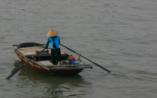 Vietnamese Fisher Woman
|
After approximately
an hour, I get tired of the sun. Since I’ve had episodes of skin cancer, I
have to be careful not to get too much. We return downstairs. Steve and Long
again discuss photography. I admire the scenery. We pass boat villages of
people who fish and farm the water. Approximately 1600 people live on Ha Long Bay
in fishing villages. They work on their floating houses fishing and performing marine
aquaculture. We see other boats like ours and small boats with Vietnamese people
fishing or rowing. I get a beautiful quintessential picture of a lone woman in
traditional dress rowing her boat.
We
dock at a location which is easier to disembark than where we embarked. I only
have to climb three sets of lower stairs. I sleep almost the entire ride back
to the city. We return to our room and Steve naps. We go out for dinner to
what is supposed to be a Vietnamese restaurant. It seems to be a very high end
one. I order a bowl of soup and a glass of gewürztraminer. Steve orders a
lobster dish but what comes appears to be more like crab.
During
the night, Steve gets nauseous. He finally feels better. Then a leak in our
ceiling starts.
Day
6: Monday, December 15
We
get up at 8:30 am so we can get to breakfast by 9:30. Since we have the day to
ourselves, this is early for us. Steve eats light while I have dim sum,
salmon, and rice porridge into which I mix meat, shrimp and tofu. I remark to
Steve that he’s really changed my eating habits. On our first international
trip in 1991, I only wanted an American breakfast and while I’d eat what locals
eat at any other meal, breakfast was non-negotiable. Now I really enjoy local
breakfasts. I’ve loved Dim Sum since I first tried it years ago and find the
porridge a new, wonderful taste.
After
breakfast, we look for the hotel business center, so Steve can check his work
email. We walk to the other wing of the hotel encountering several sets of a
few stairs each. We decide to return to our wing by walking outside. This
turns out to be a rather long half block but it’s quite interesting. A vendor
approaches us selling hats and says “remember me?” Steve says yes but he
doesn’t want her products. Many vendors approach us. We continue to refuse
their wares and keep walking. On the other side of the hotel, we have to walk
in the street because many motor bikes are parked on the sidewalk.
Back
in our wing, we find the business center. We report the leak to reception and
return to our room. Soon maintenance comes, inspects the leak and fixes it.
He says that it’s a small leak. Steve reads and I work on my log. We take a
rest to catch up on our sleep.
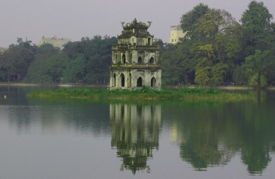 Thap Rua Pagoda
|
When we get up, we
head out to Hoan Kiem Lake in the middle of our section of Hanoi. The park is
beautiful. I especially like some very nice, colorful flower gardens. We see
the Thap Rua pagoda in the middle of the lake, a rather simple pagoda. Hanoi
often uses it as its emblem. The name means tortoise tower which I believe
comes from the legend of the lake. In the mid-1400s, heaven gave the emperor a
magical sword which he used to force the Chinese out of Vietnam. After the war,
the emperor was boating on the lake when he saw a giant golden tortoise
swimming. The tortoise grabbed the sword, dove deep into the lake and returned
the sword to its godly owners. The name of the lake means lake of the restored
sword.
People
in the park are friendly although it’s difficult to know when to say hello. If
a person is trying to sell something, a greeting invites the start of the sales
pitch. An older woman with a bag comes up next to us as we are taking a
photograph of the street. She greets us and we look the other way. When she
doesn’t try to sell what she’s carrying, we exchange greetings.
This
park is known for a temple on one of its islands. We see the bridge to the
temple and decide to take it. I barely notice the military guard at the
entrance of the bridge to the island. His green uniform blends in with the
shadows and the plants. I very much like the artwork on the gate, especially
the picture of a tiger. Unfortunately a graffiti artist has decided to draw a mustache
on its face. When we get across the bridge, the ticket taker asks us for our
tickets, which we didn‘t know we needed. Steve tells him this and we begin to
go back to buy our ticket, but he lets us go in. We arrive at a stone bridge
which appears hard to push the wheelchair over and difficult for me to walk.
Steve leaves me facing the water and he goes to see what’s on the other side of
the bridge. Two groups of men play a game that looks like checkers. They take
their game very seriously. Out of respect for their privacy, I covertly take
one picture. Others come by and just shoot away, so I openly take more shots.
They don’t seem to even notice. I enjoy watching many people come and go.
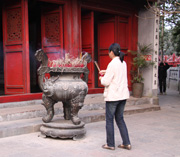 Woman Praying
|
When Steve returns,
he says that I can go through most of the temple on the other side of the
bridge since there are only a few steps. Built in the 18th century, the Ngoc
Son Temple provides a meditative spot for relaxation and prayer. The outside of
the temple has an incense burning area. We see several people praying there.
We look through a window to the inside of the temple. There is a very large
turtle enclosed in a glass case. It looks colorful because it lit up with
tinted lights. The turtle supposedly lived in this lake. The temple is interesting
and quite different than others we have seen. We think it’s a Shinto temple
since Shinto often focuses on nature. As we leave the temple area, we see the
ticket booth and we buy our tickets.
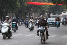 Motorbike Rider Wears Business Suit
|
We start back to our
hotel, checking for places to have dinner along the way. It's the beginning of
rush hour and traffic is heavy. The many motorbike riders wear clothes ranging
from suits to very casual. At this time, motorbikes comprise the most common
mode of transportation. While Steve checks menus as we pass restaurants, I see
an old woman selling bananas and pineapple. With sign language, she asks me to
take her picture by making a circle with two fingers, holding them up to her
eyes and pointing from me to her. It takes me a while to get what she‘s trying
to say but when she points to my camera, I understand. I take her picture and
she wants to see it. She appears to like it. Then she tries to sell me first
bananas then pineapple. Steve returns from menu reading and by this time I‘ve
grown to like my old woman so we buy two bananas for $1.25. She tries again to
sell us pineapple slices and we attempt to explain that we can’t eat it since
it's already peeled. Finally we just say no and walk away. If we had thought
it would be safe for us to eat, we probably would have bought it. Since we
don’t know how sanitary her preparation knife is, it’s not worth the risk.
It’s
now getting dark and quite trafficy. We’re not sure where we are and begin to
get a bit panicky. Unfortunately the map we have is not detailed enough to
help us determine our location. We decide to head back toward the lake and get
our bearings. As so often happens when we make a wrong turn, we find something
better than expected. We pass the Viet Kitchen. Its menu looks authentic and
we decide to try it. On the back of their flyer, there’s a map and we learn
we’re on the wrong side of the lake. We enjoy our dinner. Steve has rice
pancakes with scallops and shrimp. I have shrimp, vegetable and shaved cashews
in a somewhat spicy red sauce with rice. We share an appetizer of house spring
roll. Steve has beer and I have wine. We enjoy dinner very much. The next
day we confirm with Long that it was an authentic restaurant, proving that
getting lost often provides some of the best experiences.
On
our way back to the hotel, Steve stops at an ATM. While Steve goes in, a young
man begins to talk to me. He says his name is Ming. He’s from the mountains, and
is going to school in Hanoi to become a tour guide. He opens his knap sack and
it’s filled with Lonely Planet guides and other books recommended by Lonely
Planet. Here comes the sales pitch. When I say no, he tries to sell me
postcards of his tribe. Since we’re not going to that area, I am not
interested. Steve returns and he tries again to sell us something. Finally he
says all he wants is to earn money to buy dinner. We wonder how much of what
he’s told me is true.
When
we arrive back in our room, our hotel has left me a birthday card and roses. (Tomorrow
is my birthday. It’s also my first birthday on which we’ve ever vacationed!) We
pack since tomorrow we move to our next destination. Then we visit the top
floor lounge of our hotel for a drink. The bar is empty so while the lounge is
nice, it’s disappointing.
Day
7: Tuesday, December 16
We
get up early and go to breakfast at 6:30 am. However breakfast doesn’t open
until 7 am. We return to our room to finish packing, and then go back to the
restaurant at 7 am. I have what’s come to be my usual breakfast which I find
delicious. We check out. Another car takes us to the airport because Mr. Tang
is caught in a traffic jam. We get pulled over. Afterward Long tells us that
the traffic police are very rich because it’s easier to pay them off than to go
through the official fine process where the police take the driver’s papers and
issue a fine. The driver waits two days before he can report to the payment
location, pays the fine, and then he goes to the office which issued the ticket,
presents his receipt and gets back his papers. What bureaucracy! In addition,
there’s no way to fight a ticket. When our driver returns, he tells us that he
was pulled over for crossing into a bicycle lane, to which he was not even
close. Fines are very high for Vietnamese income.
We
arrive at the airport and Long checks us in. A woman comes with an airport
wheelchair and I transfer to it. She takes us through security to a waiting
area and says she’ll be right back. There’s a man sitting opposite us, so I
say hello and ask where he’s from. He replies Holland. He’s a physician on
special leave who came to Vietnam to learn acupuncture. We chat for a while.
He liked his travel outside of Hanoi more than in the city.
People
begin to line up and we get nervous that we’re being forgotten, since it‘s
happened before on other trips. We get on line. In awhile our escort comes
for us. We go to the end of a ramp and change wheelchairs once again. Then airport
staff load us on to a truck which is level to the ramp. We drive to the plane
and they wheel me to the entrance. I proceed to walk to my seat while the crew
offers to assist me many times. The flight is quick and comfortable.
When
we arrive in Hue, the weather is cool with light rain. We meet our guide Van
and driver. Unfortunately Van speaks with a very heavy accent. Despite the
rain, we see motorbikes and bicycles on the roads since they are the most
common type of transportation in Hue. Our hotel, the Saigon Morin Hotel, is
beautiful but not very functional. The layout requires a lot of walking to get
anywhere. We go to lunch outside the hotel, where I order a pancake and Steve
gets a soup and fried rice. We enjoy both.
History of Hue
Although occupied much earlier, Hue became prominent when the feudal dynasty of the Nguyen made the city its capital. Over 300 years ago, the city was an important center of Buddhism. From the 17th to the 19th century, Hue dominated most of southern Vietnam. Originally known as Phú Xuân, in 1775 Trinh Sâm captured it. In 1802, the Nguyen leader won control over all of Vietnam and made Hue the national capital. It remained the capital until 1945 when the Emperor abdicated. In 1949, the French proclaimed the Emperor “Head of State” and made his capital Saigon because the Communists had taken over and established their capital in Hanoi.
During the Vietnam War, Hue’s location placed it in South Vietnam but very close to the border between North and South Vietnam. The battle of Hue occurred during the Tet Offensive of 1968. The city endured much physical damage from both sides. The Communists staged a massacre while the Americans bombed buildings in which they believe Communists were hiding. After the war, the Communists regime and other Vietnamese saw the historical sites as relics of feudalism so restoration did not occur for many years. In 1993, UNESCO declared Hue a world heritage site.
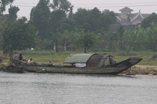 Phu Fishing Village
|
We start our
afternoon with a ride on the Perfume River in a dragon boat. Again only three of us
ride on a boat which probably holds about 20. To board, Steve lifts me down
the stairs then across a plank to a large boat. A smaller boat pulls along
side. Steve and a crew member lift me over the rail onto it. Once we launch,
we see the Phu fishing village. Families live on small boats. Many families
have at least five children. Van says they are very poor. They fish the river
often dredging it with nets. Sometimes all of the children don’t get to go to
school because the families are too poor to pay tuition for each of them.
It rains for most of
the ride so only the brightly and lightly colored buildings look impressive.
Hue is one of Asia's most wet cities. Van tells us that most mornings are very
wet but it often clears by the afternoon. She's rearranged our schedule so that
we'll encounter the better weather for our walking tour.
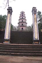 Thiem Mu Pagoda
|
This
boat has a table display of items for sale. Unlike at Ha Long Bay, we don't
encounter a hard sales pitch. One of the crew asks if we'd like to buy
something. When we say no thanks, she doesn't try to change our mind.
We
arrive at our destination, the Thiem Mu Pagoda Temple, Hue’s largest
pagoda and the city's official symbol. There’s a large flight of uneven, high
stairs up from where we dock. The view of the pagoda from the bottom of the
stairs is very impressive. We're happy to see that the sun has begun to come
out. It’s not easy but I climb the stairs with a lot of help from Steve. Today
is training for young monks so we see a good number on the grounds. The
complex is beautiful and peaceful. It has much history. There was no cement
in Hue, so the pagoda was built with limestone. We see a large bell. Van
tells us that when rung on a clear day, it can be heard five kilometers away. We
observe several plaques which contain poetry written by monks.
We
meet Don and Patty from California. They recognize us from Hanoi. Don gives
Steve his card with his email address and asks that if we get a picture of the
historical car which we will soon see, would Steve email him a copy. On June
11, 1963, the monk Thich Quang Duc drove this car from this pagoda to the busy
intersection of Phan Dinh Phung and Le Van Duyet in Saigon. According to the
plaque next to the car, he got out of the car, sat down in lotus position, and set
himself on fire to protest the Ngo Dinh Diem regime policies of discriminating
against Buddhists and violating religious freedom. The car is housed on the
pagoda grounds as a monument to him.
We
observe several young monks tending a rather large bonsai tree. I wonder why
all of them are working on the same tree when there are so many areas to take
care of. The grounds are peaceful and picturesque.
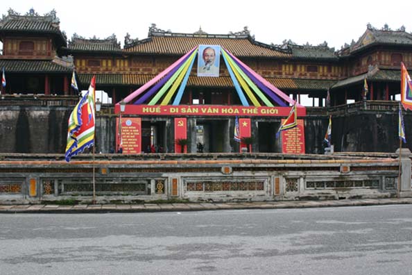 Main Gate of Hue Citadel
|
We
drive to the Hue citadel. Modeled after China's Forbidden City, the royal family
lived here. It’s surrounded by three walls and quite large. Many building were
destroyed by US bombing because the Viet Cong took refuge at this site. Built
in 1804, a moat surrounds the outer wall. First we see the Emperor’s Ceremonial
Hall which contains the Emperor's throne. The inner wall guarded the Emperor's
private world. Most people were not allowed into the gates. They could only
see the king
when
the gates were open. Steve climbs to the top of the inner wall and takes some
good photographs, while I take pictures of the lower level and a few of him on
top of the wall. I’m enthralled with the dragons on roof tops and other ornate
work. We find the architecture so impressive that both of us have a hard time
stopping our picture taking so we can move on.
Next
we go to a Buddhist temple with past, present and future Buddhas. I don’t go
in because there’s stairs and those who enter must take off their shoes. Van
says I can leave mine on. Steve says he’ll come back for me if the temple is
different enough from others we’ve seen to make it worthwhile for me to come
in. When he returns he says that it's nice but we've seen enough similar
temples.
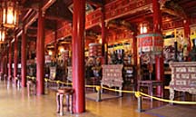 Temple of the Emperors:
An Altar for Each Emperor
|
We walk through the Purple
Forbidden City, which is the English name for Vietnam’s citadel. It has many
stairs going up over a relatively narrow platform. As the saying goes, what
goes up must come down so we climb down the next set of stairs (just like in
China). We go to the Temple of the Emperors. Steve goes in and comes back for
me. There’s a separate altar to each of 10 emperors. Two emperors do not have
altars because they were deported. It’s very impressive. Outside of the Mieu
Temple a.k.a. Temple of Generations, Van points out 10 urns, one for each of
the emperors for whom we saw altars earlier.
We
see several museums. Then we walk through the court and other structures.
There are a good number of beautiful Hindu type gates. We see the outsides of
living quarters. The city goes back much farther than we do but Van tells us
it’s not restored from the bombing destruction. She says Steve can go farther
if he wants, but he decides not to wade through the wet grass. Van shares much
history and background information, but I have an extremely hard time
understanding her due to her accent. I find the complex very impressive.
Next
we’re suppose to go to Dong Ba Market but it’s getting dark and Van says the
market would be difficult for me. Instead she offers to take us to another
market in Hoi An which we’ll visit in a few days.
We
return to the hotel and we’ll meet in two hours for a cyclo ride to our
dinner. The hotel has left me a birthday card and flowers in our room. We take
a rest. When we get up, I have a pump alarm for no delivery. It’s scary and I
only have enough time to do a quick line change. Even with that, we run late.
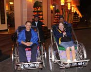 Our Cyclo Ride To Dinner
|
We enjoy the cyclo
ride although it’s hard to see much because by now it’s quite dark. Many of
the streets we ride down don’t have much light. It’s also cold. We cross the
Huong River. The bridge is nicely lit up. We go through the old section of the
city. Van meets us at the restaurant, carrying a helmet. Like most everyone
else in Vietnam, she travels by motorbike.
This
is my birthday dinner and we enjoy the many different dishes selected for us. We
eat at Y Thao Garden and have spring rolls placed on a dish so the arrangement
looks like a peacock, vegetable soup, steamed shrimp, Hue’s specialty pancake,
mixed salad fig, fried fish with tomato sauce, mixed steamed rice and desert of
fruit and green bean cake formed as fruit. The restaurant is nice, but not
what we expected. Our itinerary says we’d be treated to a local family
prepared dinner so, as we have had on other small group trips, we expected to
have a meal with a family. When we ask about this, Van says it’s called a
family dinner because the restaurant is a restored old family house. This is
disappointing because we really enjoy meeting local people and learning about
their lives. On the way out of the restaurant, Van shows us the family altar.
As we look at it, we see several items which give us ideas for our Vietnam chachka.
We
ride back to our hotel by cyclo. My sugar is still high and I think I
underestimated the carbohydrate count of my meal. Tomorrow I will ask Van
about the ingredients of pancakes.
Day
8:
Wednesday, December 17
Breakfast
is okay but not as good as what the Metropole served. They charge for water
here. Overall, I am not very happy with this hotel.
First
we visit the palace outside of the citadel, the Museum of Royal Relics. Most
of it is being renovated by a German team since over the years it deteriorated
from the weather and lack of care especially during the years of communist
isolation. We go through the museum which I find interesting. Built in 1845
and restored as a museum in 1923, its wooden walls have approximately 1000
Vietnamese poems inscribed on them. We see displays from the Nguyen dynasty
including clothing, sedans, gongs or bells and decorative art from many of the
palaces of Hue. I like the green picturesque courtyard. Steve goes to the
front of the palace but I stay behind because the front
is hard to reach.
The
weather today is rain off and on. Van reminds us that mornings are typically
rainy and afternoons clear. Next we visit the tombs of two emperors. At Tu
Duc’s tomb, I stay on the down stairs level in the pavilion. I see the lake and
one building adjacent to the lake which the Emperor built before his death. He
came here to read and meditate. I can see why since it’s a beautiful, peaceful
place.
I
talk with Van and ask her about her life. She chose this work after studying
history and working in the Tourism Department. She didn’t like office work.
She’s been an English speaking guide for more than 15 years and enjoys it. She
has a boyfriend who she’s been dating for approximately 10 years. She likes
singing, music, karaoke and plays the piano. She didn’t realize she had a good
singing voice until a friend heard her and encouraged her to develop her talent.
Van’s parents live with her sister in Danang. Her mother is not in good
health. She has four brothers and sisters. She sends money to her sister to
help support her parents.
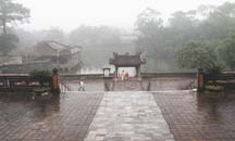 Tu Duc's Tomb: Looking Down from Upper Level
|
Van’s father worked
in construction before and during the war. He did well and invested in
buildings. When the North Vietnamese came, he lost everything. The north
treated the south poorly. He got a job but it was not nearly as good as what
he previously had. The family became poor. All of the children got through school
and those who wanted to went to the University. Her mother never worked
outside the home. Obviously, Van admires and loves her father. She says that
others in similar situations did not do so well for their children. Van sees
her parents when she can, approximately every few weeks.
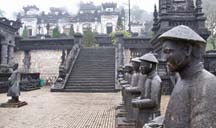 Mandarins Guard Kaih Dinh's Tomb
|
When Steve returns, he
tells me that the tomb is up the stairs, around the bend and across the river. As
we've seen elsewhere, a stele tablet documents the life and achievements of the
Emperor. It's housed within a large ornate arch. He saw a tomb, but actually
the Emperor isn't buried in it. He’s buried in a secret location to prevent his
body from being desecrated by enemies. Steve also saw carvings of elephants, an
important cultural symbol.
Next
we go to Kaih Dinh’s tomb which is quite a distance from Tu Duc’s tomb. This
Emperor wanted his tomb in the mountains. To reach the tomb, we drive through
the countryside. For the first time we see the type of jungle vegetation that I
remember seeing so much of during the newscasts of the war. We pass many homes
which are not well kept. We see shops in front of a good number of homes. When
we arrive at the tomb, I stay in the car because there are many stairs and it’s
raining.
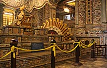 Emperor's Statue Sits on Top of His Tomb
|
Both Emperors started
building their tombs before their deaths. Tu Duc outlived the building of his
tomb and would visit it to relax, write poetry and do other solitary
activities. The second Emperor died before his tomb was completed so his son
finished it. This tomb has a lot of artwork. Steve says that for him it was
well worth the climb to each of the three levels. On the middle level, statues
of mandarins, who ran the bureaucracy, guard the tomb which is one level above.
At the top level the tomb is housed in a beautiful, very ornate museum. There's
a gold statue of the Emperor sitting on top of his tomb. His body is buried 18
meters below. His altar is a lavish display with blue and white inlaid tile and
Phoenix statue, in front of both sides.
On
our drive out of the tomb area, Steve asks about the construction we see just
past the shops and homes. Van says the rich are building homes. I ask if the
present residents will be displaced. Van says that they will be forced to move
to another place. They won’t have any choice in where they’re moved.
We
have lunch at the Tropical Garden restaurant. It consists of a good number of
dishes including legume soup, grilled pork ball wrapped in rice paper, fried
crab meat, grilled beef, fried fish with garlic, grilled aubergine (a.k.a. oriental
eggplant) with onion in oil, sautéed cabbage with garlic rice and fruit. It’s
delicious! We try rice wine. Afterwards I ask Van if this is a typical meal.
She says that the dishes are authentic but Vietnamese would only have two or
three at one meal.
Before
we begin our drive to Hoi An, we stop to see if Steve can replace his distance
glasses. He and Van are in the shop for approximately 20 minutes. He returns
with a nice pair of glasses that do what he needs. A staff member measured his
eyes with a machine. The total cost was $17! His last pair was about $400.
If only the airfare wasn’t so high, we’d become repeat customers.
We
take Route One to Hoi An. It’s a slow going road with a good number of shops.
We ride through villages with shops in front of homes. In the countryside, the
typical Vietnamese home is small, one storey and close to its neighbors. We
see many rice paddies. Van tells us that children in grammar and middle school
attend for five hours a day. We watch a water buffalo munch on roadside
vegetation.
We
stop to taste locally made rice wine and decide we like it. We buy a half
liter for 20,000 dong, approximately $1.00. We continue riding through the
countryside and villages. We reach the mountain pass. Instead of going over
the pass, we take the tunnel. Because it’s so wet, there won’t be a good view
from the pass.
We
ride through Danang and pass China Beach. American soldiers came to the beach
for recreation during the war. We ride through Hoi An and Van tells us we’ll
come back tomorrow. We stay at the Hoi An Palm Garden Resort, a five star
resort outside the city. We have a large room with a patio and a
view of the beach. I find the hotel, room and view beautiful. It’s quite a
walk from the lobby to the room but it’s all ramped and Steve pushes me
easily. I am very impressed with the hotel grounds. The one disadvantage is
that the hotel is far from any restaurant where we’d feel comfortable eating.
There are a few places across the road, but we’re dubious about the food with
my sensitive stomach.
We
take a rest and go to dinner at the hotel. The food is good and the staff
shows interest in us. We talk with one staff member for a while. There aren't
many other tourists in the large restaurant.
Day
9: Thursday, December 18
History of Hoi An
In 200 BC, the Cham probably migrated to this area from Java. By the first century AD, they established the Champa Empire which extended from Hue to just north of Saigon. Hoi An, then known as Lâm Âp Phô, served as the empire’s commercial capital. The city had the largest harbor in Southeast Asia and the river system of the Thu Bon River transported goods between Vietnam Highlands, Laos, Thailand and Asian low lands. From the 7th to the 10th century, the Champa controlled the spice and silk trade. Today's boats continue to have a resemblance of the same hull shape used on the ocean by the Champa.
In approximately 1595, the Nguyen Lord established Hoi An as a trading port of the Nguyen empire. Once again Hoi An became the most prominent trading port on the South China Sea. During the 16th and 17th century Chinese, Japanese, Dutch and Indians came to Hoi An to settle. At this time the town was known as Hai Pho a.k.a. Seaside Town. At first it was divided between the Japanese and Chinese by the Japanese bridge called Chùa Cầu, the only known Japanese covered bridge with a Buddhist pagoda on one side. During the 18th century, Chinese and Japanese merchants regarded Hoi An as the best destination for trade in Southeast Asia. The Japanese believed the heart of Asia, the Dragon, rested below the earth of the town. The city also became a strong and exclusive trade route between Europe, China, India and Japan particularly in the ceramic industry which exported to as far as Egypt and Sinai.
By the end of the 1700’s, Hoi An’s prominence declined with the fall of the Nguyen empire. When Emperor Gia Long became victorious, he thanked the French for their aid by giving them exclusive trade rights to the nearby port of Da Nang, which became the new trade center of Vietnam. For the next 200 years, Hoi An changed little.
UNESCO declared Hoi An a world heritage site as a well preserved example of a Southeast Asia trading port from the 15th to the 19th centuries. Many buildings display a unique blend of local and foreign influences. Currently its population is approximately 120,000. It's a popular tourist destination for travelers from backpackers to cruisers, and especially shoppers.
On
the way into town, we encounter a traffic jam. As usual during our travels in developing
countries, this is a traffic jam with cattle not cars. These cattle are very
thin and each has a rectangular block of wood hanging from its neck. We wonder
what this is for. Neither our driver nor Van has any idea.
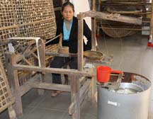 Unwinding Cocoons To Make Silk Thread
|
We
ride to the handicraft center Thắng Lợi. As we enter, we pass by
many beautiful silk lanterns! I’d like to buy at least one but think they
would be difficult to pack. First we see a detailed demonstration of the
production of silk starting from silkworms and ending at the weaving of cloth.
The worms are fed mulberry leaves. They spin their cocoon and become larvae. When
cocoons mature, they are put into boiling water. A machine unwinds the cocoons
to make silk thread, and then it twists several threads together. Next the threads
are died. We see women working weaving looms to make the cloth. Then we go
into the embroidery room and learn about the training program.
We
purchase three sets of table clothes and napkins, one each for our mothers and
us. We go into the clothing room and I am in awe of what I see. I buy a blazer
which will be tailor made for me. I make every decision about style and
materials. They measure me. My jacket will be made this afternoon and tonight
and delivered to our hotel lobby by 8 am tomorrow morning! This will cost $75
- I am astounded.
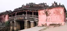 Friendship Bridge
|
We go into town on a
walking tour. The Chinese settled in Hoi An when they sailed to Vietnam. They
left China because they didn’t like the Ming dynasty. The Japanese built the
friendship bridge because they believed a flood was caused by a monster that
lived in the river. They located it over where they believed the monster lived
with the purpose of killing him. The Japanese live on the other side of the
bridge, which is very quiet. Steve goes over to see the other side. There are
two altars inside, one to a dog and the other to what looks like a type of a
monkey. At this time of day, the lighting is better on the other side so Steve gets
some nice shots of the entrance on that side. I stay on the Chinese side
because the entrance steps are steep and in disrepair and the inside is dark
which means it would be difficult for the wheelchair and possibly not safe for
me to walk. Also, we have much to see today, so we can’t spend too much time
here.
We
visit three Chinese temples and I go into the two of them. I skip the one
which Steve says is much like others we've seen. I think the front of the third
temple is quite interesting so while Steve's investigating inside, I take a
picture of it. Quang Dong Temple, the second temple, is very ornate and
beautiful. Built in 1653, dedicated to Guangdong we see his partially gilded
statue on the central altar in the back of the Temple sanctuary. The carp
shaped rain spouts on the roof of the court yard is interesting. Van tells us
that they repaint some of the decor every year for Chinese New Year. They
rotate through all the decorations so that everything gets repainted within a
certain number of years.
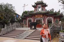 Phuoc Kien Temple
|
<We arrive at the
Phuoc Kien Temple, circa 1690. Dedicated to Thien Hau Thanh Mau, goddess of the
sea, she's regarded as the protector of sailors and fishermen. This temple is
designed like a Chinese pagoda and was restored and enlarged in 1900. This temple
is also ornate, especially the murals and the figurines of the goddess in three
sizes, large, medium and small. I like the decorative roof ornamentation and
artwork in and around the entrances. Originally built as the assembly hall of
the Fujian Chinese congregation and used for community meetings, it was later converted
into this temple.
As
we walk down the streets, we look in shops for a chachka and I look for
earrings. I buy a pair of pearl earrings which I like more than the more
expensive ones from Ha Long Bay. We decide that what’s available for chachkas
are more Chinese than Vietnamese so we don’t purchase a chachka.
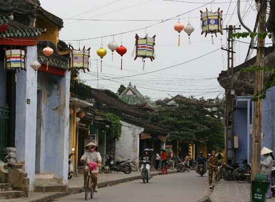 Lanterns for Each UNESCO Country Hang
Over Streets
|
As we walk around the
town, many of the streets have lanterns hanging across them. I ask Van about
these and she explains that there's one for each of the UNESCO member
countries. We look closer at them and see that each displays its country's name
and flag. We pass by a statue of a Portuguese man which seems quite out of
place. Van explains that he helped Hoi An achieve its UNESCO status. Steve
stops to take a picture of the statue. We notice that while there’s still a
lot of wire hanging from the polls, there's not as many as in the larger
cities. One building has vegetation growing on its lower roof. When I ask Van
about that she doesn't have any explanation. I enjoy going down the streets of
Hoi An where the river is never far away. I find it quite atmospheric.
Next we go to the
Museum of Trading Ceramics which contains a collection of blue and white
stoneware made in the Dai Viet period which began in 1054. I find many of the
pieces quite beautiful and jokingly asked Steve if he wants to buy me
something.
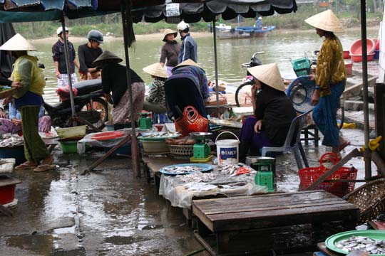 Shoppers & Vendors Come to Market By
Boat
|
We
go to the market next. It’s mostly food. The fruit and vegetable section
contains beautiful produce. Many shoppers and vendors arrive by
boat. I don’t go all the way to the river, because it’s wet and appears
slippery. This area contains seafood. On the way out of the market, Van sees
a soup vendor whom she knows. She stops to buy soup and treats us to some. Since
we’re on our way to lunch, we decide to save it for later. I take a picture of
the vendor, a mother holding her baby, as she dishes out soup.
The
restaurant at which we have lunch backs up to a street on which boats dock. We
have a nice view, but any time we show obvious interest in looking out of the
doorway, several vendors try to sell us something. We manage to take a few
pictures without them. I find our lunch very enjoyable. It’s mostly seafood.
We have an eggplant dish which we really like. Like many of the restaurants we’ve
been to, this one also has a Christmas tree but it's quite unique. Made of
branches which look like birch stuck into a pot of dirt, it has lights,
snowflakes and some evergreen decorations hanging from it.
 Section of Mother
of Pearl Carvings
|
 Carvings Up Close
|
Next we go to the Tan
Ky House, the oldest home in Hoi An. The family, of a wealthy Vietnamese merchant
of Chinese ancestry, has lived here for seven generations. The home goes
from the street to the river. The back of the house serves as the business
warehouse. The beautiful table and chair set have inlaid mother of pearl.
There’s a large portrait of the family matriarch. Along the posts which
support the ceilings, we see intricate mother of pearl carvings. From several
feet away they look like Chinese characters but up close, one sees that they
are actually birds. I wonder if this is the type of Chinese writing described
in a book I read, Snow Flower and the Secret Fan. I see both Chinese and
Japanese influences in the decor of this house. As I look around, I notice the
family cat, a calico who looks like our cat Tribble, sleeping at the foot of
the family altar. As I have on each of our trips, I take her picture and
realize how much I miss my cats.
As
we walk back towards the van, I take some pictures of the river from the main
bridge. The homes on the other side of the river are larger and quite
attractive. We return to the van and ride back to our hotel. I really enjoyed
the day but Steve said that he’d rather have spent more time with Vietnamese
culture. We sit on our porch for a while. Steve reads and I enjoy our view.
Even though it’s cool, I see someone in the water.
Our
resort hands out newsletters at the end of each day announcing events for the
next day. Each newsletter starts with an article about some facet of Vietnamese
culture. The one we receive this evening contains information about Vietnamese
weddings. Since we see quite a few during this trip, I will include some of the
highlights. Today's wedding ceremonies are much less complicated than those of
ancient times. The ceremonies depend on which ethnic group(s) the couple
belongs. The Le An Hoi people have a betrothal ceremony. Prior to the wedding,
the groom and his family visit the bride and her family bringing round
lacquered boxes as betrothal gifts. These boxes contain gifts of areca nuts,
betel leaves, tea, cake, fruits, wines and other delicacies. Unmarried girls or
boys carry these boxes which are covered by red cloth. During the gathering
both families agree to pick a good day for the wedding. In the Le Cuoi ethnic
tradition wedding ceremony, guests are invited to come join the party and
celebrate the couple's happiness. The couple prays before the altar requesting
their ancestors’ permission for their marriage. Next the couple expresses their
gratitude to both sets of parents for raising and protecting them. Afterwards
the guests share their joy at a party.
Once
again we have dinner at the hotel. I eat light because my stomach seems to be
bothering me a bit. After dinner, I order cognac. As usual, it clears up my
stomach. I also eat a banana that we had in our room. That could have helped
too. Steve tries and like Malibu liqueur which is coconut flavored.
Day
10: Friday, December 19
Before
8 am, we go to the lobby to pick up my blazer. The delivery man is late and he
apologizes. The sleeves are longer than I had wanted but otherwise it’s
awesome! We enjoy our final breakfast at this hotel.
 City HomesArtisan Carving Marble
|
Today our first stop
is Marble Mountain. As we drive up the mountain, we see several marble
projections which we learn were once islands. Van points out caves which she
says contain Hindu and Buddha temples. I like the simple pagoda which sits
partway up the mountain. Although Marble Mountain is no longer mined, the
community imports marble so that its craft continues. The mountain is protected
by law making mining illegal. The craft is handed down from one generation to
the next. We watch artisans doing their craft, one carving and two polishing.
One polisher works with water. The other uses sandpaper. Their finish works
are beautiful! We purchase a Buddha chachka and I buy a pair of earrings.
We
return to Danang, a major port in south-central Vietnam at the mouth of the Han
River. Currently a commercial and educational center of Vietnam, it has the
highest urbanization ratio in the country. It's the third-largest city in
Vietnam, preceded by Hanoi and Ho Chi Minh City. Unfortunately we won't have
time to see much of it.
 China Beach
|
On our way into
Danang, we pass China Beach, a renowned rest and relaxation place for US troops
during the Vietnam War, especially those stationed at the major air base in
Danang. This morning the weather is sunnier here than yesterday and we see more
people on the beach.
We
visit the Cham museum. Van tells us the history. As groups of people moved
down the coastal plain towards the Mekong Delta, they divided into the Cham and
Khmer ethnic groups. The Cham Kings ruled most of southern Vietnam until the
10th century. The expansion of the Vietnamese people brought about the decline
and eventual fall of the Cham by the mid-15th century. Today less than 100,000
Cham people remain. Most live on the coast or at the Cambodian border. A small
group lives in Ho Chi Minh City. Many living on the coast still worship Hindu
Shiva and follow the matriarchal practices of their ancestors. They earn their
living by farming, silk weaving and making gold and silver jewelry. Those on
the Cambodian border practice Islam and are patriarchal. They do river fishing,
weaving, border trading and a small amount of agriculture. Most Cham have
adopted the Vietnamese way of life and dress. The Cham traditional arts,
especially dance and music, have undergone a revival in recent years.
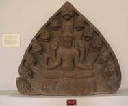 Champa Museum: Goddess Vishnu
|
The museum contains
rooms of Cham carvings most of which are Hindu gods. I'm not very familiar with
Hinduism and realize I have a lot to learn before we go Angkor. Vishnu, the
female representation of the Hindu god, is prominent. The society was
matriarchal so there are many breasts on the statues. I especially like a
statue I called Carefree Dragon. It has a dragon like head with its legs and
rear end kicked up in back. We see a map which shows Cham settlements
and pictures of temples and people. Steve goes upstairs to see the display on
the people. He says they look a little different than Vietnamese people but
it’s difficult to describe in what way.
We go
to the airport and check in. Security goes smoothly. They take us to an area
which is supposed to be a VIP lounge, but isn‘t. At boarding time, staff
takes us to a lift and we ride up to the plane.
Our
flight to Ho Chi Minh City, still more commonly called Saigon, takes one hour.
Although there’s a jet way, we disembark via a lift. We meet our guide Cao and
driver. It takes forty minutes to drive the seven kilometers to the hotel.
The roads are very trafficy, mostly with motorbikes. We even see a motorbike
driven by Santa. A woman sits behind Santa. Vietnam is 10% Catholic and
December is a big tourist month. I enjoy the Christmas decorations which are
everywhere. I find one decoration quite unique, a palm tree wrapped several
feet up in shiny green paper crisscrossed with a wide red ribbon and tied into
bow at the top.
 Notre Dame Basilica From Our Room
|
Our
hotel, the Caravelle Saigon Hotel, is large and beautiful. The lobby contains
a large sleigh of gold and red with four Christmas trees in back of it. We have
a corner room, across the street from the opera house! Of course Steve takes a
picture with me sitting in the desk at the corner.
We go to dinner at
The Blue Ginger Restaurant. The food is okay. Perhaps we would've enjoyed it
more except for a large group of loud men at the table next to us. On our way
back to the room, we are impressed with all of the Christmas lights. Cao tells
us that it's become a family event to come into the city to enjoy the Christmas
decorations. From our room, we can see the Notre Dame Basilica, built by the
French from 1863 to 1880, all lit up. I am enchanted by all the red and green
lights at street level, which we’re way above.
 Saigon Christmas Lights From Our Room
|
History of Saigon
The city began as a small fishing village named Prey Nokor. Originally swampland, the Khmer people inhabited it for centuries before the Vietnamese arrived. Khmer folklore says that South Vietnam was given to the Vietnamese as a dowry for the marriage of a Vietnamese Princess to a Khmer prince for the purpose of stopping frequent invasions and pillaging of Khmer villages.
Early in the 17th century, colonization of this area by Vietnamese isolated the Khmer in the Mekong Delta from those in Cambodia, making them a minority. In 1623, King Chey Chettha II let Vietnamese refugees fleeing from the Civil War settle in the area of Prey Nokor and set up a customs house. More Vietnamese settlers came. The Cambodian kingdom could not stop them because it was weakened from its war with Thailand. Prey Nokor, the most important commercial seaport to the Khmer, became Saigon. The loss of the city prevented Cambodians access to the South China Sea, making their only access through the Gulf of Thailand.
In 1698, the Nguyen of Hue sent a Vietnamese nobleman, Nguyen Hữu Kính, to establish a Vietnamese administration and to detach the area from Cambodia. He's credited with building a large Vauban citadel called Gia Dinh and expanding Saigon into a significant city.
In 1859, the French conquered Saigon and built classical western style buildings. The city became known as "Pearl of the Far East" and "Paris in the Orient". In 1949, Emperor Bao Dai declared Saigon the capital of the state of Vietnam. In 1954, when the Communists gained control of North Vietnam, Saigon became known as the government of South Vietnam. In 1955, with the deposing of Bao Dai, the South was renamed the Republic of Vietnam. Saigon and the adjacent city of Cholon combined into one administrative unit called Do Thanh Sai Gon or Capital City Saigon.
At the end of the Vietnam War, April 30, 1975, the city was taken over by the Vietnamese People's Army. Those who had been on the side of the South call it the "Fall of Saigon" while the Communists call it the "Liberalization of Saigon". In 1976, at the establishment of the unified communist Socialist Republic of Vietnam, the government combined Saigon including Colon, the province of Gia Dinh and two other provinces into the city called Ho Chi Minh City. The name Saigon is still more commonly used today. During the late 1980’s, Saigon benefited from government reforms and became Vietnam’s financial capital. It's the most populous metropolitan area of Vietnam and of the countries of former French Indochina. By 2020, it's projected to have an area of 30,000 square kilometers and a population of 20 million.
Day
11: Saturday, December 20
Today
we go to see the Cu Chi Tunnels, a.k.a. the Iron Triangle, about 19 miles
northwest of Saigon. Cao gives us background on the drive there. Until 1990,
most buildings in Saigon were two storeys. Five storeys made a building big.
After 1990, many more buildings with more than two storeys were constructed.
The city has many bus routes but most people prefer motorbikes. Saigon has bad
pollution especially because of old motorbikes. People keep them for up to 30
years. Buses often run late during commuter time. Cao gave up his motorbike a
year ago. He feels better now but has to get up earlier. He makes $300 a
month. He has two sons at the University and pays between $100 and $150 each
month for each one’s education. Saigon’s population is eight million. We see
a funeral truck which Cao says is ornate like their graves. When communist
Asia reopened, the west invested quickest in Vietnam because of its former
connections.
Cao’s
father was killed in the war in 1968 when Cao was eight year old. He went to
the University to become a teacher. He’s originally from a rice farm in the
north. He taught in a village and liked teaching but the pay was low. He
decided to come to Saigon.
Vietnamese
choose their wedding dates based on the couple’s horoscopes. Traditional
weddings are held in the home with the two families. On the weekend, friends
are invited to celebrate. When the home is small only the immediate families
can attend.
During
the war, Vietnamese volunteered with the north because they had strong feeling
against invasion by foreigners. North Vietnam had three communist forces. The
regular army was well trained and armed. Organized provincial forces fought
within their province. Guerilla forces operated in villages. These forces
armed themselves by killing their enemy and capturing their weapons and arms.
Much fighting occurred at night. Mostly local farmers became Cu Chi guerillas.
Communist headquarters sent few regular army soldiers. The guerillas had much
success holding the land. The south offered higher pay but since it was
controlled by foreigners and minority Catholics, it was not popular with the farmers.
From
Saigon center, we drive through the expanded new city divisions, then rice
paddies and into the highlands. It takes approximately one hour and 50 minutes
to reach the tunnel area. Today we see a very green, forested countryside.
During and after the war, it was devastated and not much green was left. In
the lowlands, Vietnamese grow rice and in the highlands they grow rubber
trees. The French purchased rubber trees, the largest export of the highlands.
This
area was the base from which the Vietnamese mounted their operations for the
Tet offensive in 1968. At its height, the tunnels stretched from the outskirts
of Saigon to the Cambodian border, making approximately 155 miles of tunnel.
Starting in 1940, it took about 25 years to build. During the times of fighting
in the area, the tunnel system became an underground city. In some places it
consisted of three levels. It housed up to 100,000 people. At night the
inhabitants came out to tend their crops. The tunnels were also used to smuggle
Viet Cong and weapons into the South.
We
enter the complex via a large tunnel built for tourists. I think that this large
tunnel entrance must have been built to provide atmosphere. We pass a pavilion
but Cao says it's too crowded, so we’ll stop on the way out to see the
presentation.
 Cu Chi Tunnel Entrance
|
We
see an example of a hole in which a soldier trying to get back to the tunnel
would hide when he needed to disappear from pursuers. A guide demonstrates how
it would be used. There’s a top covered with branches for camouflage. We see
several examples of tunnel entrances. They are quite small and well
camouflaged.
 Hunting Trap Used to Capture Soldiers
|
I find the display of
several traps gruesome. Used for hunting before the war, the Cu Chi converted
these traps to ensnare enemy soldiers during the war. When a soldier fell into
a trap, he would become entangled. His unit would attempt to rescue him but
become a target for the Viet Cong guerillas. There are a number of different
types of traps, each of which was covered with foliage.
We
go to a US tank destroyed by a rocket launcher. At first, from the front, it
doesn't look damaged. When we go around the back we see that much of it was
blown off and the inside destroyed.
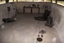 Munitions Factory Bunker
|
Cao shows us a
trench. Trenches were dug and then camouflaged. They served to lead the Viet Cong
soldiers to the tunnel entrances. Running through the jungle, a soldier followed
it until he found a tunnel entrance. Many bunkers were built as rooms on level
one, off of the tunnel to take care of all the needs of the soldiers and people
who lived in the tunnels. They were built so that no light could get in from
above. We see examples of a munitions factory. Here the soldiers used
unexploded US bombs to build their weapons. Approximately 1/4 of our bombs
didn't explode. Cao tells us that there were also bunkers for cooking, storage,
eating, sleeping, family homes, field hospitals and command centers. He shows
us an air hole made through natural formations such as hills of dirt and
leaves. However the one that's displayed is much larger and less camouflaged
than those actually used.
Next
we go to the rifle range. Steve purchases 10 bullets for an AK-47, for $20. He
goes down several
stairs into the range and fires an AK-47. Unfortunately he forgot to bring his
glasses, but when he returns he says he thinks he did fairly well and got close
to the targets which consisted of red polls.
Next
we see a demonstration on the production of rice paper, a Vietnamese food we've
enjoyed for years, used for spring rolls and other types of foods. Cao tells us
this technique is still used today. We see a mill used to grind the rice into
flour. The cook takes the rice flour and mixes it with water. She ladles it
into a flat pan. Next she picks up what looks like a rolling pin covered with
cloth. It has a larger circumference but no handles. She rolls this tool over
the rice paper which adheres to the tool and lifts it out of the pan. Then she
unrolls it onto a bamboo mat and places the mat in the sun for the rice paper to
harden. Nothing goes to waste. What's left in the mill is mixed with water and
used to make rice wine. Anything else left over from this whole process gets
fed to the family pigs. I find the whole process interesting and wonder if the
rolling pin might be something we can use when we make our crêpes.
A
little further on we reach a display of how the tunnels were built. The ground
is made up of hard clay which made construction of the tunnels possible. The
entrances were dug with hooks on long poles. The dirt was placed in a basket,
then in a container such as a hollow bomb and carried elsewhere. The container
was then taken to a final location far from the tunnel entrance, such as bomb
craters and the Saigon River. The builders installed large vents so they could
hear helicopters approaching, smaller vents for air and layered vents to
dissipate cooking smoke. Cao explains that smoke from cooking went through many
vents and filters before it was released outside the tunnel. This served the
purpose of preventing tunnel detection.
We
see a display and demonstration of Viet Cong footwear, sandals made from old
tires. Cao tells us that for the jungle these made very effective footwear, especially
against bamboo spears used in the traps. They protected feet much better than
American army boots and they lasted considerably longer. The complex has a
display of eight sandals hanging from a pole, ranging from baby size to that
worn by a person with a very large foot. Straps cross the toes and wrap around
the ankle.
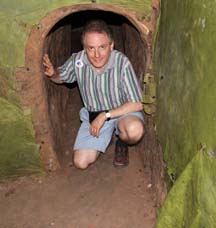 Steve in the Tunnels
|
We see craters formed
by bombs but the bombs did not get deep enough to destroy the tunnels. Steve
goes down into a tunnel with a tunnel guide. Cao takes me to the place where he
thinks that they will exit. When Steve comes back he tells me that first he
went down a set of "easy" stairs with four or five people ahead of
him. When they got to the first level the other people came back up. In total
Steve went through approximately 120 meters of tunnel. He had to crouch very
low to get through approximately 40 to 50 meters of tunnel. He said that at
first this was no problem but then he got tired because he had to stoop down
low and his legs got sore from crouching. The guide asked him if he wanted to
go down to the second or third level. He said that he would. When level one
stopped, there was a 3 foot drop. He sat on a ledge and jumped down. At the
next level the tunnel got narrower and lower. Now he was even more crouched and
he told me it was quite difficult to move. His shoulders brushed both side
walls. It was dark and at times even black. The guide had one flashlight which
he shined in front of Steve but when the guide shined it forward to find his way,
Steve saw nothing. During his time in the tunnel, Steve saw a very sparse hospital
room with wooden stretchers placed on top of polls and draped with sheets or
blankets. The room also has one cabinet.
Meanwhile,
on top of the tunnels, Cao pushes me to the next tunnel exit. We stay there awhile
and when Steve doesn't come out we move onto the next one. After doing this two
or three times, we see Steve, my "tunnel rat", walking towards us
with his guide. I want to get a picture of them together but the path was so
bumpy that it comes out with much motion blur. Cao tells us that the US had to
bring in Philippines men to invade the tunnels because the tunnels were too
narrow for American soldiers.
At
one point during the war, the US tried to flood the tunnels. The tunnels had
been designed to go to the Saigon River so the flooding attempt failed because
the water ran down the tunnels in the mountains to the river.
On
our way out, we return to the pavilion and watch a video presentation which we
conclude was most likely made in 1967. It talks about the great Cu Chi heroes who
used their skills to make Viet Cong battles victorious. We see so much
anti-American propaganda in the film. At the front of the spectator area we
look at a diagram of the tunnel system which shows all three levels. It's done
very well and we find it quite instructional, much more than the film. Level I is
located three to four meters below ground level, level II is five to six meter
below that and level III is seven to eight meters below. Cao says that tunnel
guides don’t take tourists to level III.
 Diagram of Three Level Tunnel System
|
Cao
gives us more background on the tunnels. The Vietnamese community moved into
the tunnels only when the area was under siege. They lived there until the
enemy retreated. Tunnel systems were actually designed and used by the French
in Europe in World War II. The Vietnamese learned of them from the French which
seems quite ironic to us. This was an incredible experience for us both.
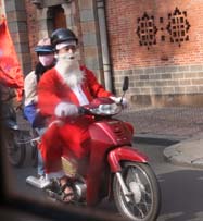 Santa on Motorbike
|
We ride back to
Saigon, passing many motorbikes. We find it amusing that one is driven by a man
dressed up as Santa. We enjoy a wonderful lunch at the restaurant Nhà hang Ðông
Ðuơng consisting of gòi ngó sen tôm thịt (lotus rootstock salad with
shrimp and pork), nghêu hấp rúợu vang (steamed clams with wine), bò
núớng sổt mật ong (grilled beef with forest honey sauce), rau
muổng xào tói (stir fried water morning glory with garlic), cơm rang
lá sen (vegetables, pork and seafood fried with rice and lotus leaves) and bánh
flan (cream caramel).
After
lunch we go to the post office to investigate sending a box of items home. We
go to the DHL window but they would charge $193 to send our box to our home. We
ask Cao about using the post office but decide against it because they don't
have any way to track our package.
We
return to our room. We decide not to go out for dinner because both of our
bowels are acting up. I work on my log and realize that while Steve was excited
about going to the tunnels and I was interested in doing so, I couldn't imagine
that I'd be able to see much. I found some of the path to be quite
rough. As Cao pushed me over the paths, he called them "Ho Chi Minh
Trail". I'm pleased to report that the site was doable for someone in a
wheelchair. It seems to me that although it was rough, it was harder for the
person pushing the chair. Thank you Steve and Cao!
Day
12: Sunday, December 21
Today
we tour the city of Saigon. We drive to the Chinese district of Cholon. On our
way there, Cao provides historical background. About 350 years ago when the
Ming dynasty ended and the Qing dynasty began, Chinese people came to Saigon.
They set up a community outside of the city boundaries, in the rice fields. The
Chinese were great traders. As the city expanded and encompassed the Chinese
community, the entire area became a marketplace.
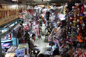 Inside Binh Tay Market
|
Steve and Cao go to
the Binh Tay market, a wholesale market where the community still keeps its
heritage. Most Chinese still speak the Chinese language at home. The market is
used for trade with the Mekong Delta. People from the Mekong Delta bring rice
to the market and buy supplies for many rural communities. Store owners from
all over the city come here to shop for their supplies. Inside it’s arranged in
sections
by product. The stores are tightly packed with goods overflowing into the
aisles, which is the reason I don’t go with the men. It would be too tight to
maneuver the wheelchair. Shoppers find a great variety of food, much of which
is in sacks or on tables. A provider of pots and pans has an incredible variety
of every type of cooking utensil and accessory crammed into a small space. Each
item touches the one next to it. Steve sees a stand with the fake money that
devout worshipers burn in temples so their ancestors can buy what they need in
the next life. There is a section of shoes which includes every type and color
of flip-flop imaginable. Another sells hats of incredible variety of styles and
colors. Steve takes a picture of an escalator which broke a few years ago. It
couldn't be repaired so the market carpeted it. While Steve and Cao visit the
market, I sit in the minivan and observe people on the streets. It's a busy
area.
Next
we go to the Chinese Thien Hau Temple built to honor the goddess who kept the
Chinese safe on their sea journey to Vietnam. It's not as bright as those in
Hoi An but appears more functional. It has separate areas for meetings and worship.
Upstairs they hold classes. Children come here half a day each week to learn
their heritage. Formally the upstairs was used to provide housing for new immigrants
until they were able to obtain and pay for their own housing. Since immigration
has stopped, it's been converted to classrooms.
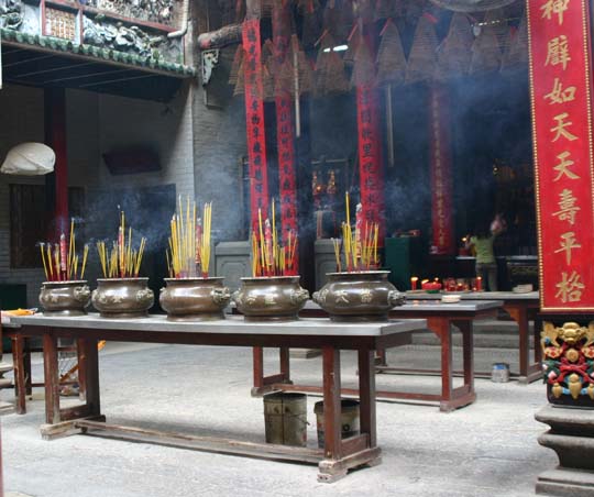 Thien Hau Temple
|
We observe many
people lighting incense and praying. We see a main altar and another with five
incense pots which represent the five basic elements of water, fire, air, earth
and ether. A woman is preparing an offering of food which will be set before the
altar. We see a glass enclosed cabinet which contains three statues of
different sizes of the goddess of the sea. The large one always remains in the
case, the medium one is moved outside in front of the temple for special
occasions while the small one is carried around town. The prayer wall contains
many pink strips of paper which look like thin bookmarks. People donate money
and hang up a paper on which a prayer is written in Chinese characters. The
wall looks similar to the section of US supermarkets where people tape up
business cards.
As
we leave Cholon, I observe that most buildings are two stories. The first story
contains shops and the second story serves as homes. Some streets are organized
by product. One of the streets which we ride down features decorations. I see
many lanterns and flowers.
Next
we go to city center, stopping first at Notre Dame Cathedral. Built in
neo-Romanesque architecture between 1877 and 1880, it’s located in Paris Square.
All the materials were imported from Marseille, France. It has two 131 foot
tall towers which dominate the city skyline. There's a closed gate in back of
the pews, preventing us from entering the area in which mass is being said. I
find it interesting that mass is in English. Steve tells me that the priest is
giving a sermon but it's not loud enough for me to hear. We stay for a while
and I pray the Creed and the petitions with the congregation.
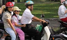 Family Outing
|
We
walk to the post office but since we were there yesterday, we don't go in.
Since it’s a historic building, we take a picture. On our way back to the van,
we see a wedding party on the steps of Notre Dame Cathedral, so we stop for
another photograph. The bride wears a traditional red gown but has a white veil
on top of her head.
We
see quite a few families and many motorbikes in the heavy Sunday traffic. Many
families of one or two children ride on motorbikes with the children between
the parents. We're astounded to learn that adults must wear helmets by law but
children are not required to wear helmets. We speculate that since children
grow quickly, helmets would be too expensive to replace as often as needed. We
see one father with a "Finding Nemo" helmet. His daughter behind him
wears a baseball cap.
 Presidential Palace Map Room
|
We precede to the Presidential
Palace a.k.a. Reunification Palace, built in 1962 on the site of Norodom Palace.
I find it beautiful yet somewhat simple. Today it's only used for tourism. We
visit three floors, seeing many conference rooms used by the president, vice
president and first lady. Most of the rooms are blocked off and tourists are
only allowed to look inside from the barriers. Steve finds the map room, from
where the South executed the war, fascinating. We also see the presidential
office with a desk on which the red phone sits, and the president's family
living quarters. We're moved by the Cabinet room where, on April 30, 1975 the
surrender treaty was signed. Cao tells us that after the war most of the
Cabinet members spent a few years in reeducation camps and then left the
country. Steve goes up to the roof
and takes a picture of the helipad. He finds is quite moving because it
contains a helicopter. We recall the scene which we watched on the news of the
last American helicopter leaving the palace roof before the North took over.
We
return to our hotel to check out. We go for a final Vietnamese meal at le
Cordon Bleu. I have jo quil and shrimp in a red wine sauce and white wine.
Steve has veal cordon bleu and beer. We share a vegetable and enjoy our meal
very much.
We
go to the airport and check in, keeping our wheelchair to be gate checked. They
have us wait in a special section close to an area where people weigh their
suitcases and boxes. When a person finds his suitcase overweight, he reorganizes
the contents until it's within the weight limit. After waiting for quite
a while, a security person comes for us and takes us to the gate. I find a
restroom for people with disabilities and find it wonderful especially since
it's the first one since JFK airport.
They
change our gate and an official says someone will come for us again. It takes a
while but they do. We sit at the new gate until someone comes for us to take us
down the jet way. Our plane to the Angkor area of Cambodia has very few
passengers. A flight staff member gives us a visa application,
entrance/departure card and customs form. We're required to fill each one out.
Our flight time is 40 minutes. The staff hands out box sandwiches, snacks and
water. We eat one snack and save the water and other snack. Steve has some of his
sandwich but I skip it.
Once
we arrive in Siem Reap, we have to walk down stairs to disembark. There's no
railing at the last step. I get a bit scared when the staff tries to help me
but actually pulls me but I am okay. It takes a bit to get through passport
control and visa security. A man takes my passport and papers. Steve goes with
him and I wait. Steve says about 10 people perform the process. One takes an
action then passes it to another who does his task and passes it to the next.
This goes on until the process is complete.
We
meet our guide Hoeun and go to our hotel, the Sofitel Royal Angkor, and check
in. Our room in this resort hotel is beautiful but quite distant from the
lobby. After a rest, we go to dinner at the restaurant Thida Spean Neak. We have
soup, Cambodian cake, beef shish kebab with onion, pepper and pineapple, shrimp
stuffed with garlic, pork, pumpkin and vegetable in a leaf cup, fresh fruit and
a sweet rice cake. We drink ginger wine
On
our way back to the room, Hoeun tells us that there's been a problem between
Cambodians and Thai people. Currently Thailand wants a Thai temple and land
about 25 km from its border. During the past there have been problems when
Thailand invaded Cambodia, resulting in Cambodian dislike of Thailand. This has
made it difficult for both Cambodians and Thai populations located close to the
common border, which formally traded with each other. We return to our room and
I go right to bed because I've been tired all day.
History of Angkor
Before the 9th century A.D., several politically independent principalities made up today's Cambodia. These were collectively known to the Chinese as Funan and Chenla. The Angkor period began in 802 AD. Khmer King Jayavarman II declared the independence of Cambodia, then called Kambujadesa, from Java. He established his capital of Hariharalaya which today is Roluos at the north of Tonle Sap. He unified the country which stretched from China on the north to Champa on the east and the ocean on the South with a combination of military campaigns, alliances, marriages and land grants. The western border was a place identified by a stone engraved with the saying "the land of cardamoms and mangoes". Today this land is Myanmar. He declared himself "Universal Monarch". The new state religion based on the deity Hirihara which combines Vishnu, a.k.a. Hari, with Shiva, a.k.a. Hara, established the king as god-king, a.k.a. devaraja. Large irrigation systems led to intense cultivation and dense population around Angkor.
In 889, Yasovarman I became emperor. He developed into a renowned king and builder, constructing a new city called Yasodharapura. Following tradition, he also built a huge reservoir called a baray. It's believed that these reservoirs had the purpose of either irrigating rice fields or serving as religious symbols of mythological oceans surrounding Mount Meru, the abode of the gods. An elevated temple represented the mountain which contained representation of one or more gods. Therefore Yasovarman built his temple on Phnom Bakheng, a low hill, surrounded by a moat fed from the baray. In addition he built many other Hindu temples and other retreats for ascetics.
From 900 to 1200, the Khmer empire produced astounding architectural masterpieces in Angkor. Seventy-two major temples and other buildings and the remains of several hundred minor temples have been found in this area. As far as we know, Angkor never had a formal boundary since medieval Khmer settlements were disbursed and of low density. An area of at least 1000 square kilometers beyond the major temples contained a complex system of infrastructure which included roads and canals with functional integration and an urban core. In physical measurement this makes it the largest urban area prior to the Industrial Revolution, close to the size of Los Angeles.
The construction of Angkor Wat occurred between 1113 and 1150, under King Suryavarman II. He ascended the throne after becoming victorious against a rival Prince. Through military campaigns, diplomacy and firm domestic administration he consolidated his political position and started construction of his personal temple mausoleum, Angkor Wat. He dedicated the temple to Vishnu rather than to Siva. Until this, it had been Khmer tradition to devote temples to Siva.
After the death of Suryavarman II, a period of internal conflict occurred in the kingdom. In 1177, the Cham to the east sailed up the Mekong River and across Tonle Sap. They sacked the Khmer capital and killed the king. A Khmer Prince, who would become King Jayavarman VII, rallied his troops and defeated the Cham. In 1181, Jayavarman VII became king. He constructed the walled city of Angkor Thom to replace the ruins of Yasodharapura. This included the geographic and spiritual center of Bayon Temple, as well as Ta Prohm and Preah Khan. He dedicated the latter two to his parents. During this time the change of religion from Hinduism to Mahayana Buddhism occurred. He adopted Mahayana Buddhism as his personal faith. Buddha images were added to Hindu temples. Angkor Wat briefly converted to a Buddhist shrine. King Jayavarman VII is considered to be the greatest Angkor king.
After King Jayavarman VII’s death, a Hindu revival ensued. A large-scale campaign of Buddhist image destruction occurred. In 1298, the Chinese diplomat Zhou Daguan came to Angkor and stayed for one year in the capital during the reign of King Indravarman III. Zhou Daguan wrote his observations of Khmer society, approximately 40 pages which still exists today. His work became what's regarded as the most important source of information on everyday Angkor life. He described religion, justice, kingship, agriculture, slavery, birds, vegetables, bathing, soldiers, servant woman and concubines, ministers, princes and "the sovereign, standing on an elephant, holding his sacred sword in his hand.
During the 13th and 14th century, the Angkor civilization declined. Various reasons have been proposed as the cause. None have been conclusively proven. What follows below are summaries of the possible reasons.
1) Ayutthaya, a Thai kingdom, invasions forced the abandonment of the Khmer capital. In his memoirs, Zhou states that the country was devastated by war in which the population was forced to fight. In 1431, Thai invaders sacked and looted Angkor. This is generally regarded as the end of the Angkorian period. After Angkor's collapse, many people, documents and other objects were taken to Ayutthaya in the West or Longvek, the new center of Khmer society, in the south. Within Angkor, internal problems occurred because kings had several wives. This led to princes fighting for power and the thrown. The internal fighting made it easier for the victory of external forces.
2) During the 14th century, Theravada Buddhism came from Ayutthaya and became the dominant religion. Some historians believe this to have caused the Angkor decline because the change in religion destroyed the rooted Hindu concepts of kingship and Angkorian civilization. Buddhist denial of the importance of the royal class brought made the building and maintenance of grand monuments unimportant. War weakened the government, destroying its ability to maintain public works including waterways. The new religion of social equality may have led to rebellion.
3) Natural disasters including earthquakes and climate changes caused the civilization to decline. Australian archaeologists have found that the transition from the medieval warm period to the Little Ice Age may have caused a drought across Southeast Asia in the early 15th century. Angkor’s canals and reservoirs could have run dry and ended farmland expansion.
4) Others believe that the change of trade routes from land to water caused the decline of this landlocked area. The shift in trade routes could have caused the ruling class to move its capital toward the Mekong River for economic purposes.
5) In its July 2009 issue, National Geographic states that infrastructure excavations show that the resourcefulness that changed the fiefdoms into an empire caused its demise. Angkor learned to control its water supply with a great system of reservoirs and canals so that it had abundant rice harvests. However, over time Angkor lost control of its most valuable water resource. Research shows that a large waterworks structure was destroyed by Angkor engineers. At some point an important dam failed and the engineers could not fix it. Instead they took the materials which had not been destroyed and used them elsewhere. When the drought referred to above (in no. 3) came, it could have caused parts of Angkor to hoard water and therefore have an abundance of food. Others parts of Angkor starved. Internal problems ensued. Populations from other parts of Cambodia and outside the country attacked and conquered.
Day
13: Monday, December 22
We
meet Hoeun in the lobby. Our itinerary states that we will begin today touring
Angkor Wat. However Hoeun says that if we first tour Angkor Thom in the morning
and go to Angkor Wat in the afternoon, the lighting will be much better for
pictures. He also states that there will be fewer tourists if we tour the
sights in this order. We tell him that's what we prefer.
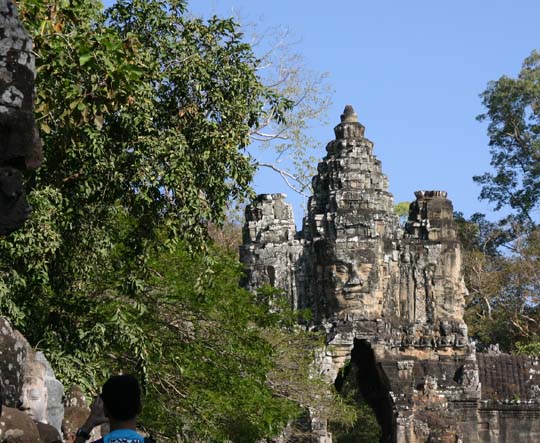 Angkor Thom Gate with
Stone Guards on Left
|
We drive to the
Southgate gate of Angkor Thom. A roadway leads up to the gate and each side of
the road has a row of stone guards. All of the statues on the right side frown
which symbolizes that they are evil demons. On the left side, the guard smile
showing that they are good, happy guards. I find the gate and guard statues incredible.
Many of the guards have been restored. It's easy to tell which ones have not.
The originals have many features worn away and much discoloration. Those that
have been restored have a smooth and clear face. The gate tower also contains several
huge faces of Avalokiteshvara, the being believed to embody the compassion of
all Buddhas. The middle face looks southward while the side faces look east and
west. The middle one appears to me to be meditating. I expect there's a face on
the other side looking northward. However once we enter the gate I am too
amazed at what's in front of me to look back at the gate.
Angkor
Thom was a walled city covering four square miles and containing 50 tower
temples built by what Lonely Planet calls Angkor's greatest king, Jayavarman
VII during the 12th century. The name means "great city". We stop at
the checkpoint and have our pictures taken for our pass card. This will be
checked at each tomb. Back in our minivan, we ride past Angkor Wat. Hoeun tells
us that Cambodians have dark skin. Asians with light skin are not 100%
Cambodian. He is half Cambodian and half Chinese. His grandmother is Chinese.
She used to speak the language but has now forgotten most of it.
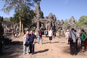 Us Just Inside of Bayon Temple
|
We stop at the first temple
we’ll tour, Bayon, in the heart of Angkor Thom. Bayon Temple contains 216 huge
faces of Avalokiteshvara. Originally Bayon was built as part Buddhist and part Hindu
by Jayavarman VII. After his death, the king’s son removed the Buddhist parts. Two
guards which appear to be mystical animals, an odd looking lion and a flame shaped
nagas, stand at the entrance, one on each side of old worn steps. Later I read
that these are spirits trusted to bring rain. Even with Steve
and Hoeun's help, I find the going rough so I only go part way into the temple.
Much of the surface on which we walk has cracked and become very uneven. Steve
and Hoeun leave me in the shade while they climb through the rest of the
temple. Even though I stay behind, I see more than I expected.
Some
statues have had their heads removed because people and museums want the heads
but not the bodies. I sit and watch tourists walk by, amazed by the number and
variety of tourists. I see several Buddhist monks pass by and I’m happy when I
can get a decent picture of one. I find the Temple majestic. It's built from
large stones some of which are numbered and stacked off to the side, waiting to
be integrated into the restoration. As I look off to the side, I observe a
small lake which is in the shade. Many people are gathered there enjoying the
coolness. It's a nice scene. After watching the area for a while, I write in my
log.
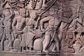 Fresco: Woman Holding Turtle Biting Man While He Points
Arrow at Her Head
|
When
Steve returns, he tells me about what he saw. The lower-level which is the one
on which we entered, has an extensive fresco system. Most of the frescoes
picture war. One shows spear-bearing Champa Warriors packed into a boat
crossing the Tonle Sap. Some depict daily life, such as cooking and a board
game. The board resembles chess. Although this fresco predates chess by
several centuries. Other frescos portray cooking, kickboxing and cock fighting.
The fresco with cockfighting also depicts other events such as a crocodile
hunting for fish. Hoeun said this is his favorite. Another one shows a father
teaching his son how to hunt. Steve says that he found one even comical, a woman
holding a turtle that is biting a man in the ass. The man is pointing an arrow
at her head. On the second level, the towers each have four faces, one on each
side. Everywhere he looked he saw faces, many he said were gigantic. He took an
interesting picture of a face framed by a doorway. He saw a traditional Buddha
draped in a robe with an umbrella over his head.
When
we leave Bayon Temple, we see ruins of pyramid shaped Baphuon Temple. We see a large
causeway leading up to it. Steve pushes me to the side of the causeway where
it’s easier to navigate the wheelchair. Again we see a stack of large blocks
waiting to be added to the restoration. Lonely Planet states that this
structure was taken apart by an archaeological team before the Civil War.
During the Civil War in the 1970’s, the Khmer Rouge destroyed the
archaeologists’ records. Much research has gone into the restoration of
Baphuon. It's believed to be one of the most ambitious restoration projects. There’s
a line of large windows one floor down from the top. Steve goes into the temple
while Hoeun stays with me in my wheelchair. We sit in the shade by a small body
of water. Hoeun says that Cambodians catch frogs in this water and use them for
food. Especially in the rainy season, frogs are abundant. They eat the entire
frog, not just the legs. Hoeun tells me the background of this temple. The
pyramid shape represents Mount Meru. The building of the temple began in 1044 probably
under Suryavarman I and finished in 1065 under Udayadityavarman. It stood in
the center of the city that existed before Angkor Thom.
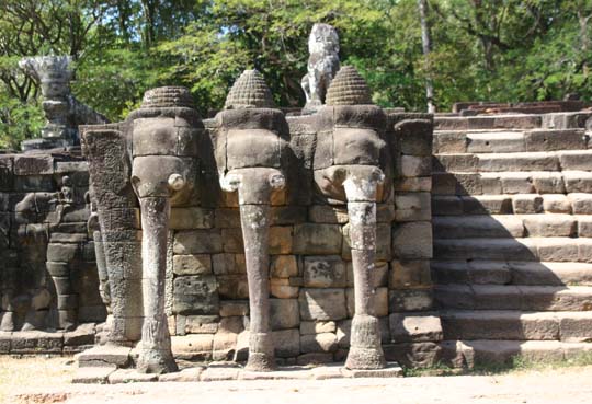 Terrace of Elephants
|
When
Steve returns we go to the next temple, Phimeanakas which is on the grounds of
the Royal Palace. Hoeun tells Steve
that after he sees the temple he should take the platform which will lead him
to where we'll meet him. Hoeun and I enter the gate to the Terrace of
Elephants. Kings used the terrace as a reviewing stand and for public
ceremonies. First we pass the monument of the three headed elephant, Airvata. In
Hindu, it's believed to be a white elephant that carried Lord Indra. It's on
one side of the terrace's central stairway. On the other side, I see elephants
and mahouts (elephant drivers) hunting. I also see garudas, mythical human birds,
and lion-headed figures. Both have their arms stretched so they appear to hold
up the platform.
Hoeun
backs me away from the platform which is on top of the 200 meter long wall so I
can see more of the structure. He explains that soldiers stood on the wall which
contains elephants. The other wall has carvings of lions and this was for the
King and his officers. The king’s place was on the highest platform and only he
was allowed to go up here. In its day, the terrace was decorated with gold
framed windows. All ordinary people gathered on the grass. Only those closest
to the King could hear him speak. So the people that heard what he said relayed
his message to those behind them and those people told those behind them until
all had heard. By the end of all this retelling, the final message was nothing
like what the king had actually said. Hoeun asks me if I understand what he
just explained. I reply that I did and tell him about the game of telephone we
played as children. He says that's exactly what happened.
Hoeun
points out several towers and says they were jails for offenders who had to
spend time in prison. Most of their sentences were brief stays of several days
or weeks.
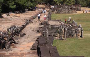 Walkway to King's Platform
|
Steve returns greatly
impressed with what he saw. He shows me some of the pictures he took and I see
the grandeur of the structure from a different angle. He tells me that a small
girl tried to sell him a fan. He said no but she followed him the entire way
through the royal palace area until finally she saw some others who she took
off after. I had seen several children trying to sell items. I guess they
didn't approach me because Hoeun would wave them away. The hawkers in Angkor
are the worst we’ve seen since China.
Hoeun
shows us the Terrace of the Leper King. One of the Angkor kings developed
leprosy. He gave up his kingship and went into isolation. At his place of
isolation he had a six meter high wall built. It contains images of his 1040
concubines to remind himself of them. Hoeun told us that the king's name was
Akas. However when I attempt to verify the spelling, I find that several sources
identify different kings as the one with leprosy.
Next
we go to lunch at a place inside Angkor Thom. We meet some tourists from
France. We order frog. Unfortunately, they’re out of frogs. We also order
Palm Wine. It’s quite strong so we only drink half because the sun is very
strong.
This afternoon we go
to visit the incredible Angkor Wat, built in the early 12th century by King Suryavarman
II as the state temple and capital city. It's the most famous temple in
Cambodia and is depicted on the national flag. According to our itinerary,
Angkor Wat is the world's largest temple complex and covers an area of close to
one square mile. Over 25,000 men built it in 37+ years. It's dedicated to the
god Vishnu and portrays Hindu
cosmology. Its central towers represent Mount Meru, the outer walls symbolize
mountains which were believed to enclose the world and the moat signifies the
oceans. The three layered pyramid temples have towers at the corner of each
storey. Each encloses a square surrounded by interlinked galleries. The central
tower is 31 meters above the third level and 55 meters above the ground. Local
people still use some of the small shrines.
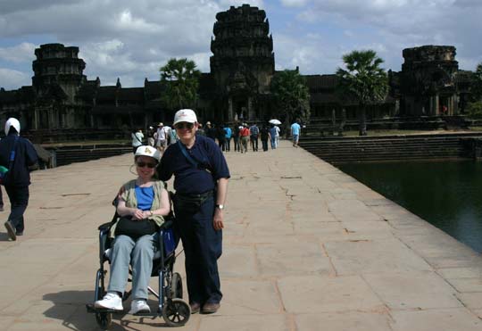 Us Entering Angkor Wat
|
We enter through the king’s gate and see the outer structures.
We pass several libraries where artisans came to learn the art of temple
building. Hoeun tells us that there were no books. Scribes wrote on palm
leaves, stones or scrolls. Along the walk to the king's entrance, we see an interesting
railing that depicts a snake. Later I read that it's actually a seven headed
serpent.
We
go into several halls in Angkor Wat. We see quite a few statues of Buddha and
many Hindu figures. Steve takes a picture of Apsaras, the female spirit of
clouds and water. In carvings of her throughout the temple, she has 56 headdresses
each with its unique meaning. It's supposed to be good luck to rub Apsaras. The
viewer can tell by the discoloration in the carving where most people rub, her
breasts and her legs. We see a hallway that appears to go on forever. It has a
warning sign that says "no access". It's just as well because it
has many doorways, each with a doorjamb which would be difficult for me to step
over. For most of the way, Steve pushes me in the wheelchair. However, when the
going gets rough or the view is down a short hallway, I get up and walk. After
a while we encounter too many stairs and I become tired especially in the heat.
Steve and Hoeun take me to a shady place.
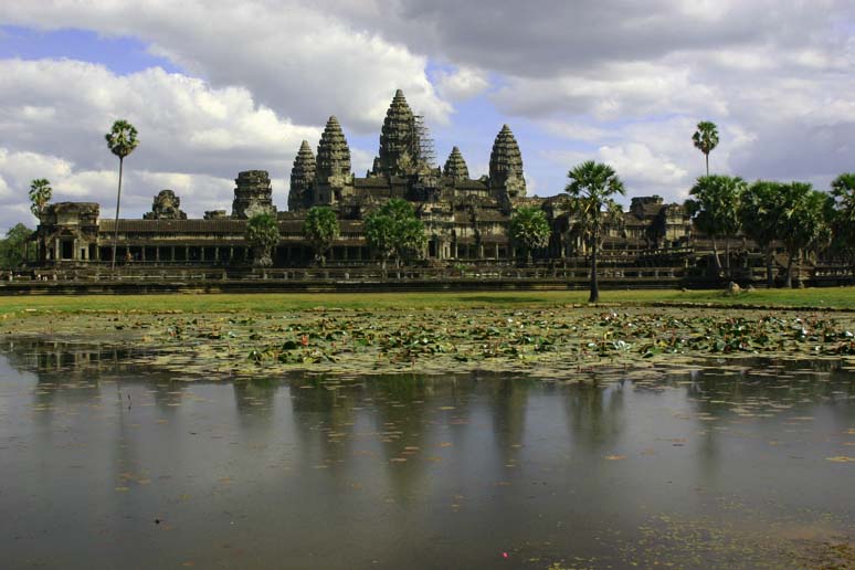 Angkor Wat
|
On the way to the shade, we pass a
lake which has a nice reflection of the five towers of Angkor Wat. Picture time
and I get a nice one!
Steve and Hoeun leave me in the shade and return to Angkor Wat to
explore. For a while I watch people. There’s a building off to my side into
which Cambodia people come and go. One woman exiting the building approaches me
and asks if she can move me because she says I am under a dead branch and she’s
worried it’ll fall and hit me. I let her move me a little, but am concerned
this is a sales tactic. Later I realize that the building she came from is a
place for guides. When Hoeun returns, he confirms that this building serves as
a place that staff can go for a break.
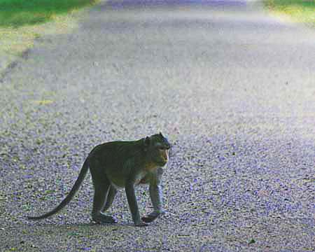 Monkeys Come Out at 3 PM Sharp
|
While Steve and Hoeun explore, I am comfortable in the expanding
shade. I watch a quiet path which I face and write in my log. Occasionally I
see a person walk down the path which is just to the side of Angkor Wat. I find
the view quite peaceful and relaxing. At exactly 3 PM, several monkeys come out
of the forest on the side of the path opposite Angkor Wat. They walk over the
path and go to some benches closer to the front of Angkor Wat. A few people sit
on these benches. Later Hoeun explains that every day at 3 PM a tour group stops
at this location and they often feed the monkeys. I guess the tour group was
small today.
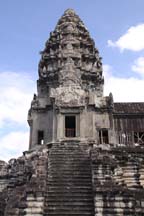 Tower Where King Often Sat
|
When Steve and Hoeun return, Steve tells me that the inside is
incredible. He’s sorry I didn’t come, but it would have been too hard for me. He
found much of the inside similar to Bayon Temple, but on a much larger scale.
On the towers, each stone had a unique hand carved sculpture. Most have been
weathered away or otherwise destroyed.
The stairs up to the tower where the
king often sat are steep and narrow to prevent people from dishonoring the king
by running up them. Seems like a good tactic to me. He also saw an inside pool;
today it has no water. Like in Bayon Temple, he saw many frescoes. In the
southern section of the East Gallery, he saw the Churning of the Ocean Milk
which has 88 asura or demons, and 92 deva or gods with crested helmets. These
figures stir up the sea to obtain its liquid which is believed to provide immortality.
We return to our room for rest. Steve shows me his pictures. I
especially like one fresco of a monkey army.
We go to dinner at a restaurant in Siem Reap but we're not too
impressed. We order two main dishes and two appetizers. Our waiter says that we’re
only allowed three dishes for two people. We tell him that's not our
understanding of what we're supposed to get. Finally he checks with somebody
and lets us have all the dishes for which we've asked. Actually three dishes
would have been plenty.
Day14:
Tuesday, December 23
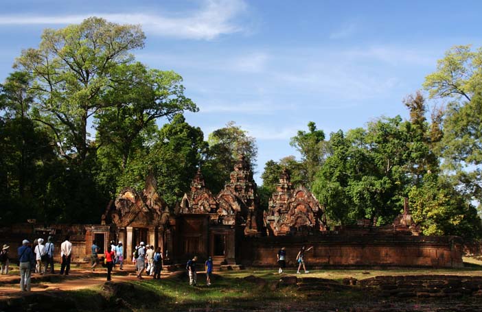 Banteay Srei Temple
|
This
morning we see more of the Angkor temples. First we go to Banteay Srei, a.k.a.
the Pink Temple. Built in the 10th century out of red sandstone. No one has
been able to figure out where the stone came from. Most of the other temples we’ve
visited are gray. Hoeun tells us that this is the only one with pink stone. It
has also been called Ladies Temple, not because of the color but because there
were three ladies on the outside. However they've been destroyed. From the
outside it appears small but it's actually narrow and long. Steve says that he
likes photographing it because it fits all in one
photograph. Due to the uneven access path, I go only part way in. Steve and Hoeun
continue. Later they tell me the inside was somewhat like Angkor Wat with Hindu
religious stories depicted. It also has several towers. I'm amazed at some of
the intricacy of the sculpture on the roofs. Steve comments that these temple
towers have a different feel from the others we've seen. He took a picture of
the Hindu devil (demon god) which has nine heads and nine arms on each side.
Some scholars consider this to be the artistic jewel of the temples. I enjoy it
but found Angkor Wat and Bayon Temple more impressive.
We
stop at the East Mebon Temple crematorium. When a person died, the body was
cremated here. After
washing the pieces in the water, the remnants were put in a container and
brought to the survivors’ home. After a period of time the family drank the remaining
liquid. Steve goes into the temple but it's obvious that the climb would be too
much for me.
Back
in the minivan, we ride down a local road. I take several pictures of the homes,
most of which are on top of stilts. Many have tables under the house or in the
front yard. The families sell produce and goods which they display on tables.
Most of the homes are quite poor and made from palms thatched together. Some
are more substantial, made from wood. Hoeun tells us that some families have
many children and generations living in the same house. There's hardly enough
room for all to sleep. Most people farm. We stop to look for a chachka and end
up buying a slingshot. Hoeun tells us that mostly children use these for
hunting small animals. When he was growing up he had one which he used to kill
mice that came into his family's home. The mice ate their food. We're pleased we
found a chachka for which our guide gave us a personal story.
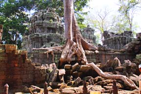 Ta Prohm: The Jungle Temple
|
Next we go to Ta
Prohm, a.k.a. the Jungle Temple so named because trees have grown over and
through many temple  structures.
There’s a long walkway to the temple entrance. On top of a wall, we see a piece
of what used to be a sculpture from a temple tower. It’s intricate and I enjoy
seeing it up close. On the path into the temple we pass a group of musicians.
Cambodia is still filled with land mines and unexploded ordinance which has
left a legacy of disability. These musicians were mutilated from explosions and
now make their living playing music for tourists. We find them quite good and
make a donation. Many such groups work like this throughout the temples in
Angkor. Later at a different temple, we make another donation.
structures.
There’s a long walkway to the temple entrance. On top of a wall, we see a piece
of what used to be a sculpture from a temple tower. It’s intricate and I enjoy
seeing it up close. On the path into the temple we pass a group of musicians.
Cambodia is still filled with land mines and unexploded ordinance which has
left a legacy of disability. These musicians were mutilated from explosions and
now make their living playing music for tourists. We find them quite good and
make a donation. Many such groups work like this throughout the temples in
Angkor. Later at a different temple, we make another donation.
In
the late 12th and early 13th century, King Jayavarman built this Mahayana Buddhist
temple as a shrine for his mother. Later a monastery devoted to the temple's
upkeep developed here. Today silk-cotton trees, strangler fig trees and encroaching
lichen have sent out roots wherever their seeds land. The jungle has not been
cleared. We’re amazed when we see the first wall where roots surround it. We've
seen pictures but seeing the actual structure is incredible.
In
many places there are piles of large stones, some numbered, set aside for
restoring parts of the temple. Steve mentions that parts of the movie Tomb
Raiders was filmed here. When
the going gets too rough, Steve and Hoeun wheel me into the shade and continue
to explore. I sit across from a structure under which groups of tourists come
to stand for pictures in which they’ll be framed by tree roots. I’ve never seen
anything quite like it and find it fascinating to watch tourists of all types
react to it and pose under this gigantic root.
I
read that within the temple there is an inscription that states 12,640 people
worked in this temple. It took more than 66,000 farmers to produce almost 3000
tons of rice each year. The kings and their administrators relied on revenue
generated from rice. Beside farmers, personnel included priests, dancers and
temple workers.
 Within Years This Face Will Be Covered
By Roots
|
When Steve returns,
he tells me that he saw many more and greater structures where trees and
especially their roots have grown through the temple. He took a picture of a
statue with only the area from its eyebrows to its upper chest visible. In a
decade or two, it will be totally covered by the roots. Some of the hallways
were obstructed by huge stone blocks which had been pushed into them from the
weight of crushing plant growth. The roots pry portions of the building apart.
Some Cambodians want to clear the jungle before it destroys more of the temple.
Because of the uniqueness of this site, there is much debate on making such a
significant change to it. Ta Prohm is one of the most popular tourist
attractions in Cambodia.
Next
we ride to Ta Keo, a.k.a. the Unlucky Temple. King Jayavarman V who began
building it, died before it was finished. Another king continued the building
but he also died before its completion. The next time building started, it was
struck by lightning. No one else attempted to complete it because it was so
unlucky. Even though it was never finished it’s taller than 50 meters. However
the towers are not
as intricate as others we've seen because they were never finished. There’s a
large, dry mote around it, so I stay in the minivan while Steve goes in. When
he returns he says it goes quite far back. He saw a wall of what looked like
red sandstone similar to that at Banteay Srei. He climbed to the top of an
“incredibly steep” set of stairs to see a small shrine. I think the picture he
took looking out from the top made the climb worthwhile.
Before
we leave this area, Hoeun points out Ta Mma Mom Temple across the street.
Built in the 11th century, it was the model for Angkor Wat. We
decide not to attempt it and settle for taking a few pictures.
I
am very pleased at the amount of the Angkor temples that I was able to see. While
planning this trip, I was concerned that I would only be able to see the
temples from the outside. While most of the going was rough, with Steve’s and
Hoeun's help I was able to see as much as I felt comfortable doing. It wasn't
easy, but the effort was well worth it.
We
stop for lunch at the same restaurant as we had dinner at last night. Hoeun
says it’s the only good one open at this time. We find it better for lunch. We
return to our room for a brief break. We’re both tired from the heat and enjoy
our rest. We meet Hoeun at 4:20 pm in the lobby and he gives us our tickets
and other information for our trip to Lao tomorrow.
This
evening, we’re scheduled to take a cruise on Tonle Sap, the largest fresh water
lake in Southeast Asia. The name Tonle Sap means Great Lake. It's a lake and
river system. According to our itinerary, during the monsoon season, the river
which connects to the lake to the Mekong River reverses its flow. At this time
water is pushed up from the Mekong into the lake and increases the radius of
the lake from 8800 feet to greater than 52,000 feet. After the rainy season the
water recedes and leaves rich deposits of sediment which make prime agricultural
land for the remainder of the year. In addition, this unique process makes the
system one of the world's best sources of freshwater fish.
When
Steve and I see that the boat is down a steep hill, we don’t think there’s any way
for me to get to it. Hoeun asks if I’m okay with being carried because the
captain can do this. So once again in Southeast Asia, I’m carried like
royalty.
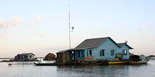 Lake Village Homes
|
We sail through a
community of floating homes. Some are fairly nice and picturesque while others
are quite poor. The family toilet is an outhouse on back of the living
quarters. They use lake water for washing. When the family can afford it,
they drink other water. Hoeun says life span here is about 50 years. We see a
floating school, community meeting house, a school with an outside gymnasium and
a Catholic church. The community moves with the seasons, staying somewhat
close to the bank of the lake.
We see market boats
which go from house to house selling goods. Hoeun tells us that Vietnamese have
been migrating to this boat community. We see a boy fishing in a small motor
boat. Hoeun says that this is his afterschool job.
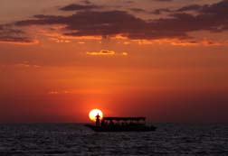 Sunset On Tonle Sap
|
We
sail into an area without floating houses and wait for the sunset. It's a
beautiful sunset! We watch the yellow sun as it descends into the red sky
towards the lake. Steve shoots a wonderful picture of another boat with a man
on its bow standing right in front of the sun. It's his favorite picture of the
trip.
After
the sun sets, I'm amazed at how fast it gets dark. Many of the boats on the lake
race to get back to the bank. I'm glad our captain isn't in such a hurry
because it looks like the ride could get rough in the strong wake. However I
find it kind of exciting to watch the race. Hoeun explains that they're racing
for the best docking spot. It looks to me like we get the same spot as where we
departed from. Once docked, the captain carries me back to the minivan. We
thank him very much and give him a good tip.
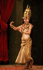 Cambodian Dancer
|
On our way back into
town, we ask on about the tour boats on the lake. Hoeun says many are owned and
run by the people who live in the floating community. We ask how these people
can afford to buy them. He says that many build these passenger boats
themselves.
Tonight
we go to dinner followed by Cambodian dance show. We're not very impressed with
the food selection which is obviously set up for tourists. However we find the quality
of the Oriental food excellent and we especially like the pancakes which are Vietnamese.
We enjoy the interesting and entertaining dance show very much. It reminds us
of Thai dancing. Later Hoeun tells us that when Thailand ruled Cambodia,
Thailand stole traditional Cambodian dancing. We're amazed at the position in
which the dancers hold their fingers. Hoeun says that many Cambodians have
extremely strong and flexible fingers. He shows us that he has the same
flexibility. Several times when he's been assisting me I had to ask him to
lighten up on his grip. I guess this explains why his grip was so tight.
After
the show, we return to our room and pack.
History of Laos
The beginning of Lao has no definite date. Several sources state that authentic Lao history can be traced back to 1353. However, I like to trace a country back to before it was even a country so I will go back to as far as I can find decent information. It's important to note that at least until 1353, much of Lao history is greatly influenced by what's going on elsewhere in Southeast Asia. As appropriate within this section, I will briefly write about countries bordering Lao.
Sometime prior to the ninth century, a culture called the Tai originated in Southern China which included Lao. During the first millennium A.D., the Tai began to migrate into Southeast Asia because of the Chinese strength. They displaced the Iron Age people who made the stone jars at the Plain of Jars (which you’ll hear more about when we get to that area). The Mekong River served as a main migration route. The Khmer strength kept the Tai from achieving dominance in the Mekong valley. The Tai lived in small groups which were influenced by more highly developed adjacent cultures of the Khmer to the south and several Hindu cultures to the West. Most Tai people converted to Hindu.
From the sixth to the ninth centuries, Buddhism came to Lao and became the main religion. The first Lao legal document, which is also the first sociological evidence of Lao people, is a set of laws called "the laws of Khun Borum". There is disagreement between Lao people and Western scholars on whether Khun Borum actually existed. Lao believe he’s a myth but Western historians believe he existed. In the ninth century, probably during southward migration into Lao, the author wrote the manuscript as a type of indigenous verse. It describes an agrarian society where life centers on subsistence farming and domesticated water buffalo. Stealing or killing a neighbor’s elephant demanded strict punishment, showing that elephants were expensive and important possessions of these people.
The Lao people split into groups. Each group took on an identity determined by where they lived in relation to the Mekong River. The Lao-Lum lived on the valley floor. Since the Lao-Lum had the best land for farming and river transportation, they became the wealthiest group. The Lao-Thoeng inhabited the mountain slopes. The Lao-Sūng resided on top of the mountain. This group included minorities related to the Tai and spoke different languages. These groups influenced Lao history including that of today. The people of the Lao-Thoeng and Lao-Sūng have only weak loyalty to the current Lao-Lum controlled government.
In the 11th and 12th century, the Tai-Lao spread into the Mekong valley and today’s North Eastern region of Thailand. In 1353, the "official history" of Lao begins. During the 12th century, historians believe that Khun Lô, the first identified Lao leader, conquered Luang Prabang after attacking the non-Lao people who lived there. Three areas, called mandalas, each with its own capital, developed as a result of the Mekong River geography. The Mekong has three sections defined by river rapids. The Lao-Lum of each area controlled the capital. The section capitals were Luang Prabang, Vientiane and Savannakhēt.
In 1253, the Mongols advanced down the Mekong to attack the Khmers. On their way, they invaded Lao. When they withdrew, the Siamese at Sukhothai founded a new kingdom. In 1351, a more powerful Siamese faction took control and made its capital Ayutthaya. At this time the
kingdom of Lān Nā containing Lao and Siamese formed. The Tai-Lao leaders of Luang Prabang also formed a new state although they were technically subject to the Mongol leaders of China.
The Tai-Lao became the principal strength among Lao people. Beginning in 1271, the dynasty called Phrayā ruled this area. In 1350, following a clash with the court, Fā Ngum one of its princes escaped the Phrayā court. They went to the Khmers in Angkor and the prince married a royal princess. In 1353, as commander of an army, he captured Luang Prabang and set up a new Lao state which included all of the Lao speaking Mekong valley. This became Lān Xāng, a.k.a. the Kingdom of a Million Elephants.
History differs on this point in time. The revision by the French during colonial time, states that prior to the 14th century the civilizations of the Mon kingdom of Dvaravati and Proto-Khmer dominated. After the French colonial time, historians try to represent all groups as equally indigenous and interacting with the predominant Cambodian kingdoms to the south. This version highly regards the Proto-Khmer as Lao nationalist for their bravery and struggles against Westerners.
During the decade after establishing Lān Xāng, Fā Ngum worked to bring all of Lao under his control. He conquered areas including territory in today's northwestern Vietnam. The Khmer leadership considered him to be one of their lords. However his control extended far beyond what the Khmer could claim. His wife probably introduced Theravada Buddhism to Lao. In 1368, she died. Soon after the Chinese Mongol dynasty was defeated. Both events destroyed associations which kept Fā Ngum in power. In 1373, he was overthrown and replaced by his son.
The King of Lān Xāng who resided in Luang Prabang only directly ruled and taxed his town and surrounding areas. Once again Lao was made up of three mandalas. The lords of the other two levied their own taxes and ruled as they thought appropriate. They paid an agreed amount to the King, came to the court for major ceremonies and recruited their own troops to support the King when he went to war. This gave Lao elasticity but demanded that the King have enough authority to keep the country unified. In 1416, the king died. For the next 50 years a series of weak kings ensued, therefore Lān Xāng declined. By the 15th century, Lao's neighbors had become powerful. In 1478, they invaded Lao sacking Luang Prabang. They occupied Lao for more than one year.
Lao's King Vixum, who reigned from 1501 to 1520, took two actions to strengthen Lao leadership. He mandated that the chronicle of royal history, the Story of King Bôrum, be written down to provide legitimacy for Lao. Also he obtained a precious golden image of Buddha from Angkor and brought it to Luang Prabang. These actions showed that the King of Lān Xāng ruled by (1) hereditary right which came from the celebrated King Bôrum and (2) merit earned by the good that he did, which is a key concept in Buddhism, a.k.a. karma.
The next two strong Kings worked to continue the strength and status of Lān Xāng. However, in 1558, the first of a series of Burmese invasions occurred. The Burmese overtook Chang Mai which included the western areas of Lān Xāng. The Lān Xāng King struck an alliance with Ayutthaya. In 1560, he moved the capital to Vientiane because its location was easier to defend and closer to Siamese help. He built a beautiful new temple, the Ho Phra Kaeo and moved the revered Emerald Buddha rescued from Chiang Mai into this new temple. This became a symbol of his reign. He left the Pra Bang Buddha to protect its city. This is when Luang Prabang got its name.
In the 16th century, King Photisarath helped institute Theravada Buddhism as the major religion of Lao. However there have been some discoveries which show this may have at least started to occur in the ninth century. While some fragments of Shiva worship existed in ancient Lao, artifacts show that a gradual process occurred over a lengthy duration causing Buddhism to become the predominant religion as Shiva worship decreased.
In 1569, the Burmese attacked again. They captured Ayutthaya and left Lān Xāng exposed. In 1570, the Burmese occupied Vientiane. The Lān Xāng King drove them out in a few months. The next year the King tried to invade Cambodia but was killed and his army dispersed, leaving Lān Xāng without defense. For 60 years the Burmese took control.
In 1637 Surinyavongsā, regarded as the greatest king of Lān Xāng, became the last to take the Lān Xāng throne. He reestablished Lān Xāng’s independence and restored decent relations with the Siamese King at Ayutthaya. This alliance held off the Burmese and Vietnamese for years. Prosperity increased and Vientiane built many temples and palaces. With the temples, it became a renowned center of Buddhist study. Monks came from Siam and Cambodia to study.
During this time, the first Europeans arrived. Dutch merchant Gerritt van Wuysthoff wrote an account which interested the Jesuits. Soon the first missionary arrived. He stayed for six years and learned the Lao language, religion and customs. Much of our knowledge of Lān Xāng comes from his records. Although he converted few, he made the outside world aware of Lao.
In 1763, the Burmese made their most forceful invasion. All Lao lands were captured. In 1767, Ayutthaya was conquered. The Siamese succeeded in launching a quick counterattack. The Siamese general founded the new capital of Bangkok. He set a goal of capturing Lao. In 1774 he attacked Burma and in 1776 recaptured Chang Mai. This permanently united Siam. In 1778, the Siamese army conquered Vientiane, looting it and taking its most revered article, the Emerald Buddha, to Bangkok. The Vientiane King escaped but didn't survive long. The Siamese deported many prominent Lao families. They forced others to move to Siam. In the eastern lands, some of the Lao groups remained under the control of the Vietnamese court.
In 1792, the Siamese conquered Luang Prabang. However, the Siamese were not as harsh there. They allowed the Phra Bang Buddha to remain in the city and the king to keep his throne, providing he submitted to Siamese demands. In 1782, King Rama I took over the Siam throne and began to change his country from a classical mandala to a modern entity. At first Lao was not affected much and only required to continue to perform Siam obligations.
Although considered a national state before the 19th century Siam, Lao and other groups which spoke the Tai language had almost identical culture and religion. Therefore Lān Xāng or Lao is not usually regarded as an independent country. Different languages were spoken by different groups including Siamese, Khmer, Lao-Thoeng, Lao-Sūng and various minority languages. The Lao-Lum ruled and treated other groups as slaves or savages. It wasn't until the Siamese adopted European concepts of superiority and forced colonial rule on Vientiane that Lao started to develop a national perception.
From 1795 to 1828, Lao became a state of Vietnam. In 1802, Vietnam sacked Vientiane and assumed control of northern Lao. In 1804 when King Ānuvong of Vientiane started rebuilding the strength of his state with secret assistance from Vietnam, Siam was unaware of it. He built Wat Sisakēt to symbolize the revival of Lao. By 1823, he began to go after control in neighboring lands, easily capturing the area around his city. His army crossed the Mekong River and captured Siam’s northeast. He unsuccessfully attempted to go further into Siam. Luang Prabang’s king took Siam’s side. Vietnam did not provide aid to Vientiane. In 1827, Siam King Rama III defeated Vientiane at a battle south of the city. The attackers burned Vientiane. They left a few temples but deported some of the population. In 1828, Siam captured King Ānuvong and he died imprisoned in Bangkok. The Vientiane kingdom became a Siamese province.
In 1848, Lao again became a state of Vietnam. Luang Prabang’s king retained some independence by fulfilling the requirements of China, Vietnam and Siam. Siam ruled the rest of Lao with a heavy hand as Siam continued to modernize moving toward the practice of European imperialism. Chinese and Vietnamese immigrated to Lao, displacing Lao people who were forced out of their lands. It seemed that Lao people would become a minority to the Siamese.
European arrival saved Lao from Siam. The French and British rivalry divided most of Asia between the two powers. Siam modernized to be able to keep its independence, but was unable to defend its borders where minority cultures lived. In 1883, a treaty between Vietnam and France provided the French with control of the territories formerly under control of the Vietnamese court. Since most of Lao fell into this group, the French claimed what had been Lān Xāng. In 1886 Auguste Pavie, who had 17 years experience in Vietnam and Cambodia, became French vice-counsel of Luang Prabang. He saw the French domination of the Indochinese as emancipation from ignorance and Siamese feudalism since he considered the latter as corrupt and oppressive. When Tai from the mountains attacked Luang Prabang, Pavie organized defense and rescued the king while the Siamese fled. The king requested French protection to replace Siam rule. Pavie could not provide this but did annex a Tai area to French Vietnam, labeling the act as building goodwill.
In 1890, the French leadership in Hanoi wanted to annex all of Siam using Lao separation as the first step. In 1892, Pavie became French Consul-General in Bangkok. He insisted that Siam allow French “commercial agents” in major Lao cities. He believed that he could establish a French protectorate over Lao which would facilitate sufficient weakening of Siam so it could be annexed. Siam quickly sent troops and administration to its Lao lands but two factors prevented it from maintaining control of Lao. The infrastructure in these distant lands did not provide enough capacity for Siam to gain enough leverage and Siam relied on British support which did not come.
During 1893, border clashes occurred and French armed vessels sailed towards Bangkok. Siam gave in and France became protectorate over the east of the Mekong River. In 1904, the French induced another conflict. Once again Siam backed down and relinquished two parcels of land west of the Mekong. Another portion of land was reallocated from Cambodia to Lao. Changes were made to the Lao Vietnam border. These changes establish the Lao borders as they exist today.
The French wanted to capture more of the land within Siam borders, where Lao speaking people resided. However Britain wanted to maintain Siam as a neutral country between its territory and French territory. In 1909, the French decided it needed Britain as an ally and gave up its efforts to capture Siam. Lao borders stabilized as they exist today. Only approximately half of Lao's population spoke Lao as its first language, although the other half spoke North East Thai which is very similar to Lao.
Although it remained a French territory, for approximately 50 years, France did not pay much attention to Lao. The French added the s to Loa’s name, making it Laos. In this history, from here forward, I will refer to the country as Laos but will continue to call the people Lao. The areas of Luang Prabang and Champāsak formally had internal independence but actually French residents
controlled them. This included the king of Luang Prabang who remained loyal to the French throughout his 55 year rule. The remainder of the country was originally divided into two regions, Upper and Lower Laos. Each had its own leader. Afterwards the country was partitioned into 11 provinces. In 1898, all of Laos came under supervision of a Resident-Superior who resided in Vientiane and answered to the French Governor-General in Hanoi. The local authorities were responsible for health, education and justice. Funding of their operations had to come from local funds. Hanoi controlled security, customs and communication.
In 1910, the population numbered 600,000 which included many Chinese and Japanese. A local militia of Laos and Vietnamese troops under French officers was put in place. They decreased theft and abolished slavery including the Lao-Lum practice of demanding labor from the other Lao subgroups. Vietnamese staff provided administrative support to the 200 French officials running the country. Vietnamese and Chinese came to repopulate Laos towns and revitalize trade. The head tax collected by the Siamese remained. However revenue increased because the French misappropriated less than the Siamese. The French mandated the Lao each provide 10 days of service per year. Exemptions could be purchased with cash. This was the first time the Lao-Lum had this requirement and they resented it. Chinese and Vietnamese were exempt by paying higher head tax. Additional revenue came from opium, alcohol and salt. However Laos ran at a deficit. Development especially in the Highlands remained slow.
Organized resistance to the French did not occur for a while because the Lao preferred French rule to Siamese. In 1901, an uprising occurred in the South. It gained ample support and reestablishment of control did not take place until 1910 when its leader was killed. One of the lieutenants survived and became a Lao Nationalist leader. In 1911, fights occurred in the north. The French tried to regulate the opium trade which encountered resistance in some areas. From 1914 to 1916, a Hmong rebellion brought more unrest to the country.
Since French rule seemed to be favorable over Siamese, a number of Lao from northeast Siam returned to Laos. This increased the Lao population and revived trade especially in the Mekong valley towns. The French tried to strengthen trade between Laos and Vietnam. However because of Laos’s isolation and rough terrain it didn't become profitable from an imperialist perspective. Subsistence farming remained at more than 90%. Agriculture produced just enough surplus for farmers to pay their taxes.
Establishment of an education system happened slowly for the Lao people. Literacy rates did not increase among the Lao in the major cities until the 1930s. The first Lao (men, of course) who received higher education were three aristocratic brothers who became dominant Laos political leaders. Postcolonial history shows that colonialism brought about its own termination when it educated natives who later became leaders of the anti-colonial movement. French encouragement of Lao culture and historical studies facilitated a Lao intellectual class led by Phetxarāt. At first he worked with the French and was appointed Indigenous Inspector of Political and Administrative Affairs. In this highest ranking Lao position, he increased the number of Lao administrators and decreased the authority of Vietnamese. Phetxarāt and other Lao leaders preferred French rule because it gave Laos protection from the Siamese and Vietnamese.
When France fell to Nazi Germany, Siam once again became Laos’ biggest threat. In December 1940, Marshall Phibun’s forces in Bangkok attacked French Indochina with secret assistance from the Japanese. They seized parts of Laos. In 1941, fear of Thailand, formerly Siam, and Japan led Phetxarāt to organize the first Lao nationalist association, The Movement for National Renovation. He received support from local French officials. This organization wrote the Lao national anthem and designed the flag.
">
Late in 1944, the Japanese staged a military coup in Hanoi during which the French fled to Laos. The Japanese pursued them. In 1945, the Japanese occupied Vientiane and Luang Prabang. The Japanese detained the king. The crown prince prevailed on Lao people to assist the French. As a result many Lao died. The Japanese made Prince Phetxarāt, who had opposed the crown prince’s position, prime minister of Luang Prabang but not of the rest of Laos. He had no real authority but he believed that Laos independence could be obtained with loyalty to Japan.
Another group, the Lao Sēri, a.k.a. Free Lao, formed and became agents of the Thais. Free Lao therefore also supported the Japanese. Vietnamese forces loyal to Ho Chi Minh also came. Despite the official Communist stand of uniting all forces against the Japanese, the Vietnamese despised the French and supported Phetxarāt. By August 1945, Laos was dissolving into a many sided civil war. When World War II ended with Japan’s surrender, a rush to gain power in Laos by two major factions ensued. A new Lao Nationalist group with Phetxarāt as its leader had formed. The former Free Lao had become Lao Issara. The French had guerrilla forces with Lao support in several areas of Laos. They had no intent of giving up Indochina. However, Allied forces were not united behind France. The United States was officially opposed to the reestablishment of French rule in Indochina and the British could not be expected to assist the French. The nearest Allied forces of the Chinese Nationalist army located in southern China were supposed to march south to receive the Japanese surrender.
On August 27, 1945, Prince Phetxarāt took charge of Vientiane from the Japanese. However he had no authority over the rest of the country. The French were in control of Luang Prabang and were beginning to gain control in the south. The king remained loyal to the French. Phetxarāt declared unification of the country and Laos independence. In September, the Chinese army arrived and found that a Laos government controlled Vientiane. The Chinese accepted Phetxarāt and disarmed French forces in Luang Prabang. The Allies did not accept Phetxarāt’s government. De Gaulle instructed the king to dismiss Phetxarāt as prime minister of Luang Prabang. Phetxarāt proclaimed the king dethroned. Phetxarāt appointed his half brother, Suphānuvong to organize the defense of Laos. Suphānuvong had married a Vietnamese, spent most of the war in her country and supported Ho Chi Minh. Suphānuvong advised Ho to support Phetxarāt’s government. Vietnam could only spare a few forces from its struggle against the French in its own country. Kaisôn Phomvihān came to Vietnam with Suphānuvong. Later Kaisôn became Laos’s Communist leader and Vietnam's principle agent in Laos. At the end of 1945, all leaders for the next 30 years of political conflict had taken their starting place.
Thailand and the Allies became suspicious of the role of communists in the government. In March 1946, the Chinese halted preying on Laos and returned to China. The French advanced and on April 24, occupied Vientiane. When they arrived in Luang Prabang, they rescued and rewarded the king by proclaiming him King of Laos. They attempted to modernize Laos, establishing a Lao National Guard and police force. In December 1946, elections for a Constituent Assembly were held. In 1947, the assembly enacted a constitution setting the status of Laos as a constitutional monarchy and autonomous state within the French Union. A high school opened in Vientiane and new schools opened in other cities. In August 1947 elections for the National Assembly occurred. A royal relative became prime minister and head of the Cabinet made up of members of the powerful Lao-Lum families. These families alternated in office, fighting with each other over the benefits thereof.
In 1949, with French status in Vietnam getting worse, a good relationship between the French and Laos became more important. Therefore France gave the Laos more control. France only retained control of defense and foreign affairs. However Laos almost totally depended on French aid for the economy. In February 1950, France declared Laos an independent state which was recognized by other countries. It applied to join the United Nations but was vetoed by the Soviet Union. In actuality Laos remained controlled by France.
In 1930, Ho Chi Minh and others founded the Indochinese Communist Party (ICP) in Hong Kong. It had responsibility from Moscow for all of French Indochina. Throughout the 1930s, the ICP recruited Lao members, mostly teachers and other middle ranking civil servants with some Western education. However Laos did not have much opportunity for communism since it had few industrial laborers and more than 90% of the Lao population were rice farmers who owned their land. Toward the end of the 1940’s the ICP had recruited a group of activists. In January 1949, Kaisôn led Lao communists in establishing a military force in Vietnam accountable to the Indochinese Communist Party (ICP).
Early in the 1950s, the Laos government in Vientiane became increasingly unstable. The French forces increased and monetary aid came from France and the US. The money led to an economic boom but with it came high inflation. The aid went mostly to towns. Little reached the peasants. Funds were sidetracked to military goals instead of health and education, so the government remained weak and corrupt.
In August 1950, the communists organized an association that formed a group called the Resistance Government of the Lao Homeland, a.k.a. Pathēt Lao. Representatives of highland minorities became leaders. These leaders obtained support of the minority people in their areas. However, Communist leadership elsewhere belonged to the Lao-Lum. In 1955, a separate Communist Party was created, the Lao People's Revolutionary Party headed by Kaisôn. All members of the governing Council were Lao-Lum. The Pathēt Lao depended on Vietnam for arms, money and training and stayed under the supervision of the Vietnamese party for 20 years. Both Vietnamese and Lao parties fought for the same goals of the eviction of the French and the establishment of socialism. In 1953, the Pathēt Lao gained control of a large area of land in the mountain areas on the Vietnam border and some areas of the South. However after the Pathēt Lao gained control, they depended on Vietnam to maintain their control. This became similar to the relationship of the Eastern European Communist bloc to the Soviet Union. Dependence on Vietnam cost the Pathēt Lao opposition of the majority of the Lao-Lum who hated Vietnam more than France. It took until the late 1960s for the Pathēt Lao to gain support in Lao-Lum areas.
The Pathēt Lao with Vietnamese forces continued to gain territory up to 30 kilometers outside of Luang Prabang. In May 1954, the French incurred a political blow. A new Prime Minister came to power with a policy of withdrawing from Indochina. An international conference in Geneva made decisions about Laos. Representatives from both the Laos French government and Pathēt Lao attended. The conference agreed to make Laos an independent and neutral country. They set up a cease-fire, followed by withdrawal of all foreign forces, disbanded the Pathēt Lao army, formed a coalition government representing all parties and called for free elections. Lao anti-Communist politicians became violently angry focusing on their representative for agreeing to these terms. They funded a gang which attempted to assassinate the representative. He was slightly wounded but the Defense Minister was killed. This forced the existing leader to resign and Katāy Don Sasorit organized a new government.
Two months after the conference North Vietnam organized a military force called Group 100 with the purpose of organizing, training, directing and supplying the Army of Pathēt Lao. Katāy encountered problems implementing the Geneva agreement because he had no resources to force the Pathēt Lao army out of the highland areas. The Pathēt Lao and Vietnamese considered these provinces as their liberated areas and denied Laos government authority. The communists also expelled Hmong groups loyal to the Laos government and kept underground forces in the south. For a year a stalemate ensued. In December 1955, the government held elections in the non-Communist areas of the country. Katāy’s party lost and the former leader, Suvannaphūmā, returned to office. Suvannaphūmā’s goal remained to create a neutral government since he believed Laos could settle their own differences.
The US in conjunction with supporting anti-Communist forces in Vietnam set up the Programs Evaluation Office a.k.a. PEO in Vientiane. Although civilian, it worked with the Royal Lao Army and anti-Communist Hmong tribe. In August 1956, Laos formed a coalition government with representation of Lao Nationalist and Communists. The communists agreed to allow the areas of their control and their army to integrate with the rest of the country. Both sides agreed that Laos would be a neutral country. In November, the government officially took office and in May 1958 free elections occurred. In the National Assembly, the Pathēt Lao won nine of 21 seats.
In December 1958, North Vietnam crossed into Laos capturing several villages. Laos did nothing and so lost credibility with loyal groups. In July 1959, North Vietnam stepped up its attacks. North Vietnamese forces attacked and captured the resistance but let Pathēt Lao allies claim the victory and occupy the acquired area. North Vietnam formed a new association in Laos called Group 959. Group 959 served as the Vietnamese command which controlled, organized and provided equipment to the Pathēt Lao.
The Laos government encountered problems. The US and other providers of aid adamantly wanted economic reform to decrease inflation. Laos resisted and aid payments stopped. Those opposed to the existing government in the Assembly used this to change the government. Prime Minister Suvannaphūmā was replaced by Phuy Xananikôn. Pathēt Lao members lost their positions. In December the controlling party suspended the constitution and began ruling under emergency powers. In July 1959, fighting occurred throughout the country. The elderly king died and his son succeeded him. King Savāngvatthanā became the last King of Laos.
From July 28 to 31, 1959, North Vietnam regular army attacked Laos at the north border. The Pathēt Lao remained in the captured area to hide North Vietnamese existence in the area. North Vietnamese strategy opened the first path through the very rugged terrain of what would become the Ho Chi Minh Trail.
On August 9, 1960 a coup occurred and demanded the reinstatement of former Prime Minister Suvannaphūmā who began his third government. The US evacuated the PEO. Right wing factions went south to form the anti-Communist Revolutionary Committee backed by the US. The coup split the Army with some supporting the coup leaders and others supporting the right wing. The former group could not maintain itself and sought alliance with the Pathēt Lao which the Prime Minister supported. This made great propaganda for the Pathēt Lao and facilitated communist advance and occupation of most of the north and east of Laos. Pathēt Lao began to receive sizable Soviet military and financial aid and advisers came to Laos. In turn the US sent aid to the anti-Communist side. The National Assembly met and opposed the Prime Minister replacing him with anti-Communist Bunūm. In December, the anti-Communist army reached Vientiane and captured the city. Communist forces retreated to Pathēt Lao areas.
A second Geneva conference occurred but did not come to an agreement. However, in June 1961, Lao communist and anti-Communist leaders met at the Plain of Jars and compromised on a government of 11 neutralists, four anti-communists and four Pathēt Lao. In June 1962, Suvannaphūmā began his fourth government with the support of all factions.
The Vietnam War escalated and North Vietnam used the Ho Chi Minh trail as a supply route. Once again the Vietnamese had no intention of honoring the agreement of the Laos leaders. The Soviets and Vietnamese continued to aid the Pathēt Lao and the US armed and trained Hmong forces in the Plain of Jars. The Laos neutralist forces accepted US aid causing a split within the neutralist membership. In April 1963, fighting occurred again in the Plain of Jars. Fighting became widespread. In April 1964, there was another coup attempt in which the Prime Minister was briefly arrested. The US refused to support the coup. It collapsed and the Pathēt Lao ministers permanently departed from the capital, thereby ending the coalition government.
From 1964 to 1968, the Pathēt Lao did not pose a serious threat to the government. Corruption and warlords within the army caused a greater problem because military officers did not cooperate and spent more time on political maneuvering. The Prime Minister continued to push for his country to be neutral. All factions agreed in theory, but none was willing to compromise.
In 1968, the Army of North Vietnam took over fighting the war from the Pathēt Lao. In January, they launched an attack which basically rendered The Royal Lao Army ineffective for several years. Laos became a battlefield between the United States and North Vietnam with Hmong and Thai forces against North Vietnam and Pathēt Lao. This divided the country into two zones. About two thirds of the land containing one quarter of the population was controlled by North Vietnam with assistance from Pathēt Lao. Their objectives included keeping the Ho Chi Minh Trail open and preventing the US from using Laos as a base for raids into Vietnam. The US controlled the remaining one third of the land which contained three quarters of the population. US objectives included extending government control as far into the east as practical, preventing Communist forces from holding the Plain of Jars, gaining intelligence and stopping North Vietnam from using the Ho Chi Minh Trail. The war became centered in the Plain of Jars. In 1969, the North Vietnamese resistance collapsed at the Plain of Jars. They abandoned much equipment and withdrew almost to North Vietnam border. Later they counterattacked and regained what they had lost. For us, as US citizens, we were not told about our country's involvement in Laos. Our involvement became known as "The Secret War".
In 1970 when the war extended into Cambodia and closed Cambodian trails, the Ho Chi Minh Trail became more important. In 1971, the Royal Lao Army reentered the war. The Thai and other forces built fortification through the middle of the Plain of Jars. In 1971, the US supported an invasion of southern Laos by the South Vietnamese to break the Ho Chi Minh Trail and support the South Vietnamese government as the US withdrew its troops. However the North Vietnamese were victorious and captured more territory.
Approximately 200,000 people were killed in Laos during the war, mostly Lao civilians. The influx of American aid allowed Laos to experience an economic boom, grow service industries and move to a cash economy for the first time. The Pathēt Lao attempted to convince Laos and other countries that it would provide a program of modernization and follow a moderate course. Following a peace agreement between North Vietnam and the US, the two sides in Laos signed a cease-fire announcing an Agreement on the Restoration of Peace and National Reconciliation. Provisions included formation of a Third Coalition government, Suvannaphūmā as prime minister, 12 ministers from each side, and the Consultative Council would replace the National Assembly. The Consultative Council would have 42 members, 16 from each side plus 10 nominees. It would be chaired by Suprānuvong and have equal status with the government. This made Suprānuvong, who leaned towards communism, co-ruler of Laos.
In March 1975, with communism spreading in Vietnam and Cambodia, the North Vietnamese authorized action in Laos. Demonstrations occurred in Vientiane and rightist ministers resigned and fled Laos as did senior Royal Lao Army officials. A Pathēt Lao official took over defense so the army would not resist the takeover. The Prime Minister instructed that the Pathēt Lao not be resisted and the US withdrew diplomatic personnel.
For awhile the Pathēt Lao seemed to keep their policy of moderation by preserving some of the coalition government, making no arrests and respecting private property. In December a big change occurred. Suprānuvong demanded change at a joint meeting of the government and the Consultative Council. No one resisted, the King abdicated and the Prime Minister resigned. The Laos People's Democratic Republic was announced with Suprānuvong as president. Kaisôn reappeared and became prime minister. He effectively ruled the country. Elections and political freedoms ceased to exist. Thousands were sent for reeducation. Many professionals and intellectuals who had been willing to work for the new government changed their minds and left the country. Leaving the country was easier to do from Laos than Vietnam or Cambodia. By 1977, 10% of the population had left. This included most of the educated and business classes. Once again Laos and Vietnam assumed roles similar to Eastern Europe and Soviet Union.
At first Laos copied Vietnam socialism, after which it followed Soviet policies. Land became state property and individual farms became co-operatives. Peasants passively resisted. Many immigrated to Thailand. Facilitated by the difficulty of controlling the long Laos-Thai border, Lao farmers could readily sell their crops in the free market of Thailand. State food acquisition greatly decreased. With the cutoff of aid from the free world, decreased assistance from other communist countries, and no import goods, shortages and economic hardship ensued. Active resistance to Communism occurred.
In 1977, a 25 year treaty between Laos and Vietnam provided Vietnamese advisors and 30,000 Vietnamese troops to Laos. Hundred of Laos Communist studied in Hanoi. As throughout Laos’ history, the Vietnamese continued to be unpopular with the majority of Lao people. In 1979, the government announced a reversal of policy. The Prime Minister stated that Laos was not ready for socialism. He modeled his new program on China's Deng Xiaoping’s, starting free market reforms. Agricultural cooperatives disbanded and surplus grain sold on the free market. The government loosened restrictions on internal movement and cultural policy. However the communists retained their political power.
In the 1980s, Vietnam tried to create an Indochina Federation with Laos and Cambodia. However with Vietnam military presence gone and Laos’ reestablishment of good relations with Thailand and Russia, Laos did better obtaining international aid, trading partners and investors on its own. However, domestic corruption, nepotism and self interest still existed and made free market benefits slow to happen. Since Laos remained a poor country with no access to the ocean and most farmers living close to the subsistence level, they could not produce large surpluses. The country stayed quite poor and made little industrial progress. In 1985, Kaisôn put into place the New Economic Mechanism, a policy of abandoning state ownership and economic control. It decreased government bureaucracy and encouraged managers to make their businesses profitable. Unfortunately the latter produced layoffs. Deregulation of prices occurred. It didn't take long for inflation, unemployment, resentment and insecurity to occur especially in the cities. Forces which opposed the government were too weak and disorganized to create an effect.
In 1990, the Soviet Union totally cut off aid to Laos. Laos requested assistance from other sources including France, Japan, the World Bank and the Asian Development Bank. The international banks required economic reform. In the 1990s, the original communists left their positions. A main force in the economy became South East Asian growth especially in Thailand. The Laos government withdrew constraints on international commerce and investment. This led firms from outside Laos to establish business in Laos. The government encouraged exiled Lao and Chinese to come back to Laos. The increase of tourism in South East Asia also benefited Laos. Foreign countries and companies have helped Laos fill in the lack of infrastructure needed for tourism. Small businesses and employment have grown. However subsistence farming continues to furnish a good portion of the GDP.
Like most of the communist countries we’ve visited in this century, the communist party has the political power but economically Laos operates under market forces. People must not challenge the communist rule or publicly speak out against it. Those who do so receive severe treatment. The government attempts to control religious freedom somewhat. The state administers the media but the population has access to Thai radio and television. Since the Thai and Lao languages are mutually comprehensible, Lao people can get news from the outside world.
Day
15: Wednesday, December 24
Today
we get up early to go to the airport for a flight to Vientiane, Laos. The trip
is scheduled for three hours but we have a landing before Vientiane. The first portion
of the flight takes an hour on a prop plane. The plane staff gives us custom
papers which we fill out. We land at the Pakse International Airport and must get
off the plane and go through Laos immigration. Steve gets a real workout
lifting me
on and off the plane because the steps of the Lao aviation planes are steep and
narrow. Luckily they're considerate about allowing me early boarding. Although
as soon as we reach the plane, they let the other passengers follow us. The
others end up waiting on the runway for us to complete climbing the stairs and
getting into our seats.
When
we arrive in Vientiane we meet our guide Salard. Our SUV vehicle is quite hard
to get into and does not have much legroom. After trying many possibilities, I
finally sit in the middle seat on top of my boat cushion. Salard gives us
background information on Lao. Population is 6.2 million. He reviews the
history. Since I've written that previously, I won't repeat it here.
History of Vientiane
Historians believe that the Khmer established Vientiane as an early settlement in the region of a Hindu temple. The temple would later be replaced by Phra That Luang. During the 11th and 12th century when the Lao and Thai people entered Southeast Asia, they murdered, forced out or assimilated the few remaining Khmers into their civilization
In 1354, with the founding of Lan Xang, Vientiane developed into a significant administrative city. In 1560, the king established it as the capital. In 1707, when Lan Xang divided into separate kingdoms, Vientiane became one of the kingdoms. In 1779, the Siamese conquered Vientiane and declared it a dominion of Siam. In 1827, when its king launched a failed rebellion, Siam burned Vientiane to the ground and stole most Lao artifacts including revered Buddhist statues. They also kidnapped people.
In the 19th century, the French arrived and found the area of Vientiane depopulated, and, in desperate shape and beginning to be overgrown by forest. In 1893, the French assumed rule of the city. In 1899, the French made it the capital of Laos. They restored the city including Buddhist temples and built colonial buildings.
The name of the city comes from the language of Theravada Buddhism. It means "royal sandalwood grove". The sandalwood tree is greatly valued for its scent in traditional India. In current Lao, the meaning may be "city of the moon". Originally the city was called Viangchan but the French renamed it to make it easier for them to pronounce.
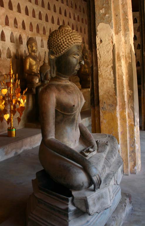 Wat Sisaket Interior
|
First we go to Wat Sisakēt.
Built in 1818 by King Anouvong to symbolize the revival of Lao after Vietnamese
domination, it’s the oldest remaining temple in Vientiane. It contains 2,000 miniature
silver and ceramic Buddha statues, many of which are in crevices within the
interior walls. Each crevice holds two Buddhas which symbolizes that everybody
needs friends. We see many other Buddhas of different sizes. A large beautiful
Buddha in the pose of enlightenment, with its left hand in its lap in the lotus
position and the right arm resting on its right leg with fingers pointing down touching
the floor predominates the inside. According to our Lonely Planet guide book,
in addition to the miniature Buddhas, the temple contains at least 300 seated
and standing Buddhas varying in age, size and made of wood, stone and bronze.
Most were made between the 16th and 19th centuries in Vientiane. A few
originated before that and probably came from Luang Prabang. I find the
interior amazing. Laos is called the land of 1,000 elephants but Steve says
he'll always think of it as the place of one million Buddhas.
Back
outside, Salard tells us that a temple is only a temple when monks live there.
At least in temperate climates, monks sleep outside all year. We see the areas
where monks sleep. It’s like an open corridor. Constructed in early Bangkok
style because at that time Vientiane was a vassal of Siam, a thick wall
surrounds it. Coconut, banana and mango trees shade the grounds. Its style may
have kept the Siamese from destroying the temple when they crushed the king's
rebellion.
Next
we walk across the street to Wat Prakeo. Built in 1566, it was the original Lao
home of the Emerald Buddha, a gift from Sri Lanka to Lao. The Emerald Buddha
now resides in Thailand where Steve
saw it when he visited Bangkok in 1990. I climb the many stairs to enter the
Wat. A class of hostesses, being trained for the 2009 South Asia Games, is just
letting out. The girls are very pretty and most courteous. I'm sure they will
make fine hostesses.
Wat
means Buddhist temple. Since this temple has never housed monks, it's not
really a temple. It's actually a museum. Inside we see many Buddhas and other
artifacts originally found in areas close to Vientiane. I find the museum nice
but not nearly as impressive as the previous Wat.
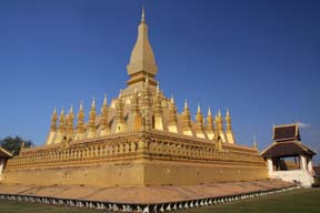 Lokachulamani Stupa
|
Back in the SUV, we
ride through Vientiane passing some beautiful buildings. Our next stop is the
national symbol of Laos, the golden Pha That Luang which signifies the Buddhist
religion and Lao sovereignty. It also appears on the country's coat of arms. In
236 BC, a modest stupa was built here to house the Buddha’s breastbone. Stupas
hold relics of the Buddha. When the capital was moved to Vientiane in the 1560s,
the King decided to build the Lokachulamani stupa to house the breastbone. The
name Lokachulamani means great stupa. During the years since then, four wats
have been built around the stupa. Two remain, with Wat That Luang Tai on the
south and Wat That Luang Neua on the north. The Supreme Patriarch of Lao
Buddhism has his monastic residence in Wat That Luang Neua. A high wall with
many small windows surrounds the stupa which is 45 meters high. The stupa base
is designed to be mounted by the faithful with walkways around each level and
stairways connecting the levels. Each side of the wall is 85 meters long and
contains many Buddha images.
The
complex is incredibly breathtaking! In many of the Buddhist structures we
notice Hindu gods and symbols. Salard tells us that Buddhism grew out of
Hinduism. The Buddha has 45 poses, each of which signifies something. The most
usual pose is enlightenment. Each day of the week has its own pose. There is a
monument of seven poses which symbolizes a week. A person's pose is determined
by the day of the week on which one is born.
Back
outside the complex, we spend quite a while taking pictures. Even the entrance
is stunning. Close by is a statue of King Sethathiraj, who built this stupa. He
sits on a throne with a gold Buddha like sash wrapped around him.
 View from Patousai Arch
|
Next we ride to
Patousai Arch, a.k.a. the Arch of Victory, a.k.a. the Vertical Runway. During
the Vietnam War, the United States gave Laos cement to build an airport.
Instead, in 1969, Laos built this monument to soldiers who died fighting for independence
from France. Steve climbs the arch and shoots some incredible pictures
including one looking at a beautifully landscaped area and some views of
Vientiane. Salard pushes me around and inside the arch. The inside ceiling is
beautiful! It has much gold and figures of Buddha within the central dome. I
think the outside is also impressive. We see many monks in the traditional
orange robe. When Steve returns from his climb, he tells me that there are
eight flights of stairs to the top with a large bizarre or market on the middle
floor.
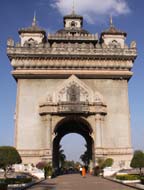 Patousai Arch
|
While
we wait for Steve, Salard asks me about my family and tells me about his. He
has an older brother and sister. His mother died when he was nine. His father
is a farmer and has remarried. His father had a son with his new wife. When Salard
was 13, he entered monk training because it was the only way his family could
afford for him to get an education. He stayed through college but realized he
didn't want to be a teacher. Now he goes to law school at night.
We
go to the hotel. When we arrive we ask if our room has a stall shower. We're
told it doesn't, but they offer to move us to a room that does. When we get to
the room, there's no stall shower. We lay down to take a nap. About 5 PM as we
begin to fall asleep, music comes from a building with an outside stage about half
a block away. I can sleep but Steve is not able to. When we travel, we like to
take a brief nap between touring and going out to dinner. The stage is
beautiful but it doesn't make up for the inconvenience. We just hope it doesn't
last long.
Tonight
we’re scheduled to go to dinner in the hotel. It's a Christmas Eve dinner of
French and American food. It's very good but many of the dishes have milk or
cream in them. We think the milk is safe because it’s a major hotel catering to
tourism. I eat as little as possible since I’m newly diagnosed with lactose
intolerance, but afterwards my digestion acts up. Santa visits each table and
hands out Christmas cookies. Although we enjoy the dinner, we're disappointed
that we didn't have Lao food. Oh well, I guess we’ll taste authentic Lao food
tomorrow. The performance outside of our room doesn’t end until between 10 and
11 o'clock. We find it quite annoying especially since they changed our room to
this side of the building.
Day 16: Thursday,
December 25
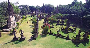 Buddha Park
|
Merry Christmas! We
have a good but unremarkable breakfast at our hotel. Our first stop for today
is Buddha Park, a.k.a. Xieng Khuan. Constructed in 1958, designed by a Buddhist
priest Luang Pu (a.k.a. Venerable Grandfather) Bunleus Sulilat, it's an open-air
grassy park. Pushing
the wheelchair isn't too difficult since most of the dirt path has been packed
down. According to Lonely Planet, Bunleus was an eccentric yogi-priest-shaman
who combined Hindu and Buddhist beliefs, folklore and symbols into this enigmatic
site. Luang Pu directed a group of artist in building the numerous Buddhist,
Hindu and single Muslim structures.
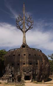 Sculpture at Entrance
|
I
like Salard’s explanation better. According to him, the builder wanted to
demonstrate the similarity of Buddhism, Hinduism and Muslim religions. At the
entrance stands what looks like a pumpkin. It represents heaven, earth and hell
on its interior three stories. From the outside we see three rows of windows. At
the bottom extending up to the second row of windows we see a large rectangular
head with an open mouth that is the entrance of this structure. The tree of
life stands on top of the pumpkin. At the base of the tree of life, there's a
hole in the trunk so that anyone who climbs up can come out and look down from
the top of the pumpkin. It's so high; I'm glad to see there's a railing around
it. Salard says that Steve can climb the pumpkin, walk around each level and
then go outside of the tree trunk. Supposedly the tree of life exists somewhere
in the world but it's blocked by a large waterfall. Anyone who reaches it
achieves something significant. I didn't quite get down what that was. There's
no way to climb the pumpkin from the outside. I find this pumpkin structure
interesting but bizarre. We decide to walk around the park first and then Steve
will climb the structure later.
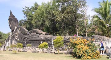 Reclining Buddha
|
We wander around for
quite a while and see most of the 200 Buddhist and Hindu concrete statues.
We're especially impressed with the huge reclining Buddha which symbolizes
Buddha’s assent into Nirvana. Steve takes a picture with me standing next to
the feet to demonstrate how large the sculpture is. Even though I stand on a
step, I don't even reach the top of the toes. (I'm 5'1" tall.) We see
Buddha in many poses.
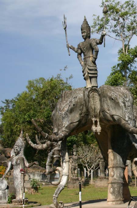 Forms of the Hindu God
|
I'm
no expert on Hindu gods but recognize Shiva, Vishnu, Rama on top of the
elephant Ganesha and the Hindu devil. I find the Hindu devil creepy. It has
nine heads and at least as many arms. Steve points out others Hindu structures
that he recognizes including Arjuna, the Hindu hero often depicted as an
archer, and Avalokiteshvara, a Buddha figure which embodies the compassion of
all Buddhas. The token Islam monument is in the back of the park next to the
Mekong River. It has three human figures which is contrary to the Muslim tenet
that life forms should not be depicted on religious structures.
 Muslim Monument
|
After visiting the
Muslim monument, I say to Salard that I see the similarity of Buddhism and
Hinduism since the former came from the latter, but I ask how Islam is similar
to these. He replies that all religions, even those not represented in the
park, worship the same God. This includes Christianity, Judaism and other world
religions. Each religion just calls its supreme being by a different name. I'm
still a bit confused about Hinduism since I'd been led to believe that its gods
are distinct and multiple gods, but later I read that each god is actually a
different way to depict the one ultimate being. Steve comments to Salard that
saying what he just told us can get a person in big trouble in some places. Salard
realizes this. I think it's a wonderful thought especially for Christmas Day.
Steve
goes into the mouth of the pumpkin. Although it's dark inside, he takes a good
number of pictures. I sit and talk to Salard and make notes in my log. It seems
quite awhile and just as I wonder where Steve is, he pokes his head out of a
window in the top row and assures us he's getting close to the top. I coax him
to keep his face in the window for a minute so I can get his picture. It can't
be too comfortable because he has to put his head catty corner for it to fit in
the window. A little while later he comes out of the tree trunk on top. He
takes a beautiful picture of the park looking towards the Mekong River and a
photograph of Salard and me sitting in the shade of a large statue. I take
several of him as he walks around the top of the pumpkin.
When
Steve returns he says that all of the inside figures are Hindu. They're
scattered around the walls of each level. The first level represents the
underworld. The steps between each level are very steep. The second level
portrays life and the final level heaven. As we leave the park, we agree that
it's a very impressive sight.
On
the way to our next destination, Salard shows us a picture of himself as a monk
and his two younger sisters. His married sister and her family live in his
father's house and farm. When his father remarried he moved to his new wife's
home. His younger sister lives in Tian with his cousin. He will see his father
at the New Year in April.
Our
next stop is the Friendship Bridge. Funded by Australia, it links Laos to
Thailand. I am looking forward to going to Thailand since I've never been
there. There's approximately a four foot, steep rocky hill to climb to get to
the walkway that leads to the bridge. This makes access to the walkway extremely
difficult. We find a small, narrow slightly smoother path going up to the main
path. Steve helps me walk up this difficult path while Salard brings up my wheelchair.
A dirt walkway goes up to the bridge. The walkway is well packed, so it's not
too difficult for Steve to push the wheelchair on. Salard assists whenever the
going gets rough.
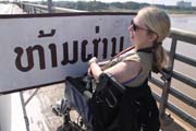 Attempt to Get to Thailand - Blocked
|
The Friendship Bridge
crosses the Mekong River. We almost make it to Thailand when we encounter a
barrier with a sign that says "No Entrance". What a disappointment! I
push my feet through the barrier so I can say I've been to Thailand, but then
Steve says there's a sign ahead that is located at the halfway point between
the two countries. I ask why all these vehicles that pass us on the road can
just drive over the bridge. Salard says that before the start of the foot path,
they have gone through border control and will have to do the same in Thailand.
Before going back, we take a few pictures of the Thailand side of the Mekong
River. Later I wonder why we weren't given a choice of how we wanted to visit
the Friendship Bridge, especially because we're skipping one of the parks that
we’re supposed to see. We walk back down the path. Getting down from the hill
seems even more difficult than it was to go up. Perhaps that's because I'm
skittish.
Back
in the vehicle, we ride to the market which is the main shopping place in
Vientiane. It's similar to many other markets we've seen and packed with goods
of every variety. I find the vendors very friendly. Many of the goods are beautiful
and colorful, especially the clothes and produce. We find our chachka, a bamboo
container used for serving sticky rice. It's quite different looking than
anything we've seen elsewhere. When we see it we ask Salard what it is. He
explains that rice is served in it and one uses their fingers to pick up enough
rice so s/he can roll it into a small ball and dip it into the sauce of the
dish one's eating. Since we haven't yet had authentic Lao food, we haven't seen
this container used. We hope we'll get to see it soon. We pass an area in which
a woman is cooking and serving hot food. She's very friendly and the food looks
delicious. I’m getting hungry. I also look for earrings but don't find any that
I like enough to buy. At one counter we see a roach which is quite large. No
one pays it any attention. Salard doesn't seem bothered by it. Actually it
isn't a surprise to see roaches in the market since we're in the tropics.
We
go to lunch and have a fish dish, a pork dish and sticky rice. Even though he
doesn't eat with us, Salard demonstrates the technique of forming a rice ball
and dipping it into the sauce. Most Lao main courses have sauce. Our waiter
also serves us dishes which have raw vegetables. We politely turn these down
and explain to Salard that we have to avoid raw foods. We enjoy our lunch very
much and are happy to have our first authentic Lao meal.
We're
supposed to go see Suan Vatthanatham, the Cultural Park. We decide to skip it
because Salard says it's not good and Lonely Planet doesn't even list it. By
the time we return to our room, there's no time to do anything else so we rest
for a while, order room service and pack. Unfortunately there's another outdoor
concert which we can hear TOO well, but luckily it's over by the time were
ready to turn in. My stomach is acting up and I'm praying that a good night's
sleep will calm it.
Day
17: Friday, December 26
Today
we fly to Xieng Khuang to see the Plain of Jars. Our flight is scheduled for noon,
so we meet Salard at 10:30 a.m. He tells us our flight is delayed until 3:10
p.m. He offers to go to the museum with us but even though we wanted to see it,
I'm feeling poorly so we decide to go back to our room so I can get some more
sleep. We come back down to the lobby at noon, check out and go to the airport
early. Salard helps us check in and comes with us through security to the gate.
We're quite pleasantly surprised with this because yesterday when we asked if
he could help us check in, he said it wasn't allowed. Salard tells us that Lao flights
are always late. There's only one gate at Vientiane International Airport. Our
flight goes first to Luang Prabang then on to Xieng Khuang. It looks to be
quite full
While
we wait, we talk to a couple who are also going to Xieng Khuang. One of their
sons will be living there for a year, teaching English. Their son visited Xieng
Khuang previously and found the people most friendly. He's so excited about
living here for this year that the parents wanted to come and see the place for
themselves. At boarding time we approach the staff desk and they take us out
first. The
steps onto this plane are even higher and narrower than on the plane on which
we flew to Vientiane. I find it a bit scary going up.
 The Smallest Airport
We've Ever Experienced
|
As we near Luang
Prabang, the announcer says that people going on to Xieng Khuang should stay on
the plane. We learn that the weather in Luang Prabang is rainy and that's the
reason our flight was late. I wonder if our original flight was canceled
because the flight number of this one is different. It takes only 25 minutes to
reach Xieng Khuang and we're happy to get there. My wheelchair is ready when I
get off the plane. About six men stand around and watch Steve lift me off. One man
does seem to be making sure we're okay. They show us the way to the terminal
but no one comes with us. The airport is one very small building! It's probably
the smallest airport we've ever been to. The temperature is quite cold, which
isn't surprising since we're up high in the mountains of Laos.
We
find our guide, Ken, get our luggage and board the van we’ll be using for the
next two days. Our itinerary says we will begin our tour of the Plain of Jars.
However, Ken says that due to the delay in our flight, there's not enough time
or daylight left to do this today. We ride through the small town of Phonsavan
in the province of Xieng Khuang. Ken points out sites including a large
orphanage. He says that Australians come to adopt children. He also points out
that there are many Chinese in Xieng Khuang. He shows us our hotel on the top
of a mountain and says it's the best in Xieng Khuang. We turn onto the road
that leads up to it. It's a dirt road and quite bumpy. Apparently very few
roads in Xieng Khuang are paved. When we reach the hotel, it looks nice. We're
not expecting much because we know it's basic.
Our
room is a distance from the lobby. It's in the last building on top of the
hill. Most of the walkway to get there is level. We pass other buildings of the
hotel to which the entrances are down a flight of stairs. At the end of the
walkway in front of our room, the family has placed a memorial watt, which is
the traditional memorial to dead family members. Our room is nice but cold. When
we look out the back door of our room, we find the view awesome! We take plenty
of pictures.
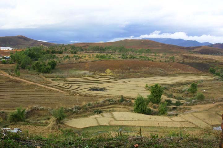 View From Our Room
|
Steve
tries to find the heater but has no luck. I take a nap under blankets and am
warm enough with my heaviest clothes on. We go to dinner at the hotel. I eat
simply, having rice soup and green tea which I enjoy. Steve also enjoys his
although it wasn't what he'd thought it would be. We ask about heat in our room
and were told "no heat, blankets." On our walk back to our room, we
notice that some buildings have fireplaces. Unfortunately ours isn't one of them.
We find two more blankets in our room, even though we already had enough extra
blankets.
We
go to bed early so we can keep warm! We joke with each other about our
insisting we come to see the Plain of Jars. Steve tells me that according to
his alarm clock it's not that cold, only 62°F. I guess our discomfort is due to
the fact that we've been in a very warm tropical climate since we arrived in
Vietnam.
Day
18: Saturday, December 27
When
we get up, it's in the high 50s and rainy. Again we wonder why we wanted to do
this part of our trip. Given the type of our accommodation we’re not surprised
to see that breakfast is a simple buffet. We head out to the Plain of Jars in
the van. To have enough leg room, I have to sit on a fairly hard seat. When we
ride on dirt roads, which are more common than paved roads, it's quite bumpy.
Oh well, we knew this part of our trip would be rough.
History of Plain of Jars
No one knows the actual history of the Plain of Jars. Several legends have developed over the years. One states the jars came from a community of giants who lived there. Another legend tells of Khun Cheung, an ancient king, who was victorious in a long battle against his enemy. He had the jars made to store vast amounts of rice wine for his celebration. Others believe local tradition used natural materials to mold the jars and fire them in the kiln cave at Site 1. Some believe the jars had the purpose of collecting monsoon rainwater for large groups of travelers when rain came only during the monsoon season. If it became stagnant, travelers would boil it. They offered prayers and beads for rain, leaving the items inside and around the jars.
Archaeological research of the Plain of Jars began in the early 1930s. Results showed that the stone jars served as prehistoric burial rites. Lao and Japanese archaeologists discovered the human remains, burial items and ceramics around the stone jars. The site is believed to have been started and used in the Iron Age from approximately 500 BC to 500 A.D. The more than 90 sites of the Plain of Jars have shown great potential for understanding Southeast Asia prehistory concerning the relationship between societies during the Iron Age. Each site has been assigned a number for identification. Unfortunately unexploded ordinance has not been cleared from most sites so these sites cannot be excavated.
In the early 1930s, a French archaeologist Madeleine Colani, found materials which showed that the cave at Site 1 could have been a crematorium. It’s a natural limestone cave with two man-made holes in the top. The holes served as the chimneys. She continued to work at 12 sites and published her findings in 1935 in which she states that the Plain of Jars was an Iron Age burial site. The makers carved the jars. Embedded in the jars she found organic soil covered beads, burnt teeth and bone fragments all of which indicate cremation. Some of the jars held contents from more than one person. She also excavated human bones, pottery fragments, iron and bronze items, beads of stone and glass, weights and charcoal outside of the jars which indicate burial sites of bodies not cremated. Colani linked the location to trade routes especially those of the salt trade, making the assumption that the inhabitants of the Plain of Jars wanted salt. Traders came there to obtain iron ore available from the area, which the inhabitants may have mined.
Archaeological research continued in 1994 with surveying and mapping of Site 1 by Professor Eiji Nitta. He concluded that the stone jars were a monument to mark the surrounding graves. Based on the urn properties and grave contents, Nitta dates the Plain of Jars to the late first to early second millennium A.D. In 1994 and 1996, Lao archaeologist Thongsa Sayavongkhamdy excavated sites. He also found that the stone jars served as a person's primary or secondary burial surrounded by family member graves.
In 2001, R. Engelhardt and P. Rogers theorized that stone jars were used for distillation as part of traditional Southeast Asian Royal mortuary practice. Current funeral practices of Thai, Cambodian and Lao royalty place the corpse soon after death into an urn while it's going through transformation from the physical to the spirit world. Afterwards it's cremated and then buried. Burial sites are located across waterways and away from residential areas in high, prominent areas. This is similar to the location of the Plain of Jars sites. Among Tai people of the area, the upper-class people get cremated to release their spirit to heaven and commoners are buried leaving their spirits to remain on earth.
Another archaeological data collection occurred from 2004 to 2005 and in 2007 during the clearing of unexploded ordinance. UNESCO archaeologist Julie Van Den Bergh found evidence to support Nitta. Colani's conclusions become questionable because many of the cremation remains appear to be from adolescents and the associated items in the surrounding burials are very similar. Van Den Bergh theorizes that the stone jars had different uses throughout their time. In the earlier ages, dead bodies were put in the stone jars to distill the bodies. Later the jars served as a repository for cremated remains. Jars with smaller openings may indicate that entire bodies were not placed inside jars or may have been for children.
Aerial photographs imply that a narrow path could have linked the sites. The differences in the jar sites may indicate that a group of villages with similar cultures inhabited the area. The jars at the various sites have different shapes and are made of different materials. The number of jars at each site varies. Common characteristics include the elevated locations and impressive views.
We
get to Site 1, the largest and easiest to reach. Luckily, it stopped raining at
least for a while. I had not read the archaeological findings or much of the
extensive Lao history about which I wrote in the History sections, so I will share
Ken's explanation of the Plain of Jars and US involvement in the Lao war
against communists a.k.a. "The Secret War". According to Ken, there
are 18 sites but only three have been cleared of unexploded ordnance.
When
we get out of the van, Ken gives us Lesson One: Safety. During "The Secret
War", the US dropped 2,000,000 tons of bombs on Laos. Thirty percent did
not explode and still pose serious risk. Markers have been placed along the
path to show where it's safe to walk. The markers are square with one red side
and one white. Ken explains and we see a large board which advises
"Mines Advisory Group (MAG) has
performed Unexploded Ordinance (UXO) clearance on this site
"Coloured concrete markers at ground
level indicate the areas that have been cleared.
[ |
] ß--------------------------------------------------à [ | ]
Cleared Area between
white markings
“WHITE: Indicates area that has been
sub-surfaced cleared of UXO.
“RED: Indicates area that has NOT been
sub-surfaced cleared but has been visually cleared only. (UXO on the surface
only has been removed)”
At
the top of the sign there is a rectangle with a skull and cross bones on a red
background.
Although
we had read of this, I find it very startling to actually see it. We trek up
the hill through mud and somewhat dry grass. At times Steve's pushes me. When
the pushing becomes too difficult, he walks with me and Ken brings my chair.
When we arrive at the jars, we are incredibly awed!
Ken
tells us it's a mystery how, why and from where the jars got here. Experts believe
that the jars were carved about 2,000 years ago by a lost Stone Age people. The
materials may be from a quarry which is a two day hard trek from this site,
over three mountains. Many jars are so large that most people wonder how the
jars were brought to this site. No one knows the reason for the jars or their
location but it's believed to be for funerary purposes. No jewelry or organic
material has been found, perhaps due to looting. Many think that the jars could
have been used as coffins or a type of container in which a body was placed.
From the shape of some, it appears that they had lids. Human images have been found
on lids and on some jars. We see one image on a jar.
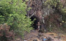 Cave Used by Viet Cong
|
Many jars were
damaged or destroyed during the bombings of the 1960s and 1970s. We see only
one lid, so they too may have been destroyed or removed. Ken points out the
cave and tells us that the Viet Cong lived there during the war. It's to one
side of the lower part of the site. In front of the cave entrance, we see a
memorial watt. It looks much like the one outside of our room except smaller
and it has sticks which look like incense on its platform. We also see several
bomb craters. Later Steve tells me that Ken never fails to point out any bomb
craters they pass. We observe many red and white markers. Not too far from the
cave, we see a war trench which is quite similar to the one we saw at the Cu
Chi tunnels. Obviously neither side cared about preserving the historical
sites.
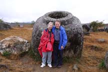 The Largest Jar
|
From the upper level
looking down to the lower level there are jars as far as we can see! The
largest jar is partially buried in a tilted position. When we stand up against
it, we only reach the rim on its lower side. I read it weighs a ton. As we walk
around the lower site, we agree that this looks like it could have been a
graveyard.
Inside
of a jar, I see what looks like it might be red clay or perhaps rust. One jar has
a lid on it, but it's not a good fit so it's probably not the original lid.
Later I read that these stones disks were probably grave markers, not lids. Archaeologists
believe that the lids were probably made from a less durable material than the
jars and decomposed over time. Some of the carvings on the jars have worn away
and become unrecognizable over the years.
While
we walk around Site 1, it begins to rain again. We pull out our rain gear and
stay reasonably dry. However this makes pushing the wheelchair even harder. The
wheels of my chair quickly become caked with wet grass and mud.
When
we planned this trip, I wondered how much of the Plain of Jars I would be able
to see. I am very pleased that I see as much as I do. By now neither one of us
questions why we wanted to come this far off the beaten track. It's an awesome
place.
Ken
tells us that there are two more Plain of Jars sites close by. The next site on
our itinerary is a historic
cave. Unfortunately, both choices requiring an uphill hike so I will not be
able to get to either. Steve says that he would prefer to see the other Plain
of Jars sites, so that's where we go. Given the cool and wet weather, I’ll be
happy to stay in a sheltered area. Even the van works for me.
We
drive to the next site, through beautiful countryside. Despite the rain, I find
it breathtaking. The 15 mile drive takes over an hour because the roads are
dirt and bumpy. The smoothest parts are bridges on which the driver has to be
careful to keep the tires on planks covering a boardwalk like surface. I'm
always happy when we reach these. I'm usually not bothered by bumpy roads, but
my seat in this vehicle is so uncomfortable that I enjoy these little even bits
of smooth ride. The homes we see are of a good size but very basic. All are
farm houses and many are built on stilts. Most have laundry hanging under a
roof on their front porch.
We
eat at a soup kitchen/restaurant located at the beginning of the path to Site
2. It's a very basic restaurant with part in a sheltered walled area and more
tables with a roof over them. The floor is dirt. The kitchen area is in the
back of the dining area where the heat source is ground pits on which pots sit.
We decide to sit inside and hope to stay at least somewhat warm. Dogs roam around
freely. Ken explains the choices and asks what we want. We order noodle soup
with chicken and a spinach type vegetable. When the food arrives it's basic but
good.
I
decide to sit in the van while Steve and Ken hike to Site 2. First I use the toilet.
It's not quite on the floor but is a squat. The floor is wet from the rain as
well as the method of flushing, so Steve helps me the whole time. To flush the toilet,
one dips a container into a tub of water nearby. This often causes a splash
which wets the floor. It's also not difficult for the water to spill between
the basin and the toilet. Then one takes the water and pours it into the
toilet.
I
sit in the van with the door open and watch other tourists. At one point, goats
in a single file walk by the restaurant. They break their formation and wander
through the eatery looking for food scraps. One goes into a small trash basket.
That's when the owners come and chase them away. They resume their line
formation and continue along their path. I begin to write in my log but end up
taking a nap. I think the rocking of the van, the bumps and the cold rain have
made me extra tired.
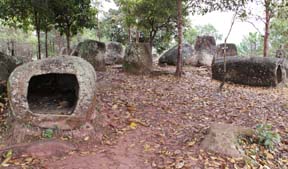 Site 2 - Long Thin Jars
|
When
Steve returns he tells me that it was a long muddy clime to get to Site 2. He
found Site 1 more interesting. They climbed at least one set of uneven brick
steps. This site contains approximately 90 jars on two hills. Most of these
tended to be longer (about seven feet) and narrower than those at Site 1. A
tree had grown through one of the jars.
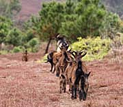 Roaming Goats
|
Apparently
the line of goats I saw earlier took the path to Site 2. Steve said that they
came in a line, broke formation and milled around for a while looking for food.
Then they got back into line and continued on their way. The line was headed by
a large horned male goat. We’ve seen a good number of goats in our travels, but
never behavior like this. I really enjoy it. I always enjoy seeing wildlife up
close in their natural environment.
We
drive to Site 3 along more country roads and across several planked bridges --
ah a bit of relief from the bumps. In back of a field we see a temple. We also
see what looks like a house burning peat and several country homes. I
especially like one white concrete home with a bright blue roof.
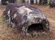 Site 3 - Small Flat Jars
|
Again
I wait in the van at Site 3. When Steve returns he says that the trek to Site 3
was the most difficult. They crossed a slippery, rickety bamboo bridge, walked
around many working fields and climbed over a barbed wire fence via a steep
wooden ladder. He saw approximately 150 jars that were smaller but more
elegant. They appeared to be more flat. Steve says he found Site 3 interesting
but liked the other two sites better.
Back
in the van, we leave the dirt route for a while and get on a paved road. Soon
we take another dirt road to the Hmong village, Ban Tha Chock. The Hmong are an
indigenous hill tribe of Laos and other Southeast Asia countries. This village
has been designated a UNESCO site. We find the village and the people very
interesting. I wonder if the people have ever seen a wheelchair before. Each
person we see seems very courteous and friendly. The adults smile and nod to
us, but don't stop their work. We see quite a few children; some are eating
corn on the cob as they wander around the village. Even though a few children
gather to have their pictures taken, they are somewhat bashful when we try to
talk to them. One young boy pushes a wagon filled with what looks like a bail
of straw. We're happy to see that our visit doesn’t disturb the villagers’
daily life.
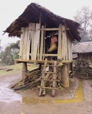 Hmong Village
|
All
of the buildings are wooden with thatch roofs. They use bomb casings as stilts
for their raised buildings. We see more bomb casings lined up against the
fence, perhaps for maintenance or future projects. We see a lot of corncobs and
husks strewn about on the ground, but otherwise the village is neatly kept. We
observe many animals wandering around, including a large buffalo, turkeys and
chickens. I see a few pumpkins hanging from tree limbs. Perhaps this is a way
of preparing them to eat. We really enjoy visiting this Hmong village!
The
rain stops just before we arrived at the village but starts
again about a half hour after we arrive. We continue our visit until it gets
too muddy to push the wheelchair. Ken tells us that this is what the weather is
like in the rainy season except that the rain is heavier. We've never seen the
wheelchair or ourselves so muddy.
By
the time we return to our hotel, we're all joking that the wheelchair needs a
car wash. Ken and the driver tell us to wait in the van. They take my
wheelchair out and use the hotel hose to wash it. When they come back, we’re
really surprised to see that my wheelchair is wonderfully clean and has no mud
on it! We thank them very much, especially because we were wondering how we
were ever going to clean it. Back in our room, Steve does a great job of
cleaning our mud caked sneakers. We'll take care of our pants when we get to
Luang Prabang and have a place to launder and time to dry them.
We
take a rest and go to dinner. Again I have rice soup and tea. I've decided to
keep my eating light until we're out of Xieng Khuang. Steve has fish with
vegetables in a light tomato-based sauce with rice. We pack and go to bed and
wonderful warmth early. I get up during the middle of the night and notice that
the high jalousie window in our bathroom is open. I tell Steve and he closes
it. It warms up slightly.
Day
19: Sunday, December 28
When
we get up, the sun is shining and it's a nice day out! There's no buffet at
breakfast, but we have the same choice of food as at yesterday’s buffet. I find
today's breakfast better since it's cooked to order.
The
only business open on Sunday is the fresh market. Ken says that since it's
Sunday, the market is busier than usual especially with a lot of children
running around. People stare and not many are friendly even when we smile and
offer greetings. The whole experience is a disappointment. It seems to start
when Steve sets up to take a picture of a live animal for sale. Several of the
active ones look like large moles. An inactive one looks somewhat like a
raccoon. The woman who's selling them says no picture. Steve asks why not,
since usually people welcome pictures or don't care. She's adamant and Ken
steers us away.
Between
the animal incident, the unfriendly stares and the hard walking we agree we've experienced
enough of the market. I wonder if perhaps the woman had a problem with me in my
wheelchair. It appears that many of the people at the market have not seen a
wheelchair before. Perhaps they were scared of it. Steve thinks that perhaps
the woman was selling something illegal.
Next
we go to a wood carving craft shop in the back of a home on a residential
street. We see two men working and their completed artwork. The results of
their finished work are beautiful. Ken tells us that there are usually eight
workers but since today is Sunday, some are off.
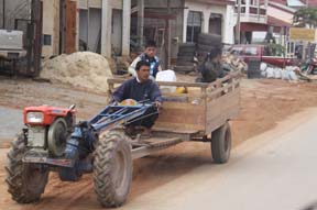 Interesting Looking Truck
|
Back in the van,
Steve mentions to Ken that he saw a sign for the Office of Unexploded Ordnance.
He asks if it would be possible to visit. We go but it's closed. Ken's suggests
a visit to a silk weaving factory. We ride there, with the same result. As we're
riding around town, we see an interesting truck. It looks more like a tractor
with four wheels, an open engine over which there's a long blue triangle of
pipes and a wagon on the back in which a boy stands watching so that the goods don’t
fallout off truck.
We
have a leisurely lunch and enjoy watching
several cats in the restaurant. I use the bathroom, but the toilet is much like
yesterday's. Today's floor is not quite as wet since it's concrete. This time I
need less assistance from Steve.
We
head over to the airport, thinking we're a little late, only to learn that they
expect the flight to be late. The airport consists of two rooms. From the
doorway, one can see registration, immigration and the gate. At registration, when
the staff person checks our tickets which take us to Vientiane for our
connecting flight to Luang Prabang he says that the flight to Vientiane lands
at Luang Prabang first! We ask to get off at Luang Prabang and for Ken to
notify the Luang Prabang office of our early arrival. We also wonder why we
were ever booked onto two flights with a long layover in between, when one
flight was available. The flight planning for our trip leaves a lot to be
desired. When we arrive home, I ask for a refund on the flight we didn’t take.
My travel agent says that the airline does not give refunds.
As
we wait for passport control, we learn that our flight has been delayed until 4
pm. I check out
both Ladies Rooms in the airport, but they’re both swatters. Thank God for my
femme device that allows me to use a swatter toilet. As we sit at the entrance
to the departure field, we’re amazed at the animals which wander around the
field. First we see several chickens. When they leave, three cows come and
go.
Our
flight to Luang Prabang goes quickly. It takes about 25 minutes. Only four of
us get off the plane so there’s no mad rush at the luggage carousel. We meet
our guide, Ping, and driver. Ping suggests I sit in the front of the van and I
try it. However leg room is tight because the seat is all the way up. Also I
can’t understand Ping when she speaks.
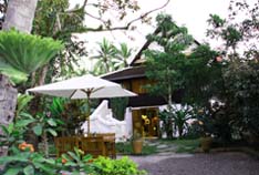 Our Hotel Villa Maydou
|
It’s not far to our
hotel, the Villa Maydou in Luang Prabang, which is a former home in the Lao
style that has
been converted into a guesthouse. This sounds nice but it turns out not too
good for me. When we leave the van, there’s a decent brick walkway, then an
area of gravel which isn’t too bad. The final approach to the guesthouse
consists of scattered slate, partly level stones. This last part is the killer.
I need Steve’s help. The dining room is also outside. From the hotel it’s
accessed by a similar path of scattered, barely level slate stones. Some stones
can be avoided by walking on grass followed by a decent brick walkway.
Everything in our room except one desk chair is low. In typical Asian style,
it’s a simple room. In addition the toilet is low and I cannot consistently get
up from it without help.
We
settle in and then go to dinner. It’s gotten cold so our food arrives luke
warm. Steve orders a duck entrée. When it arrives, it doesn't even appear to be
what he ordered, but the waiter assures us that it is.
At first, I was
unhappy with our accommodations due to the many architectural challenges.
However, by the end of our stay, I love the experience and authenticity of the
guesthouse. I'm sure it helped that the staff were exceedingly nice.
History of Luang Prabang
In 698 A.D., a Tai priest Khun Lo established a dynasty, giving Luang Prabang the name Muang Sua. The dynasty lasted through 15 rulers. In 709, the Chinese Nan-chao briefly occupied Muang Sua replacing the Tai administrators. It's unknown how long this occupation lasted. When the occupation ended, the Tai dynasty resumed control. Although dates are nebulous, it’s believed that the dynasty ruled for close to a century.
The Khmer established a settlement in Xay Fong near Vientiane. The Champa took over parts of southern Lao. They stayed on the banks of the Mekong until 1070. The Khmer ruler expanded to Muang Sua, where he took control without fighting. He and his son stayed in power, establishing a dynasty. The town was renamed Xieng Dong Xieng Thong, a Tai name.
Fighting among groups ensued. During this time, Khun Chuang from the Khmu tribe of northern Lao captured the area. From 1128 to 1169, his family reinstated the Siamese governing system from the 800’s. From 1185 to 1191, the Khmer took control. Control changed hands until 1353 when Xieng Dong Xieng Thong became the capital of Lan Xang. In 1560, the Siamese king moved the capital to Vientiane.
In 1707, Lan Xang divided into three kingdoms. Luang Prabang became the capital of the Kingdom of Luang Prabang. When the French colonized Laos, they made Luang Prabang the royal residence of the colony. The Luang Prabang leader became the nominal head of Laos. With independence, the King became the head of state.
Day
20: Monday, December 29
Our
hotel is simple, and breakfast is standard. It includes fruit, bread,
croissants and eggs. We enjoy it.
On
our way to today's sites, Ping tells us that wheelchairs aren't allowed in the
palace. The tour is about an hour long and visitors are not allowed to wear
their shoes. We decide to skip it even though we were really looking forward to
seeing it. We’ll just go to the palace grounds. I suggest to Steve that I wait
outside and he can go on the tour. He doesn't like that idea and asks why
handicapped people are discriminated against. Ping doesn't have an answer.
Between no wheelchair and an hour walk without shoes on floors that are most
likely slippery, it's just too risky for me.
We
go to see the departure place from where the Mekong River cruise leaves, since
we’re scheduled for this tomorrow. Because it's the dry season, the water level
is very low. To reach the boat, we’d have to go down approximately 90 stairs
and then walk a plank. Today the boats are docked on the plank and it wouldn't
be too difficult but if the river recedes more in 24 hours it would be very
difficult. We decide against attempting the cruise, since further recession of
the water is likely. We had extended our tour for one day to do this cruise. I
am the one who most wanted to do it and am disappointed, again.
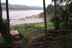 Confluence of Nam Khan River Into Mekong
|
Next we stop to see
the confluence of the Nam Khan River into the mighty Mekong River. The view
beautiful with much lush green including palm trees, plantings which I don't
recognize and what looks like small rice paddies at the river's edge.
We
ride to Wat Mai Suwannaphumaham, the largest Buddhist temple in the city. The
name means The New Monastery of the Golden Land. Built from 1796 to 1797 by
King Anourout, it underwent renovation in 1821. King Manthathorat restored it
to its present design and renamed it to Wat Mai which means New Monastery. Since
it was next to the palace, it had many royal worshippers. We see an exterior
front porch with black lacquer and gold leaf polls supporting the roof and ornate
gold leaf walls depicting scenes of Ramayana and Buddha’s pan ultimate
incarnation. I read that it's the most lavishly decorated of the city's
temples. We walk around the grounds seeing many monk dormitories and a good number
of monks performing their daily activities including hanging laundry. It
doesn't appear that monks sleep outside here.
Ping
tells us that there are 32 temples in Luang Prabang. All have monks living in
them. There used to be 65 temples. I guess that communism caused many to close.
Since Ping seems reluctant to say anything negative about her country, I don't
make this comment out loud. She tells us that there are two types of Buddhism
and each has different reasons why boys become monks.
<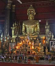 Gilded Buddha inside Wat Mai
Suwannaphumaham
|
Steve
goes inside to check out the temple and determine whether it's worth it for me
to come in because there are quite a few steps and one cannot enter wearing shoes
inside. He's back quickly and says it's definitely a must-see site. It's
beautiful! The gold and red interior has an altar on which one amazingly large
gilded Buddha sits. We see many smaller Buddhas and miscellaneous offerings surrounding
the front of the large Buddha. There's a framed picture of Abbot Pavie who
helped open Luang Prabang to the world in 1887. Nestled behind the large
Buddha, we observe the original smaller Buddha. This is the gold Pha Bang
Buddha, the most important image in Luang Prabang! The city is named for this
statue. It's 83 cm high, with approximately 54 kg of gold (thirty three inches
high and 119 pounds) statue. It will be moved to the palace temple in the
future. Legend says it was made during the first century A.D. and given to the
Angkor Khmers. The Angkor King gave it to his son-in-law who was the warrior
who founded the first Lao kingdom. I find it most impressive. We also see many
gold leaf images of Buddhas on the wall.
People
come in and pray. Ping explains that praying consists of kneeling, folding ones
hands and bowing to the floor three times. The first bow is for God, the second
for Buddha and the final for the parents who took care of the praying person as
a child. Lao people always keep their parents in their homes when the parents can
no longer care for themselves.
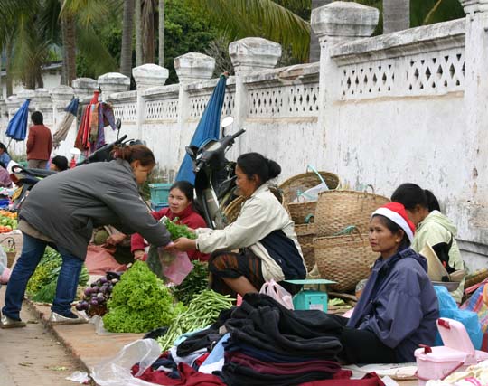 Market
|
Next
we walk through the market. The market sells a wide variety of products, mostly
food. We see many types of rice. I'm not only amazed at the different types but
each vendor has hers in a different type of container including cloth sacks,
metal bins and baskets. We see all types of plant produce and animals which are
both live and dead. Chicken and ducks are live. Fish are whole and dead. We're
amazed to see tree bark tied in bundles. After Ping tells us what we're looking
at, she informs us that it's used for cooking and chewing. We find the people
friendly. They don't try to push us to buy anything. One woman wears a Santa
hat. I really enjoy the market.
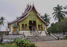 Haw Pha Bang Temple
|
We proceed to the
palace compound. Today the palace is the Royal Palace Museum, the primary
Museum of Luang Prabang. It combines Lao and French architectural styles. King
Sisavangvong built the palace from 1904 to 1909 after the original palace of
1887 was destroyed by invaders. I find the building quite impressive from the
outside. We see a good number of people in the compound. Steve and Ping go into
the Haw Pha Bang temple which is the Royal Palace Chapel being built to house
the Pha Bang Buddha. Started in 1963, the Communists halted its construction in
1975. It's nearing completion. I enjoy the beautifully ornate outside with the
façade of gold and green emerald like stone. The banister is a dragon like
snake, somewhat like the one we saw at Angkor Wat except it's gold and green
instead of blackened cement. Whereas most temples we visit are dull due to the
passing centuries, this one sparkles. Our driver offers to push me around while
I wait outside. At first I say that I'm fine just sitting, but he kindly says
there are a few things which I should not miss. He points out a statue of the
King. The grounds are most impressive. When Steve returns, he tells me about
the elaborate pedestal he saw inside on which the Pha Bang Buddha will
eventually sit. I insist that he go to see the statue of the King.
We
walk down the street which Ping says is called Friendship Street. Formerly it
was Chinatown, but today it has many hotels located on it. I wonder why we
aren't staying in a hotel here which is more centrally located. Perhaps it's
because we booked late and there are many tourists at this time of year. So far
we've met a good number from Australia. We do a bit of shopping and I find a
pair of shell earrings, the first earrings that I buy in Laos. I enjoy the
street, finding it a nice change from the traditional sites. It also has restaurants
and small shops most of which are quite active. We stop to take a picture of a communist
flag flying from a window, because it’s the only one we’ve seen so far in Laos.
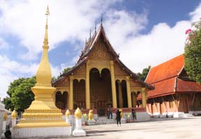 Wat Saen
|
Next
we go to see Wat Saen, a.k.a. Temple of 1000 Happinesses, built in 1718 and
restored in 1957. The restoration commemorated Buddha’s birth 2500 earlier.
Saen means 100,000 in Lao but no one is sure what the significance is to this
temple. While researching the temple, I found several different spellings of
the name and two legends about the significance of 100,000. One states that it
was built with 100,000 stones from the Mekong. Another says that a gift of
100,000 Kip was given to build the temple. (Kip is the name official monetary
unit.) It's the largest and the most ornate of the smaller temples. We see the
Buddha image in the "Calling for Rain" pose and a small picturesque shrine
which holds a Buddha footprint. The complex has many buildings and temples
within its smoothly paved courtyard.
We
go onto Wat Sop, another of the smaller temples in Luang Prabang. During the
15th century, King Theng Kham built it to commemorate his father King Sao
Takaphat. In 1479, the father was killed at the end of his 41 year reign. I
don't go in here but find a small structure to the side of the main temple
quite interesting. It has many Buddhas under its roof, which is supported by red
and white corner posts. There is a wicker altar in front of it for offerings.
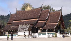 Wat Xieng Thong
|
We go on to my final Wat
of the day, Wat Xieng Thong, one of the oldest temples in Laos. The name means
Monastery of the Golden City. Some consider this temple to be the most
magnificent of Luang Prabang and Laos temples. Built in 1560 by King
Setthatirath, the crowning of subsequent kings occurred here. It contains a
series of charming sloping layered roofs and glass murals which exemplify the
classic temple architecture of Luang Prabang. Historically it has been the
principal wat of the city. It remained under imperial control until 1975.
Once
again, Steve goes in to check it out and tells me I should come inside. We admire
its large golden Buddha. We see stencils of gold leaf Buddha images and other
golden structures. The tree of life has been represented in a mosaic toward the
back. I’m impressed and glad I came in but I find the outside much more
fascinating.
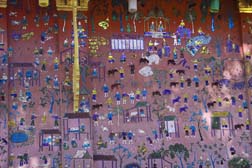 Mosaic Depicitng Rural Life
|
Back outside we walk
around the large complex. It's certainly the most extensive complex we've
visited. The mosaics on the outside of the buildings are interesting and
elaborate. Steve goes into most of the buildings including one which houses the
reclining Buddha, while Ping pushes me around to see the rest of the complex. The
exterior of most of the buildings have intricate murals. Ping explains some,
including one of a Lao fortune-telling, and the tree of life. My favorite
mosaic is on the outside of the Reclining Buddha Chapel. The walls are inlaid
with brightly colored glass mosaics that illustrate religious activity and
every day life in rural Laos. Most of the people in the mosaic are working
while others pray.
Steve
goes into the Royal Funerary Chariot Hall, built in 1960, which houses a gilded
chariot used in 1959 to carry King Sisavangvong’s body to a field for
cremation. He’s impressed by this elaborate hearse comprised of a dragon boat
mounted on tires. Some of the stencils on the wall depict the ornate caskets of
kings, queens and kings' brothers. In front of the walls he sees many standing
Buddhas of varying sizes some of which are draped in orange sashes.
We
find all of the temples that we visit beautiful. The last three are within the
same block. We wonder why they're so close together. Ping explains that outside
of the city there were villages. Each village had a temple in the city, and many
of these were built close together. She also tells us that Buddhists go to
Temple two times a month. If they can't, Buddhist homes contain a temple at which
they pray.
Our
next stop is Phu Si Hill, a.k.a. Mount Phousi, a hill in the center of Luang
Prabang. It's an anomaly that such a hill exists in the middle of this
relatively flat city. Everything we've read about the hill has said the view
from it is fantastic. While we were planning our trip, I checked with our
travel agent to see
if there was any way for me to get to the top of it. She told me that we would
be able to drive at least part way up. Our van pulls up to the staircase. I
tell Ping what our travel agent had told me. She checks with the driver but
replies that there is no way to do this.
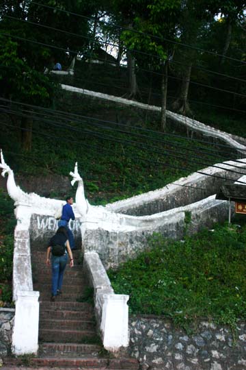 Climb to Phu Si Hill
|
Steve
and Ping climb 328 tall steps to the summit. Our driver pulls around to the
other side of the hill where they will come down. He tells me it's more
picturesque over here and I agree. I sit in the van, look out at the river and
write postcards. I look forward to hearing about the hill over lunch, which is
next.
We
go to lunch and enjoy the food. I order a Lao dish which Ping recommends,
chicken with coconut milk and herbs. Steve orders buffalo sausage and gets pork
and buffalo sausage. We enjoy the pork but don’t really care for the buffalo. My
main course is like a soup and goes well with the sticky rice which is purple. We
don't taste much difference between this purple sticky rice and the usual white
variety. For dessert we have banana, coconut milk sticky rice balls which we
love.
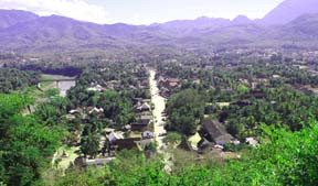 View from Top of Phu Si Hill
|
Steve
tells me about his trip up Phu Si Hill. Part way up the staircase, he saw a
woman holding a small bird cage. For luck one can buy a bird cage with a bird
inside, carry it to the top of the hill and release the bird. Wat Chom Si
stands at the summit as a landmark temple which can be seen from almost
anywhere in the city. Steve says that from here he could see almost a 360° view
of Luang Prabang. He shows me the pictures he took of the city. I find them
quite impressive. He took several of the Mekong River. One shows the smaller
Khan River on the left and the mighty Mekong running through the middle of
Luang Prabang. The mountains in the background look magnificent. In another, he
zoomed in on a bridge a few blocks away from our hotel. He also points out the
distinctive roof of Wat Xieng Thong.
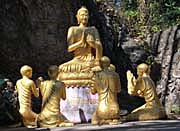 Buddha as Teacher of Children
|
He saw many temples
and statues of Buddha including Buddha teaching a group of children. During the
climb down the hill, he saw his favorite Buddha image in the pose meaning "Stop
Fighting". Buddha stands with arms at about shoulder height. Both hands face
outward in the stop sign. He saw another Buddha foot print, supposedly one made
when the Buddha walked through this region 2500 years ago. They also stopped at
Wat Tham Phu Si on the way down. Rocks have formed grottoes in this Wat. One
grotto contained the Pha Kachai style Buddha, a.k.a. the laughing Buddha. Another
grotto held the traditional Buddha with what looks like an old man sitting in
front of it with an altar in front of him and many large, beautiful flowers surrounding
both figures. Steve said that the staircase they descended had a greater number
of
stairs which made for an easier descent because they were less steep.
At
the end of lunch, I want to use the restroom. Steve goes first to scope it out.
He says it's down about six steps and once inside the tiles are very slippery.
Although I'm disappointed, I think I can wait until we get back to the hotel
which is our next destination.
We
have relax for the remainder of the afternoon. By the time we’re hungry again,
it's late and we decide to eat in the hotel restaurant. Steve had fried rice
and we both love it. I have rice soup with pork. It's okay, but I'm sure that
it's the nuances of the dish I'm not crazy about. We enjoy our wine.
Day
21: Tuesday, December 30
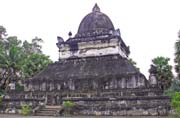 That Pathum Stupa
|
Today is our last day
of touring. First we go to Wat Wisunalat which is very close to our hotel. It’s
nicknamed the Watermelon Wat because of the dome of the structure. That Pathum
Stupa, closest to the entrance looks like half a watermelon. Since the sim
which is the main building was originally built in 1513, this makes it the
oldest continually operating temple of Luang Prabang. Built by the king of the
same name who ruled from 1501 to 1520, it symbolized the kingdom’s unity. It's
also known as Wat Visoun, named after the village. From 1513 to 1707, it served
as the home of the Pha Bang Buddha.
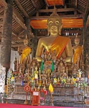 Buddha Statues Inside Wat
|
In 1887, a gang of
Yunnanese robbers (Chinese marauders) known as the Black Flag Haw set it on
fire. It was rebuilt in 1898. Those responsible for the reconstruction kept the
new structure quite close in style to the original. Inside of the high ceiling
sim building, we see the largest Buddha in Luang Prabang. It's made of stucco
and covered in gold leaf. We also view many Buddha statues made from wood,
bronze or gold gild which surround the large one. Most are centuries old. Some
of the statues have been collected from ruined temples in northern Laos.
In
the rear we see an instrument which is used in a ceremony to clean Buddha
statues, making them holy. Water gets poured into one side. It comes out the
other side and runs over the Buddha statue. It looks like a bass drum on a
stand. Colorful objects hang around the base. They look like lanterns but are
more likely fancy buckets. Water gets poured from them into the base. This is
the first time we've seen such an object in a temple and I find it interesting.
Ping tells us that these types of devices are usually shaped like dragons. If I
stand back far enough and take in all the decoration, I can sort of see a
dragon but it's quite a stretch. To me the sim seems more like a museum than a
temple.
In
front of the sim, we see That Pathum Stupa, a.k.a. Lotus Stupa. The structure
has a roof that looks like half of a watermelon and gives the complex its nickname.
Built in 1514, the building looks very old and much of it is covered in black,
possibly soot. All of the complex buildings appear to be made from stucco or
cement. When we first arrived, I thought the complex looked drab. However as
we're getting ready to leave, I've changed my mind. I really find it quite
impressive. It just goes to show, you can't judge a book by the cover. When I
comment on the difference between this temple and others we've seen, Ping tells
us that both the interior and exterior of temples are usually red and gold
because these are religious colors.
Before we leave this
complex, Steve points out Wat Chom Si at the top of Mount Phousi. It’s a
beautifully clear day and the light illuminates it nicely. Of course, we take
several pictures to show Luang Prabang’s breathtaking landmark. Next we stop at
the mini post office nearby to buy stamps for postcards and for my cousin Jimmy
who collects stamps. Steve wants to stop at Wat Mia Suwannaphumaham, to get a
photograph of the original Pra Bang Buddha. When we arrive there, Steve and
Ping go inside so he can take the picture.
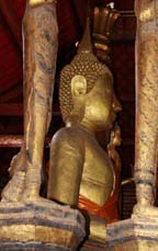 Luang Pra Bang Buddha
|
Once
we're done in the city, we head out to the countryside. We stop at a Hmong
village, Na Woun. Since we so enjoyed our visit to the Hmong village nearby the
Plain of Jars, we're looking forward to visiting this one. Ping tells us that
the houses only have a front and back door to let light in. They don't have any
windows. One door is for sunrise and the other for sunset. Houses are built on
the ground, although I do see at least one built on stilts. People marry early
and have many children, usually at least 10. If a woman fails to get pregnant,
the man marries again. We don't see any women without at least one small child.
Most of the young children are curious and shy. Unfortunately we see little of
the authentic village.
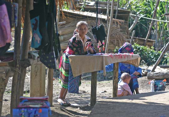 Hmong Village - Even Children Sell
|
I
find the village interesting, but in a sad way. The residents have built a
wooden walkway for visitors. All along the walkway, we see women and children
selling their crafts. Actually it reminds me of a touristy flea market. Although
some vendors are friendly and not as pushy as other places we've been, I find many
are pushy hawkers. While we understand their need for commerce, this is
overkill. Steve remarks that it is distressing they've given up their
traditional way of life to sell their crafts so forcefully to tourists. I
agree. Some of the crafts are beautiful, especially the quilts. We purchase a
male figure dressed in traditional garb for one of our nephews. The woman who
takes our money tries very hard to get us to buy another. Even though it’s not
much more money, the sales technique is obnoxious and we walk away after saying
a harsh NO more than once. Toward the end of the walkway, I observe a very
young girl who is about 4 or 5 years old, seriously working on an embroidered
piece. It seems that they don't get much time to have fun growing up.
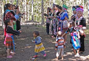 Hmong Courting Festival
|
Across
the road, Ping points out a traditional festival in progress. She suggests we
go and watch. First we walk by a group of adults who watch the courting
ceremony. We see a line of girls facing a line of boys. They look to me as if
they are about teen age. The girls are dressed in beautiful native garb that
each has made herself. The boys also wear traditional clothes. They toss green tennis
balls back and forth to the person directly opposite. I'm amazed at how seldom
they fail to catch the ball. They smile at us when they notice us, but keep
their attention on the ritual. Steve puts his camera on high-speed shooting and
gets great shots with many balls simultaneously in the air.
At
the end of each line, close to where we stand, we see some young children.
They're attempting to toss and catch the balls. They don't stay in line or
catch the balls very often. These little ones are adorable! Many of the older
women curiously approach me with their babies in their arms. Even though
they're curious, they're very friendly. Although we're very disappointed in the
first part of this stop, we really enjoy watching the festival.
Back
in the van we ride to Tat Kuang Si, a beautiful waterfall with several tiers.
It is peaceful even though there are a fair number of people throughout the
site. We see an especially picturesque green limestone pond into to which several
waterfalls tumble. We observe one lone swimmer in this pond. The other many
waterfalls pour over limestone into turquoise-green ponds.
I
stay on a platform on the first level and take pictures for while. For much of
the time Ping stays with me and we talk. I ask her about a topic she mentioned
yesterday. She tells me that boys and men become monks for three reasons. When
a member becomes a monk, it bestows honor on his family. Some become monks to
get an education. I tell her that our first Lao guide had done this. The death
of a family member can cause a survivor to become a monk because it's believed
that a monk can help the deceased’s spirit get to heaven. Males can become a
monk for a day or a week as a way of doing the right of passage. I ask Ping
about herself. She's not married. She has one younger sister who's married and
has children. She lives with her parents and an unmarried sister.
 Tat Kuang Si Waterfall Pond
|
Steve wanders around
the good-sized area which is not level. He also takes many pictures. When he
returns he pushes me to one of the lower ponds, which is breathtaking. We see
a series of pools where one pond just falls into the next. Barely a drop of
water falls into another pond. The resulting ripples are just about
symmetrical.
 Girl Poses at Tat Kuang Si Waterfall
|
Steve shows me some of his favorite pictures including a beautiful
shot of a young girl who posed for him in front of a foamy waterfall. We both
really enjoy this site!
By
the time we’re ready to leave, I’d like to make a pit stop.
Ping checks two Ladies Rooms at the waterfall park but both are squatters. Ping
says she knows of a restaurant on the way back into Luang Prabang which has a
western toilet. We stop there and I believe it's the best public restroom I've
used in Laos! It also looks like a nice restaurant. Steve asks if we can stay
here for lunch but Ping says our lunch has been contracted for at the same
restaurant as we ate in yesterday. Since we like to experience eating in
different places, this disappoints us. Given the rigidity we've experienced in
Laos, it doesn't surprise us.
Our
ride back to Luang Prabang is picturesque. We go down many switchbacks with
sharp curves. Lunch is good. We both order Ping's recommendations and she
orders a few additional dishes for us. Our lunch includes vegetable soup with
pork balls which we like, chicken casserole which is okay but spicy, purple
eggplant stir fried in vegetable oil (we love it), and fish in banana leaves
which were okay but overly fishy tasting. Earlier today at Tat Kuang Si waterfall,
Ping had bought us grilled banana. We eat them for dessert and enjoy it.
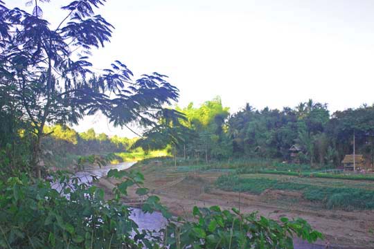 Homes Along Nan Khan River
|
We return to our room
and relax for a while. It's our last evening in Luang Prabang and our vacation.
We decide to go out for a walk all the way around Mount Phu Si, Luang Prabang and
perhaps find a place to have dinner. I find that people are generally friendly,
especially the women and children. After
a while I wonder whether women are supposed to greet men, since when I do I get
almost no response. From all the attention I receive, I'm certain that seeing someone
in a wheelchair is extremely rare. Judging from the architecture, it's no
surprise.
We
see some interesting streets and walk along the bend of the smaller river, Nan
Khan. Using our cameras, we can get a good view of the few homes on the other
side. They are small, wooden with thatched roofs, on stilts and surrounded by
gardens. When we pass by the staircase that Steve and Ping descended from the
summit of Mount Phu Si, we observe some tourists referring to a tour book to
determine whether they want to go up. They appear to be a mother who is reading
out loud to her daughters who are either teenage or in their early twenties. I like
watching the many people we see.
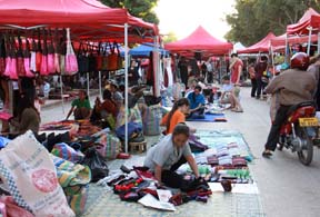 Hmong Night Market
|
We turn down
Friendship Street passing many guesthouses and come to where Luang Prabang has
closed the road to traffic. We see much activity while vendors set up the Hmong
Night Market, which starts each night at sundown. Even though the road is
closed, there are quite a few motorbikes riding through the aisles. It seems
odd to see people disregarding the rules this way, especially since we've found
Laos to be the most rigid country we visited
on this trip. My narrow wheelchair barely fits between the vendor tent poles
and where vendors have laid out their merchandise tarps on the ground. I
purchase a pair of earrings which I like better than the shell ones. After all,
since Laos is landlocked shells are hardly characteristic of the country. Steve
buys a T-shirt with a map of Laos. The market is interesting and enjoyable. It
feels like we're actually getting a taste of the authentic life of Luang
Prabang.
Of
course all during our walk, we take many photos. We take one of an Internet
café, one of many we've seen during our trip. Even here, the customers leave
their shoes outside the door. When Steve needed to use a computer during our
stay in Luang Prabang, he asked if the hotel had one available. The man who was
staffing the front desk said just a minute, after which he got up. He told
Steve that he could use the hotel's main computer.
By
the time we're ready to return to our hotel, we haven't found a restaurant
where we want to eat. We return to our hotel, enjoy a quick dinner at the
restaurant, pack and get to bed early.
Day
22: Wednesday, December 31
We
get up at 4:45 AM -- ouch! Actually we were awake by 4:30 AM because neither of
us could sleep since we're nervous about our trip home. The ride to the Luang
Prabang Airport goes smoothly. We're relieved that we can check our bags
through to JFK Airport, our final destination.
As
soon as the plane is ready, we board first but with an audience behind us of
other passengers that the staff has let go through to the gate. The flight to Bangkok
of an hour and 40 minutes goes quickly. Unfortunately we had a spoiled toddler
near us who yelled for most of the flight, so the experience was not pleasant. We
just hope that’s the worst of our trip.
Our
total trip home will take 42 hours! From Bangkok, Thailand, we fly to Singapore
then to Frankfurt, Germany and finally to New York JFK Airport. When I booked
this trip, there was so much to look over and little information about the
flights except that there would be a refueling stop along the way. I never
imagined that anyone would fly us through Europe to get to South East Asia!
This nightmare has taught me to never again accept the flight plan without
asking questions about the route!!
The
Bangkok airport was closed by anti-government forces just before we left on our
vacation. We feel lucky that they got and kept it open. When we arrive in Bangkok,
we get my wheelchair back but first someone comes with an airport wheelchair.
He brings us to mine. We have a six hour layover until our next flight to
Singapore. We proceed to the Singapore Airline terminal to see if we can get
our seats. The window has a closed sign on it, even though someone is there. We
go to get something to eat, walk around for a while and try to find a decent
lounge. In most places, we see seedy looking people sitting in hard seats. Who
knows, after traveling as much as we have, we probably look somewhat seedy too.
I finally find and get to use a handicapped bathroom – the first in several
weeks.
 Bangkok Airport
|
Looking down from the
fourth floor balcony at one end of the airport, we see a nice lounge two floors
below. Before going there, we check the Singapore Air counter. This time we talk
to the person there and she says to come back in half an hour to 45 minutes. We
go to the lounge to read, and then return to the counter in about 25 minutes.
Now there's a sign up that says the counter will open at 12:30 p.m., so we
wait. 12:30 comes and goes. Someone finally arrives at about 1 PM. She checks
us in for our next two flights which
are both on Singapore Airlines. I'm relieved! The check-in person also tells us
to return to the check-in counter because someone has to escort us to the gate.
On
the way back to the lounge, I say to Steve that since it's a while before we
have to report for boarding, we should have a drink to celebrate being set for
our last flights. He agrees but says let's wait a while. As we walk around
Bangkok airport, we're impressed by how nice it is. We go back to the lounge
and read. Steve closes his eyes for a while and when he wakes, he asks if I'm
ready for that drink. I check my blood sugar and its 80 so I decide I need a
snack with my drink. We go to a place where we can get both and order spring
rolls and white wine. Since it’s New Year’s Eve, we want champaign but they don’t
have any.
When
we go to the counter, a different person is there. While we wait, a line of
several people forms. We wait until they are checked in. Still no escort has
come, so Steve tells the staff person about our instructions to come to the
counter. The staff person makes a call and an escort comes to take us to the
gate. I'm not impressed with the ground staff of Singapore Airlines.
Our
flight to Singapore goes fairly quickly. Several young children are aboard but
they behave fairly well.
The is meal delicious. At Singapore airport, we also get back my wheelchair.
The airline offers us assistance but since we have a five hour layover and are
familiar with the airport, we say no thank you. Steve decides he wants to walk
to the terminal gate, the long way. The airport has four terminals in one
building shaped like a square U, making it almost 2 miles long. We observe an
amazing number of shops, mostly high-end. I can't even count the number of
stores selling pocketbooks. We see electronics, candy, duty-free, clothing and
many more. The airport still has many Christmas decorations up, most are of
Disney characters.
About
three quarters of the way around the airport, Steve gets a bit tired and tries
the electric walkways. When we arrive at the security gate, it's not even open
yet. We find seats but soon a crying baby and his indulgent parents arrive. At
about the 10th round of the baby screaming "I don't wanna", we decide
to move. As people begin to gather before the security station, another person
in a wheelchair
arrives with an airport staff member. We move to where they are, so we’ll be in
the correct place when it's time to be processed.
Finally
the staff opens the station. We get through security and to the gate as
smoothly as possible. Once the gate staff arrives, one approaches us to tag my
wheelchair to New York City. When I tell her I'll need one in Frankfurt, she goes
to her desk to check if I can get my wheelchair there. When she returns, she
assures me that there will be an airport wheelchair for me to use during the
time we’re in Frankfurt airport.
I’m
always careful to make sure we can have a wheelchair for the entire time we’re in
an airport. I once had a horrible experience when I only had use of a
wheelchair to go from the plane to the next gate waiting area. At the gate, I
was told to wait until boarding time when an escort would come with a
wheelchair to take me to the gate. I had several hours to wait and wasn’t able
to walk beyond the Ladies Room because Steve had to stay with our bags. Anything
of interest was too far for me to walk by myself in a busy area. When the escort
arrived, he called my name but someone else got to the wheelchair more quickly
than I. When I reported this to a staff person, she had trouble arranging for
another escort because she was told a wheelchair had already picked me up. We've
also seen others have similar experiences.
As
people begin to gather at the gate, I find it amazing to see some of their
behavior. One man decides he wants to be on the other side of several line
barriers. Instead of walking around the barriers, he just releases them and
walks right through without even replacing them. A few people lie down and
occupy several seats even though it's obvious others need seats. When we begin
to board, an airport staff member instructs us to wait for him to bring us down
the runway. People line up to enter. The staff does a good job of making sure
no one except people needing assistance, their travel party and those with
small children go through first. There has been a lighted sign instructing
people to "Remain in Your Seat Until Boarding Call" but so many
ignore the instructions.